Anton Chico, New Mexico
Anton Chico, or Anton Chico Abajo or Anton Chico de Abajo, is a census-designated place in Guadalupe County, New Mexico, United States. Its population was 188 as of the 2010 census, of which 167 were Hispanic in origin.[2] Anton Chico has a post office with ZIP code 87711.[4][5] New Mexico State Road 386 passes through the community. Anton Chico is listed in the National Register of Historic Places.
Anton Chico, New Mexico | |
|---|---|
 Anton Chico  Anton Chico | |
| Coordinates: 35°12′00″N 105°08′32″W | |
| Country | United States |
| State | New Mexico |
| County | Guadalupe |
| Area | |
| • Total | 1.784 sq mi (4.62 km2) |
| • Land | 1.784 sq mi (4.62 km2) |
| • Water | 0 sq mi (0 km2) |
| Elevation | 5,253 ft (1,601 m) |
| Population | |
| • Total | 188 |
| • Density | 110/sq mi (41/km2) |
| Time zone | UTC-7 (Mountain (MST)) |
| • Summer (DST) | UTC-6 (MDT) |
| ZIP code | 87711 |
| Area code(s) | 575 |
| GNIS feature ID | 903205[3] |
Geography
Anton Chico is located at 35.194866°N 105.143895°W. According to the U.S. Census Bureau, the community has an area of 1.784 square miles (4.62 km2), all of it land.[1]
History
Prior to 1786, when a peace treaty was concluded with the Comanches, Spanish settlements in New Mexico were confined to the Rio Grande valley and nearby. The reduced threat from the Comanches, the most numerous and dangerous of the Indian peoples surrounding the New Mexican settlements, permitted the expansion of the Spanish eastward into the Pecos River valley and onto the Great Plains. The motivation for the Pecos Valley settlements was the growing population of New Mexico plus the need to defend the Spanish and Puebloan settlements in the Rio Grande valley from raids by Apache and other Indian peoples.[6]
In 1822 the government of New Mexico created the Anton Chico Land Grant, 378,537 acres (153,188 ha) in size.[7] Salvador Tapia and 36 others petitioned the government for the grant. In exchange they promised to take up residence in the grant area, to hold the land in common for themselves and future settlers, and to obtain firearms and bows and arrows to defend the settlement against Indian attacks. The initial settlers came to Anton Chico from La Cuesta (now called Villanueva), 20 kilometres (12 mi) upstream on the Pecos River. However, Indian raids caused the abandonment of the settlement in 1827. Anton Chico was resettled in 1834, this time with success[8]
Seven settlements grew along 12 kilometres (7.5 mi) of the Pecos River. From north to south (upstream to downstream) they were Tecolotito, Upper Anton Chico, Anton Chico, Llano Viejo, La Loma, Llano del Medio, Dilia, and Colonias.[9] Anton Chico is the largest settlement of the seven. It was described in 1841-1842 as having a population of 200 to 300 people and built around a plaza designed for defense. The houses, surrounded by high walls, were described as follows:
"The little village of Anton Chico is built in a square, the houses fronting on the inner side, although there are strong doors, on the outer. The houses are of one story only, built of adobe...while the tops are flat. They have neither windows nor floors, and in point of comfort and convenience are only one degree removed from the modest wigwam of the Indian."[10]
As one of the closest New Mexican settlements to the Great Plains with its bison herds and Plains Indians, many Ciboleros (bison hunters) and Comancheros (traders with the Plains Indians) originated from Anton Chico and other Hispano communities along the Pecos River in the 19th century.[11]
Anton Chico achieved its maximum prominence about 1890 when it had a population of 900 people, all or nearly all Hispanic, and was a mercantile center for much of eastern New Mexico. Subsequently, with out-migration the population and economic activity declined.[12] A factor in its decline was the re-routing of Route 66 which before 1937 crossed the Pecos River near Anton Chico. Subsequently, Anton Chico was distant from major transportation routes.[13]
Climate
Anton Chico has a cold steppe climate (BSk) under the Koppen Classification of climates. Under the Trewartha climate classification the climate is a cold steppe with hot summers and cool winters (BSak). Most precipitation is received in the warmer six months of the year.
| Climate data for Anton Chico, New Mexico, USA. 35.195 -105.144. Elevation: 5,353 feet (1,632 m). | |||||||||||||
|---|---|---|---|---|---|---|---|---|---|---|---|---|---|
| Month | Jan | Feb | Mar | Apr | May | Jun | Jul | Aug | Sep | Oct | Nov | Dec | Year |
| Average high °C (°F) | 11.7 (53.0) |
13.9 (57.0) |
17.8 (64.0) |
22.2 (72.0) |
26.7 (80.0) |
31.7 (89.0) |
32.8 (91.0) |
31.7 (89.0) |
28.3 (83.0) |
22.8 (73.0) |
16.1 (61.0) |
11.7 (53.0) |
22.3 (72.1) |
| Daily mean °C (°F) | 3.1 (37.5) |
4.7 (40.5) |
8.3 (47.0) |
12.2 (54.0) |
16.9 (62.5) |
21.9 (71.5) |
23.9 (75.0) |
23.1 (73.5) |
19.4 (67.0) |
13.3 (56.0) |
7.2 (45.0) |
3.1 (37.5) |
13.1 (55.6) |
| Average low °C (°F) | −5.6 (22.0) |
−4.4 (24.0) |
−1.1 (30.0) |
2.2 (36.0) |
7.2 (45.0) |
12.2 (54.0) |
15.0 (59.0) |
14.4 (58.0) |
10.6 (51.0) |
3.9 (39.0) |
−1.7 (29.0) |
−5.6 (22.0) |
3.9 (39.1) |
| Average precipitation mm (inches) | 15 (0.6) |
13 (0.5) |
18 (0.7) |
20 (0.8) |
33 (1.3) |
41 (1.6) |
66 (2.6) |
66 (2.6) |
48 (1.9) |
30 (1.2) |
18 (0.7) |
20 (0.8) |
390 (15.3) |
| Source: "Anton Chico, NM,"[14] | |||||||||||||
National Register of Historic Places
In 1986, the village of Anton Chico was added to the National Register of Historic Places.[15]
References
- "2010 Census Gazetteer Files: Places: New Mexico". U.S. Census Bureau. Archived from the original on July 14, 2014. Retrieved July 11, 2014.
- "U.S. Census website". United States Census Bureau. Retrieved 2011-05-14.
- "Anton Chico". Geographic Names Information System. United States Geological Survey.
- "Postmaster Finder - Post Offices by ZIP Code". United States Postal Service. Retrieved July 11, 2014.
- United States Postal Service (2012). "USPS - Look Up a ZIP Code". Retrieved 2012-02-15.
- Ebright, Malcolm, "The Villanueva State Park," pp. 13-14, 19, Archived 2019-04-11 at the Wayback Machine, accessed 17 Mar 2019
- "Land Grants," New Mexico in Maps, http://online.nmartmuseum.org/assets/files/Maps/LandGrants.pdf, accessed 11 Apr 2019.
- Ebright, Malcolm, "The Villanueva State Park," pp. 22-23, 26. Archived 2019-04-11 at the Wayback Machine, accessed 17 Mar 2019
- Google Earth
- National Register of Historic Places Inventory,' National Park Service: Department of the Interior, p. 2, 6, , accessed 11 Apr 2019
- "The Cibolero Trail: Across the Plains of Eastern New Mexico." .
- "National Register," pp. 3, 10
- "Description and Historic Context for Pre-1937 Highway Alignments," , accessed 17 Apr 2019
- . accessed 12 Apr 2019
- "National Register," , accessed 12 Apr 2019
External links
- A Brief History of the Anton Chico Land Grant by Severiano R. Sisneros Jr., Secretary/Treasurer @New Mexico Legislature
Municipalities and communities of Guadalupe County, New Mexico, United States | ||
|---|---|---|
| City | 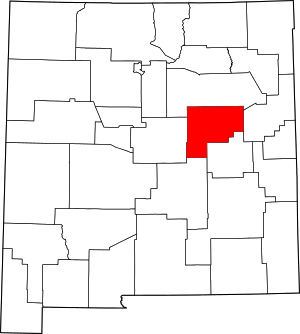 Map of New Mexico highlighting Guadalupe County | |
| Town | ||
| CDPs | ||
| Other unincorporated community | ||