Anuppur
Anuppur is a town in northeastern Madhya Pradesh state of central India. It is the administrative headquarters of the Anuppur tehsil and Anuppur District. Previously, it was in Shahdol district.
Anuppur | |
|---|---|
Town | |
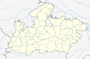
 Anuppur Location in Madhya Pradesh, India | |
| Coordinates: 23.1°N 81.68°E | |
| Country | |
| State | Madhya Pradesh |
| District | Anuppur |
| Elevation | 505 m (1,657 ft) |
| Population (2020) | |
| • Total | 26,397 |
| Languages | |
| • Official | Hindi |
| Time zone | UTC+5:30 (IST) |
| PIN | 484224 |
| Telephone code | +07659 |
| Vehicle registration | MP 65 |
| Website | anuppur |
Geography
Anuppur is located at 23.1°N 81.68°E.[1] It has an average elevation of 505 metres (1,656 feet). The Son River and some of its tributaries run through Anuppur.[2] According to 2001 Census, the total population of Anuppur District is 667155, out of which 309624 are Scheduled tribes and 48376 are Scheduled castes. In this manner, Anuppur District is a tribal dominated district.
Demographics
As of 2011 India census,[3] Anuppur district has a population of 749,521. 2001 to 2011 population growth rate is 12.3%. Males constitute 52% of the population and females 48%.
gollark: Nope, we can do an outbound call.
gollark: Although I think our apiotelephone line may be busy now.
gollark: You can also dial omega-quarantine on there to find out more!
gollark: Thus join heavserver.
gollark: Heavserver has it I think.
References
- Falling Rain Genomics, Inc - Anuppur
- Anuppur District Ground Water Information Booklet
- "Census of India 2011: Data from the 2001 Census, including cities, villages and towns (Provisional)". Census Commission of India. Archived from the original on 16 June 2004. Retrieved 1 November 2008.
This article is issued from Wikipedia. The text is licensed under Creative Commons - Attribution - Sharealike. Additional terms may apply for the media files.