Anjad
Anjad is a City and a Tehsil and Nagar Palika Parishad in Barwani district in the state of Madhya Pradesh, India.
Anjad Anjad | |
|---|---|
City | |
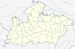
 Anjad Location in Madhya Pradesh, India  Anjad Anjad (India) | |
| Coordinates: 22.03°N 75.05°E | |
| Country | |
| State | Madhya Pradesh |
| District | Barwani |
| Area | |
| • Total | 20 km2 (8 sq mi) |
| Elevation | 151 m (495 ft) |
| Population (2019) | |
| • Total | 90,000 |
| • Density | 4,500/km2 (12,000/sq mi) |
| Languages | |
| • Official | Hindi |
| Time zone | UTC+5:30 (IST) |
| ISO 3166 code | IN-MP |
| Vehicle registration | MP 46 |
Geography
Anjad is located in the Narmada Valley, at 22.03°N 75.05°E.[1] It has an average elevation of 151 metres (495 feet). It is a tehsil in Barwani district. Prominent temples are Gayatri Shakti Peeth, Nagri Mata Temple, Shani Mandir, Bhavati Hanuman Temple, Bhairav Temple, Laxminarayan Temple, Ram Temple and Saibaba Temple (Chhota shirdi). Its distance from Barwani is 16 km and 134 km from Indore. A river flows through it named Bhongli nadi.
Demographics
As of 2001 India census,[2] Anjad had a population of 40,000. Males constitute 51% of the population and females 49%. Anjad has an average literacy rate of 59%, lower than the national average of 59.5%, with 58% of the males and 42% of females literate. 16% of the population is under 6 years of age.
The native language of Anjad is Hindi and Nimadi.
This area is mainly known for cotton, wheat, soybean, corn, vegetables and chili cultivation. Majority of the population is engaged in trading and agriculture related activities. Large number of Ginning - spinning factories, Oil mills and Wielding workshops are there.
References
- "Maps, Weather, and Airports for Anjad, India". fallingrain.com.
- "Census of India 2001: Data from the 2001 Census, including cities, villages and towns (Provisional)". Census Commission of India. Archived from the original on 16 June 2004. Retrieved 1 November 2008.