Angatuba
Angatuba is a Brazilian municipality in the state of São Paulo. The population is 24,161 (2015 est.) in an area of 1028 km².[1] The highway Rodovia Raposo Tavares passes south of the city.
Angatuba | |
|---|---|
 Flag  Coat of arms | |
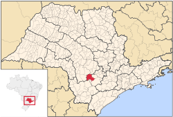 Location in São Paulo state | |
 Angatuba Location in Brazil | |
| Coordinates: 23°29′25″S 48°24′46″W | |
| Country | Brazil |
| Region | Southeast |
| State | São Paulo |
| Area | |
| • Total | 1,028 km2 (397 sq mi) |
| Population (2015) | |
| • Total | 24,161 |
| • Density | 24/km2 (61/sq mi) |
| Time zone | UTC-03:00 (BRT) |
| • Summer (DST) | UTC-02:00 (BRST) |
There is controversy about the meaning of the name Angatuba. It is a Tupi-Guarani word for "house of spirits" or "sweet fruit".[2] Angatuba was founded in 1872, under the name Espírito Santo da Boa Vista. It became a town (vila) and an independent municipality in 1885, when it was separated from Itapetininga. It was elevated to a city (cidade) in 1906. The name was changed to Angatuba in 1908. In 1991 Campina do Monte Alegre was separated from Angatuba.[2]
The municipality contains the 1,394 hectares (3,440 acres) Angatuba Ecological Station, a fully protected conservation unit created in 1985. The ecological station is contained within the Angatuba State Forest.[3] This is a 1,196.21 hectares (2,955.9 acres) sustainable use conservation unit created in 1965.[4]
References
- Instituto Brasileiro de Geografia e Estatística
- IBGE, history
- ESEC de Angatuba (ESEC) (in Portuguese), ISA: Instituto Socioambiental, retrieved 2016-06-30
- Angatuba (in Portuguese), Secretaria do Meio Ambiente - Instituto Florestal, retrieved 2016-07-01