Analalava District
Analalava is a district in northern Madagascar. It is a part of Sofia Region and borders the districts of Ambanja in northeast, Bealanana and Antsohihy in east and Boriziny (Port-Bergé) in south. The area is 4,380 km2 (1,691 sq mi) and the population was estimated to be 89,917 in 2001.[1]
Analalava District | |
|---|---|
District | |
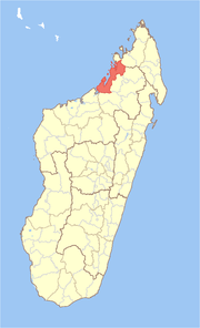 Location in Madagascar | |
| Coordinates: 14°34′S 47°54′E | |
| Country | |
| Region | Sofia |
| Area | |
| • Total | 4,380 km2 (1,690 sq mi) |
| Population (2001) | |
| • Total | 89,917 |
| • Density | 20.5/km2 (53/sq mi) |
| • Ethnicities | Sakalava |
| Time zone | UTC3 (EAT) |
The district is further divided into 11 communes.
References and notes
- "Madagascar Administrative units". GeoHive. Archived from the original on 2009-04-23. Retrieved 2008-02-29.
| Analalava | 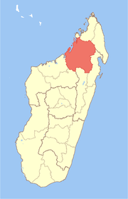 | |
|---|---|---|
| Antsohihy | ||
| Bealanana | ||
| Befandriana-Nord | ||
| Boriziny (Port-Bergé) |
| |
| Mampikony | ||
| Mandritsara | ||
gollark: You'd expect them to test it, and notice "hey, we ruined performance".
gollark: Has it managed to become *worse* than modded servers?
gollark: Modded is the One true Minecraft.
gollark: You cannot escape the mods.
gollark: INSCRIBER SIDEDNESS IS EVIL.
This article is issued from Wikipedia. The text is licensed under Creative Commons - Attribution - Sharealike. Additional terms may apply for the media files.