Amargosa, Texas
Amargosa is an unincorporated community and census-designated place in Jim Wells County, Texas, United States. Its population was 291 at the 2010 census.[1] Prior to 2010, the community was grouped with nearby Owl Ranch as part of the Owl Ranch-Amargosa census-designated place. The community is named for the Amargosa Creek that runs nearby.[3] The word amargosa means "bitter" in Spanish.
Amargosa, Texas | |
|---|---|
 Amargosa  Amargosa | |
| Coordinates: 27°53′30″N 98°06′31″W | |
| Country | United States |
| State | Texas |
| County | Jim Wells |
| Area | |
| • Total | 1.523 sq mi (3.94 km2) |
| • Land | 1.517 sq mi (3.93 km2) |
| • Water | 0.006 sq mi (0.02 km2) |
| Elevation | 299 ft (91 m) |
| Population | |
| • Total | 291 |
| • Density | 190/sq mi (74/km2) |
| Time zone | UTC-6 (Central (CST)) |
| • Summer (DST) | UTC-5 (CDT) |
| Area code(s) | 361 |
| GNIS feature ID | 2586907[2] |
Geography
According to the U.S. Census Bureau, the community has an area of 1.523 square miles (3.94 km2); 1.517 square miles (3.93 km2) of its area is land, and 0.006 square miles (0.016 km2) is water.[1]
gollark: I seem to have accidentally lost the key for a HP ML110 G7. Is there some way to open it without it and/or get a replacement?
gollark: Also less useful.
gollark: You can also emulate completely different CPUs (like ARM devices) but that's slower and so less common.
gollark: Honestly I've never really needed that, but it's useful if you need to run stuff which only runs on different OSes.
gollark: You can also run useful software!
References
- "2010 Census Gazetteer Files - Places: Texas". U.S. Census Bureau. Retrieved March 6, 2017.
- "Amargosa Census Designated Place". Geographic Names Information System. United States Geological Survey.
- Grimm, Agnes G. "Amargosa, TX". Texas State Historical Association. Retrieved 21 April 2017.
Municipalities and communities of Jim Wells County, Texas, United States | ||
|---|---|---|
| Cities | 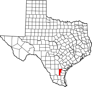 Jim Wells County map | |
| Village | ||
| CDPs | ||
| Other unincorporated communities | ||
| Footnotes | ‡This populated place also has portions in an adjacent county or counties | |
This article is issued from Wikipedia. The text is licensed under Creative Commons - Attribution - Sharealike. Additional terms may apply for the media files.