Amaravati River
The Amaravati River is the longest tributary of Kaveri River in the fertile districts of Karur and Tirupur, Tamil Nadu state, South India.
| Amaravathi River | |
|---|---|
 River Amaravathi and its tributaries | |
| Location | |
| Country | India |
| Location | Udumalaipettai- Dharapuram-Karur, Tamil Nadu |
| Physical characteristics | |
| Source | |
| • location | Anamalai Hills, Chinnar River, Pambar River at |
| • coordinates | 10°21′2″N 77°14′14″E |
| • elevation | 473 meters (1,552 ft) |
| Mouth | |
• location | Karur at |
• coordinates | 10°57′36″N 78°4′53″E |
• elevation | 360 feet (110 m) |
| Length | 282 kilometers (175 mi) |
| Basin size | 8,380 square kilometers (3,240 sq mi)[1] |
Route
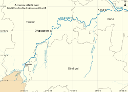
The 282-kilometre (175 mi) long Amaravati River begins at the Kerala/Tamil Nadu border at the bottom of Manjampatti Valley between the Anaimalai Hills and the Palni Hills in Indira Gandhi Wildlife Sanctuary and National Park in Tirupur district. It descends in a northerly direction through Amaravathi Reservoir and Amaravathi Dam at Amaravathinagar. It is joined by the Kallapuram River at the mouth of the Ajanda valley in Udumalaipettai. Through Dharapuram and Aravakurichi it joins with the Kaveri at Thirumukkudal, about 10 kilometres (6 mi) from Karur.
Nanganji, Kudavanar, Shanmuga nadhi, Uppar, Kudumiar, Thenar and so many tributaries are joint with the Amravati river. It has the Tributary of the Pambar and Chinnar rivers from Kerala also.
Use
This river irrigates over 60,000 acres (240 km2) of agricultural lands in Tiruppur and Karur districts.[2] The Amaravathi Dam has 4 megawatts of electricity generating capacity installed. The Amaravathi River and its basin, especially in the vicinity of Karur, are heavily used for industrial processing water and waste disposal and as a result are severely polluted due to large amount of textile dyeing and bleaching units. But nowadays in karur, the changes are vicinity by seeing Amaravati river on its clean surface because of pollution controlled by government.[3]
History
The ancient names of the river is Aanporunai and Aambravathi. Amaravathi, invokes the greenery and Kalpavriksha tree of Lord Indra's heaven. The name Amaravathi echoes the Hindu past and present of southern India. By Hindu religion, river is from the grace of goddess Ambaal form the heaven. The Amaravathi river swells into life in the Anjanad valley (Anaimalai, Kerala state) of the Western Ghats, whose slopes are awash with Kurinji blossoms once every 12 years, descends to the plains near Udumalaipettai, Tamil Nadu, and flows to make the rich plains of Dharapuram and Karur . It is one of the longest rivers (282 km) in Tamil Nadu, which join with the river Cauvery, near Karur.
Gallery
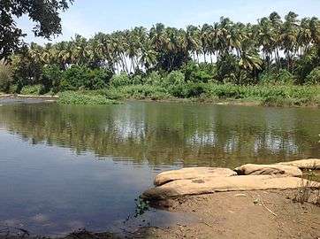 The view of Amaravathy River near the Arjuneswarar Temple in Kadathur
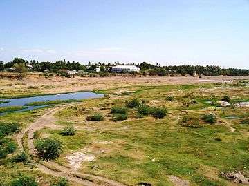 The wide Amaravathi River bed at Karur
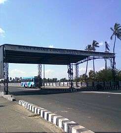 Toll plaza near Karur on NH7
Notes
- "Integrated Hydrological Data Book" (PDF). India. p. 76. Archived from the original (PDF) on 20 May 2014. Retrieved 25 March 2014.
- The Hindu, M. Gunasekaran To assess water loss in Amaravathi basin 2 April 2007
- Marcus Moench, Rethinkng the Mosaic, Investigations into Local Water Management, Addressing Constraints in Complex Systems, Chapter 1: Meeting the Water Management Needs of South Asia in the 21st Century Archived 21 November 2008 at the Wayback Machine, pub: Nepal Water Conservation Foundation, Kathmandu, and the Institute for Social and Environmental Transition, Boulder, Colorado, U.S.A., 1999, pp 145-146
| Wikimedia Commons has media related to Amaravati River. |