Altamont, Oregon
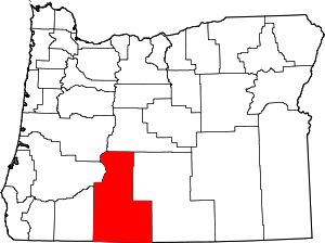
Altamont is a census-designated place (CDP) and unincorporated community in Klamath County, Oregon, United States, southeast of Klamath Falls.[4] As of the 2010 Census, the population was 19,257.[2] All mailing addresses in Altamont are Klamath Falls addresses, although Altamont is outside of the city limits of Klamath Falls.
Altamont, Oregon | |
|---|---|
 Location of Altamont, Oregon | |
| Coordinates: 42°12′9″N 121°43′35″W[1] | |
| Country | United States |
| State | Oregon |
| County | Klamath |
| Area | |
| • Total | 8.1 sq mi (21.0 km2) |
| • Land | 8.1 sq mi (21.0 km2) |
| • Water | 0.0 sq mi (0.0 km2) |
| Elevation | 4,144 ft (1,263 m) |
| Population (2010) | |
| • Total | 19,257 |
| • Density | 2,377/sq mi (917.6/km2) |
| Time zone | UTC-8 (Pacific (PST)) |
| • Summer (DST) | UTC-7 (PDT) |
| FIPS code | 41-01850[2] |
| GNIS feature ID | 1116894[3] |
History
Altamont may have been named after Altamont, a locally famous trotting horse, by a prominent local horseman, Jay Beach.[5] Altamont post office ran from 1895 to 1902.[5]
Geography
Altamont is located in southern Klamath County at 4,144 feet (1,263 m) above sea level.[4] It is bordered to the north and west by the city of Klamath Falls, the county seat. Oregon Route 39 passes through the center of the community as South 6th Street and the Crater Lake Parkway, while Oregon Route 140 (Southside Expressway) runs along the southern edge of the community. OR 39 leads northwest into Klamath Falls and southeast 21 miles (34 km) to the California border at Hatfield, while OR 140 leads east 93 miles (150 km) to Lakeview and west 72 miles (116 km) to White City near Medford.
According to the United States Census Bureau, the Altamont CDP has a total area of 8.1 square miles (21.0 km2), all land.[2]
Demographics
| Historical population | |||
|---|---|---|---|
| Census | Pop. | %± | |
| 1950 | 9,419 | — | |
| 1960 | 10,811 | 14.8% | |
| 1970 | 15,746 | 45.6% | |
| 1980 | 19,805 | 25.8% | |
| 1990 | 18,591 | −6.1% | |
| 2000 | 19,603 | 5.4% | |
| 2010 | 19,257 | −1.8% | |
| source:[6] | |||
As of the census[7] of 2000, there were 19,603 people, 7,777 households, and 5,420 families residing in the CDP. The population density was 2,248.5 people per square mile (868.0/km²). There were 8,315 housing units at an average density of 953.8 per square mile (368.2/km²).
The racial makeup of the CDP was:
- 88.65% White
- 0.64% African American
- 3.52% Native American
- 0.77% Asian
- 0.14% Pacific Islander
- 2.82% from other races
- 3.47% from two or more races
6.76% of the population were Hispanic or Latino of any race.
There were 7,777 households out of which:
- 31.5% had children under the age of 18 living with them
- 53.5% were married couples living together
- 12.0% had a female householder with no husband present
- 30.3% were non-families
- 25.0% of all households were made up of individuals
- 12.4% had someone living alone who was 65 years of age or older
The average household size was 2.51 and the average family size was 2.96.
The age distribution was:
- 26.7% under the age of 18
- 7.7% from 18 to 24
- 25.8% from 25 to 44
- 22.9% from 45 to 64
- 16.8% who were 65 years of age or older
The median age was 38 years. For every 100 females, there were 94.9 males. For every 100 females age 18 and over, there were 90.2 males.
The median income for a household in the CDP was $31,831, and the median income for a family was $37,715. Males had a median income of $31,229 versus $22,495 for females. The per capita income for the CDP was $15,957. About 9.4% of families and 13.7% of the population were below the poverty line, including 19.4% of those under age 18 and 6.4% of those 65 or over.
References
- "US Gazetteer files: 2010, 2000, and 1990". United States Census Bureau. 2011-02-12. Retrieved 2011-04-23.
- "Geographic Identifiers: 2010 Census Summary File 1 (G001), Altamont CDP, Oregon". American FactFinder. U.S. Census Bureau. Archived from the original on February 13, 2020. Retrieved April 16, 2019.
- "US Board on Geographic Names". United States Geological Survey. 2007-10-25. Retrieved 2008-01-31.
- "Altamont". Geographic Names Information System. United States Geological Survey. 1980-11-28. Retrieved 2010-01-10.
- McArthur, Lewis A.; Lewis L. McArthur (2003) [1928]. Oregon Geographic Names (Seventh ed.). Portland, Oregon: Oregon Historical Society Press. ISBN 0-87595-277-1.
- "CENSUS OF POPULATION AND HOUSING (1790-2000)". U.S. Census Bureau. Retrieved July 30, 2010.
- "U.S. Census website". United States Census Bureau. Retrieved 2008-01-31.
