Almartha, Missouri
Almartha is an unincorporated community in northern Ozark County, Missouri, United States.[2] It is located approximately thirteen miles north of Gainesville and four miles southeast of Wasola on Route 95. The village is located in a valley on a tributary of Spring Creek.[1] Several homes are located there. The old mill and current fish hatchery of Rockbridge lies downstream on Spring Creek, about six miles to the east.[3]
Almartha, Missouri | |
|---|---|
Community | |
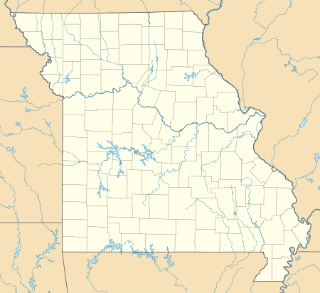 Almartha, Missouri Location of Almartha, Missouri | |
| Coordinates: 36°45′51″N 92°31′2″W[1] | |
| Country | U. S. A. |
| State | Missouri |
| County | Ozark County |
| Elevation | 284 m (932 ft) |
| Time zone | UTC-6 (CST) |
| • Summer (DST) | UTC-5 (CDT) |
A post office called Almartha was established in 1855, and remained in operation until 1969.[4] The community was named from the first names of early settlers Albert and Martha McSpadden.[5]
References
- Wasola, Missouri, 7.5 Minute Topographic Quadrangle, USGS, 2004
- U.S. Geological Survey Geographic Names Information System: Almartha, Missouri
- Rockbridge, Missouri, 7.5 Minute Topographic Quadrangle, USGS, 1973
- "Post Offices". Jim Forte Postal History. Retrieved 27 November 2016.
- "Ozark County Place Names, 1928–1945". The State Historical Society of Missouri. Archived from the original on June 24, 2016. Retrieved November 27, 2016.
Municipalities and communities of Ozark County, Missouri, United States | ||
|---|---|---|
| City | 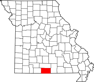 Map of Missouri highlighting Ozark County | |
| Villages | ||
| Townships |
| |
| CDPs | ||
| Other unincorporated communities | ||
| Ghost towns | ||
This article is issued from Wikipedia. The text is licensed under Creative Commons - Attribution - Sharealike. Additional terms may apply for the media files.