Alderney Airport
Alderney Airport (IATA: ACI, ICAO: EGJA) is the only airport on the island of Alderney. Built in 1935, Alderney Airport was the first airport in the Channel Islands. Located on the Blaye (1 NM (1.9 km; 1.2 mi) southwest of St Anne), it is the closest Channel Island airport to the south coast of England and the coast of France. Its facilities include a hangar, the Airport Fire Station, and avgas refuelling. In 2014 the airport handled 61,317 passengers and 6,183 total movements,[3] continuing the downturn in traffic noted in recent years.
Alderney Airport | |||||||||||||||||||
|---|---|---|---|---|---|---|---|---|---|---|---|---|---|---|---|---|---|---|---|
| Summary | |||||||||||||||||||
| Airport type | Public | ||||||||||||||||||
| Operator | States of Guernsey | ||||||||||||||||||
| Serves | Alderney | ||||||||||||||||||
| Location | St Anne | ||||||||||||||||||
| Elevation AMSL | 290 ft / 88 m | ||||||||||||||||||
| Coordinates | 49°42′24″N 002°12′52″W | ||||||||||||||||||
| Website | alderney | ||||||||||||||||||
| Map | |||||||||||||||||||
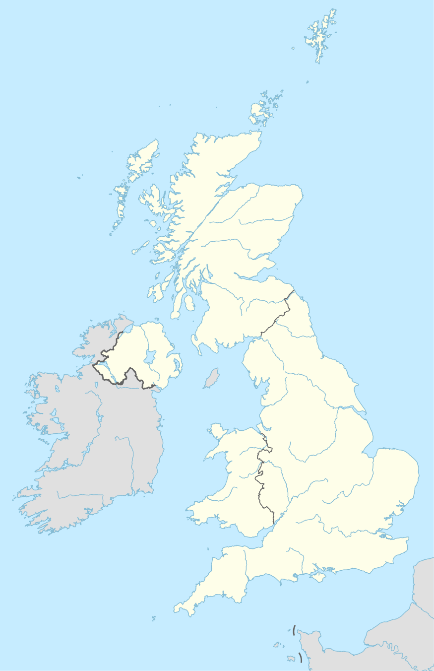
.svg.png) EGJA Location in the Channel Islands  EGJA Location relative to France and Great Britain | |||||||||||||||||||
| Runways | |||||||||||||||||||
| |||||||||||||||||||
| Statistics (2018) | |||||||||||||||||||
| |||||||||||||||||||
Runways
Alderney is unique amongst Channel Islands airports in having three operational runways. The main runway, 08/26 is 880 m (2,887 ft) long and is mainly asphalt. The two secondary runways are both grass, 13/31 being 733 m (2,405 ft) long, with 03/21 having a length of 497 m (1,631 ft). The main runway is equipped with low intensity lighting, with portable lighting being available on runway 14/32. The approach and runway lights were replaced in 2006.
Operations
The terminal building, erected in 1968, contains an arrivals room and a departure lounge, with a check-in desk for the airport's only scheduled airline, Aurigny.[4] Alderney is not a 24-hour airport; during winter, it is open Monday to Saturday from 0740 until 1830 and on Sunday from 0840 until 1830. During summer, it is open Monday - Thursday from 0740 until 1830 and Friday - Sunday from 0740 until 1920.
The airport also has its own non-directional beacon, with runways 08 and 26 utilising this for instrument approaches during Instrument meteorological conditions. A GPS (satellite) approach is also being developed in conjunction with Eurocontrol and NATS. This will mean that aircraft can land in lower visibility.
Alderney has self-manoeuvring stands. Formal stands are not required due to the lack of space to accommodate nose-in-configured aircraft.
Airlines and destinations
| Airlines | Destinations |
|---|---|
| Aurigny | Guernsey, Southampton |
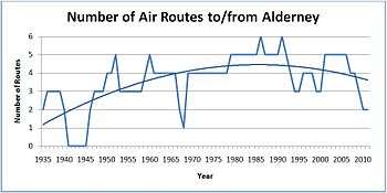
Currently the only direct scheduled links from the island are Southampton and Guernsey. Routes to other destinations such as Brighton, Bournemouth, Cherbourg, Exeter, Plymouth and Jersey were abandoned over the years due to what Blue Islands, for example, claimed was 'lack of interest'. These routes had been operated on and off by Aurigny and Blue Islands but also Alderney Air Ferries, Air Sarnia, and Air Camelot during the 1970s and 1980s. The number of air routes to the island is at its lowest since the Second World War except for a brief intermission during the 1967-8 period, when another airline (Glos Air, later to be Aurigny Air Services) was found to fill the void (see below right).
From September 2013, airline Aurigny operated direct flights to Jersey on a trial basis for a period of six weeks.[5]
In April 2015, it was announced that the States of Alderney had asked airline Citywing to operate a seasonal Summer service between Alderney and Jersey using Let L-410 aircraft.[6] However this service has not materialised.
In January 2017, a new airline Air Alderney was set up with the intention of commencing direct flights using Britten-Norman Islander aircraft from Alderney to destinations including Jersey, Cherbourg, Lee-on–Solent, and Brighton. Despite considerable progress being made in acquiring aircraft and obtaining an Air Operator's Certificate, to date operations have not yet commenced due to complications regarding ground operations at the intended destination airports.
Future
The States of Alderney has put aside £400,000 from the £1m paid for the expansion of the airport. This will most likely be used to pay for redevelopment of the terminal, which is over 40 years old and has a leaky flat roof.[7]
Statistics

| Year | Passenger Numbers | Year | Passenger Numbers | Year | Passenger Numbers |
|---|---|---|---|---|---|
| 1989 | 102,649 | 1999 | 77,198 | 2009 | 74,835 |
| 1990 | 105,458 | 2000 | 75,199 | 2010 | 70,012 |
| 1991 | 80,684 | 2001 | 72,111 | 2011 | 69,546 |
| 1992 | 78,365 | 2002 | 72,861 | 2012 | 64,165 |
| 1993 | 77,313 | 2003 | 72,248 | 2013 | 62,855 |
| 1994 | 83,681 | 2004 | 74,292 | 2014 | 61,317 |
| 1995 | 84,834 | 2005 | 76,205 | 2015 | 59,843 |
| 1996 | 84,012 | 2006 | 76,806 | 2016 | 57,595 |
| 1997 | 81,048 | 2007 | 79,087 | 2017 | 54,760 |
| 1998 | 73,099 | 2008 | 77,104 | 2018 | 53,343 |
Further reading
- Pinnegar, Edward (5 August 2010). A History of Aviation in Alderney. Amberley Publishing, Stroud. p. 128. ISBN 978-1-84868-981-7.
References
- Alderney - EGJA
- "UK airport data 2017: Tables 3, 9 and 13.pdf". UK Civil Aviation Authority. Retrieved 26 March 2018.
- Civil Aviation Authority Statistics 2014 Archived 2015-04-02 at the Wayback Machine
- Alderney Airport website (see external links)
- "BBC News: Alderney to Jersey air route back in new trial". 27 July 2013.
- "BBC News: Citywing airline asked to run Alderney-Jersey route". 16 April 2015.
- Pinnegar, Edward (2010). A History of Aviation in Alderney. Stroud: Amberley Publishing. p. 96. ISBN 978-1-84868-981-7.
- "Alderney Airport Master Plan". States of Guernsey. Archived from the original on 4 October 2006. Retrieved 25 September 2011.
- "United Kingdom Civil Aviation Authority". Retrieved 25 September 2011.
External links
![]()
- Official website
- Live Alderney Arrivals / Departures (provided by FlightStats)
- NATS AIS (NATS Aeronautical Information Service)
- CI Aviation (Channel Islands aviation website)
