Aldabra Group
The Aldabra Group are part of the Outer Islands of the Seychelles, lying in the southwest of the island nation, 1,000 kilometres (620 miles) from the capital, Victoria, on Mahé Island.[1]
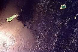
 NASA space shuttle photo showing all the islands of the Aldabra Group | |
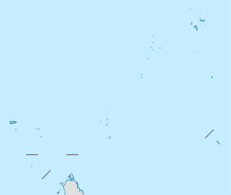
 Aldabra Group Location of Aldabra Group in Seychelles | |
| Geography | |
|---|---|
| Location | Indian Ocean |
| Coordinates | 09°42′S 47°3′E |
| Archipelago | Seychelles |
| Adjacent bodies of water | Indian Ocean |
| Total islands | 100 |
| Major islands | |
| Area | 180.03 km2 (69.51 sq mi) |
| Highest elevation | 35 m (115 ft) |
| Highest point | unnamed dune |
| Administration | |
| Group | Outer Islands |
| Sub-Group | Aldabra Group |
| Districts | Outer Islands District |
| Largest settlement | Assumption village (pop. 20) |
| Demographics | |
| Population | 34 (2016) |
| Pop. density | 0.19/km2 (0.49/sq mi) |
| Ethnic groups | Creole, French, East Africans, Indians. |
| Additional information | |
| Time zone | |
| ISO code | SC-26 |
| Official website | www |
Population and area
The group has 3 inhabited islands and 1 uninhabited. The main settlement is on Assumption Island, where construction of a large military base is currently undergoing. Another village is the Aldabra Research Station on Aldabra. The smallest village is on Astove, consisting of 2 people only. An abandoned village is located on Menai Island of Cosmoledo.[2] The total land area of the Aldabra Group is 180.03 km².
Islands in the Aldabra group
- Aldabra Atoll (a raised atoll with four main and some 40 small islets)
- Assumption Island (a single island on a raised reef)
- Cosmoledo Atoll (a raised atoll with two main and about 18 smaller islets)
- Astove Island (a raised atoll with just one island)
gollark: ... I mean, Discord?
gollark: Anyway, the e-ink ones (or at least mine) have an accursed non-Android Linuxy thing with a UI entirely done with web technology for some reason.
gollark: I think it's entirely the same except they have a different set of preinstalled apps to AOSP/Googlized Android, and Amazon services instead.
gollark: It's basically Android.
gollark: * e-paper, e-ink is a brand name.
References
- British Admiralty nautical chart BA 718 - Islands North of Madagascar, Scale 1:100000
- The Islands of the Seychelles
This article is issued from Wikipedia. The text is licensed under Creative Commons - Attribution - Sharealike. Additional terms may apply for the media files.
