Ainthorpe
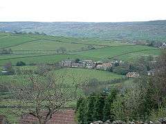
Ainthorpe is a village in the civil parish of Danby and the Scarborough district of the county of North Yorkshire, England. It is situated within the North York Moors National Park in the Esk Valley, a quarter of a mile south of Danby and 12 miles (19 km) west of Whitby.[1][2]
| Ainthorpe | |
|---|---|
 Ainthorpe | |
 Ainthorpe Location within North Yorkshire | |
| OS grid reference | NZ7028208063 |
| District |
|
| Shire county | |
| Region | |
| Country | England |
| Sovereign state | United Kingdom |
| Post town | WHITBY |
| Postcode district | YO21 |
| Police | North Yorkshire |
| Fire | North Yorkshire |
| Ambulance | Yorkshire |
| UK Parliament | |
Governance
The village lies within the Scarborough and Whitby Parliament constituency; the Esk Valley Electoral District of North Yorkshire County Council; and the Danby Ward of the Scarborough District Borough Council.[3] The village is part of the Danby Parish Group that includes Castleton, Westerdale, Fryup and Houlsyke.[4]
Community

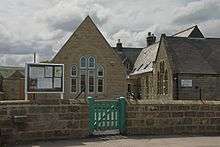
The village hosts the Danby Church of England (VC) school, located on Ainthorpe Lane.[5] Built by William Butterfield in 1860, it is a Grade II listed building.[6] The school is within the Secondary Education catchment area for Eskdale School in Whitby.[7]
There is a 16th-century hotel, the Fox & Hounds Inn, in the village.[8]
References
- Ordnance Survey: Landranger map sheet 94 Whitby & Esk Dale (Robin Hood's Bay) (Map). Ordnance Survey. 2012. ISBN 9780319228999.
- "Ordnance Survey: 1:50,000 Scale Gazetteer" (csv (download)). www.ordnancesurvey.co.uk. Ordnance Survey. 1 January 2016. Retrieved 30 January 2016.
- "North Yorkshire County Council". Retrieved 10 December 2016.
- "Parish Council". Retrieved 10 December 2016.
- "Primary School". Retrieved 10 December 2016.
- "Danby School and Masters House". Retrieved 10 December 2016.
- "Secondary School Catchment Area" (PDF). Retrieved 10 December 2016.
- "Welcome to the Fox & Hounds Inn, Ainthorpe". Retrieved 9 October 2016.