A30 motorway (Netherlands)
The A30 motorway is a motorway in the Netherlands. It is located entirely in the Dutch province of Gelderland.
| |
|---|---|
| Rijksweg 30 | |
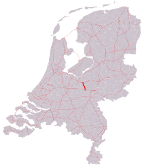 Location of the A30 motorway | |
| Major junctions | |
| North end | |
| South end | |
| Location | |
| Provinces | Gelderland |
| Highway system | |

Overview
The 18 kilometer long motorway connects the A12 motorway near Ede with the A1 near Barneveld. No European routes travel along the A30 motorway.
The section near the A1 motorway is not built at motorway standards. On some connections, for example between the A30 and the eastern section of the A1, drivers will have to pass traffic lights. For the busy relations between the A30 and the western part of the A1 and vice versa, bypasses have been created to avoid heavy congestion.
Exit list
The entire route is in Gelderland Province.
| Municipality | km | mi | Exit | Name | Destinations | Notes |
|---|---|---|---|---|---|---|
| Ede, Netherlands | 7 | 4.3 | — | Interchange Maanderbroek | ||
| 8 | 5.0 | 1 | Industrial park Ede | Schuttersweg / Galvanistraat | ||
| 10 | 6.2 | 2 | Ede-Noord | |||
| 15 | 9.3 | 3 | Lunteren | Postweg / Scharrenburgersteeg | ||
| Scherpenzeel, Gelderland | 20 | 12 | 4 | Scherpenzeel | ||
| Barneveld (municipality) | 23 | 14 | 5 | Industrial park Harselaar | Thorbeckelaan | |
| 25 | 16 | — | Barneveld | |||
| 1.000 mi = 1.609 km; 1.000 km = 0.621 mi | ||||||
gollark: Oh, is yours the 2 or something?
gollark: 3B.
gollark: I was going to say I could try compiling it on my pi, but it runs a sane 64-bit OS.
gollark: Possibly, but that is *pretty* old so the dependencies might break.
gollark: Not strictly needed but it might be slightly more vulnerable to data loss without that.
References
This article is issued from Wikipedia. The text is licensed under Creative Commons - Attribution - Sharealike. Additional terms may apply for the media files.