215th Street station
215th Street is a local station on the IRT Broadway–Seventh Avenue Line of the New York City Subway. Located at the intersection of 215th Street and Tenth Avenue in the Manhattan neighborhood of Inwood, it is served by the 1 train at all times.
215 Street | |||||||
|---|---|---|---|---|---|---|---|
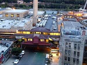 Aerial view of station | |||||||
| Station statistics | |||||||
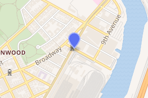
| Address | West 215th Street & 10th Avenue New York, NY 10034 | ||||||
| Borough | Manhattan | ||||||
| Locale | Inwood | ||||||
| Coordinates | 40.869473°N 73.915074°W | ||||||
| Division | A (IRT) | ||||||
| Line | IRT Broadway–Seventh Avenue Line | ||||||
| Services | 1 | ||||||
| Transit connections | |||||||
| Structure | Elevated | ||||||
| Platforms | 2 side platforms | ||||||
| Tracks | 3 (2 in regular service) | ||||||
| Other information | |||||||
| Opened | March 12, 1906 | ||||||
| Station code | 297[1] | ||||||
| Opposite-direction transfer available | No | ||||||
| Traffic | |||||||
| Passengers (2019) | 527,505[2] | ||||||
| Rank | 408 out of 424[2] | ||||||
| Station succession | |||||||
| Next north | Marble Hill–225th Street: 1 221st Street: no regular service (demolished) | ||||||
| Next south | 207th Street: 1 | ||||||
| |||||||
| |||||||
| |||||||

History
The West Side Branch of the first subway was extended northward to a temporary terminus of 221st Street and Broadway on March 12, 1906 with the first open station at Dyckman Street, as the stations at 168th Street, 181st Street, and 191st Street were not yet completed.[3][4][5] This extension was served by shuttle trains operating between 157th Street and 221st Street until May 30, 1906, when express trains began running through to 221st Street.[6][7]
In 1948, platforms on the IRT Broadway–Seventh Avenue Line from 103rd Street to 238th Street were lengthened to 514 feet (157 m) to allow full ten-car express trains to stop at this station. Previously, the station could only hold six-car local trains. The platform extensions were opened in stages. On July 9, 1948, the platform extensions at stations between 207th Street and 238th Street were opened for use at the cost of $423,000.[8][9]
In 1969, the station's wooden platforms were replaced with concrete ones.[10]
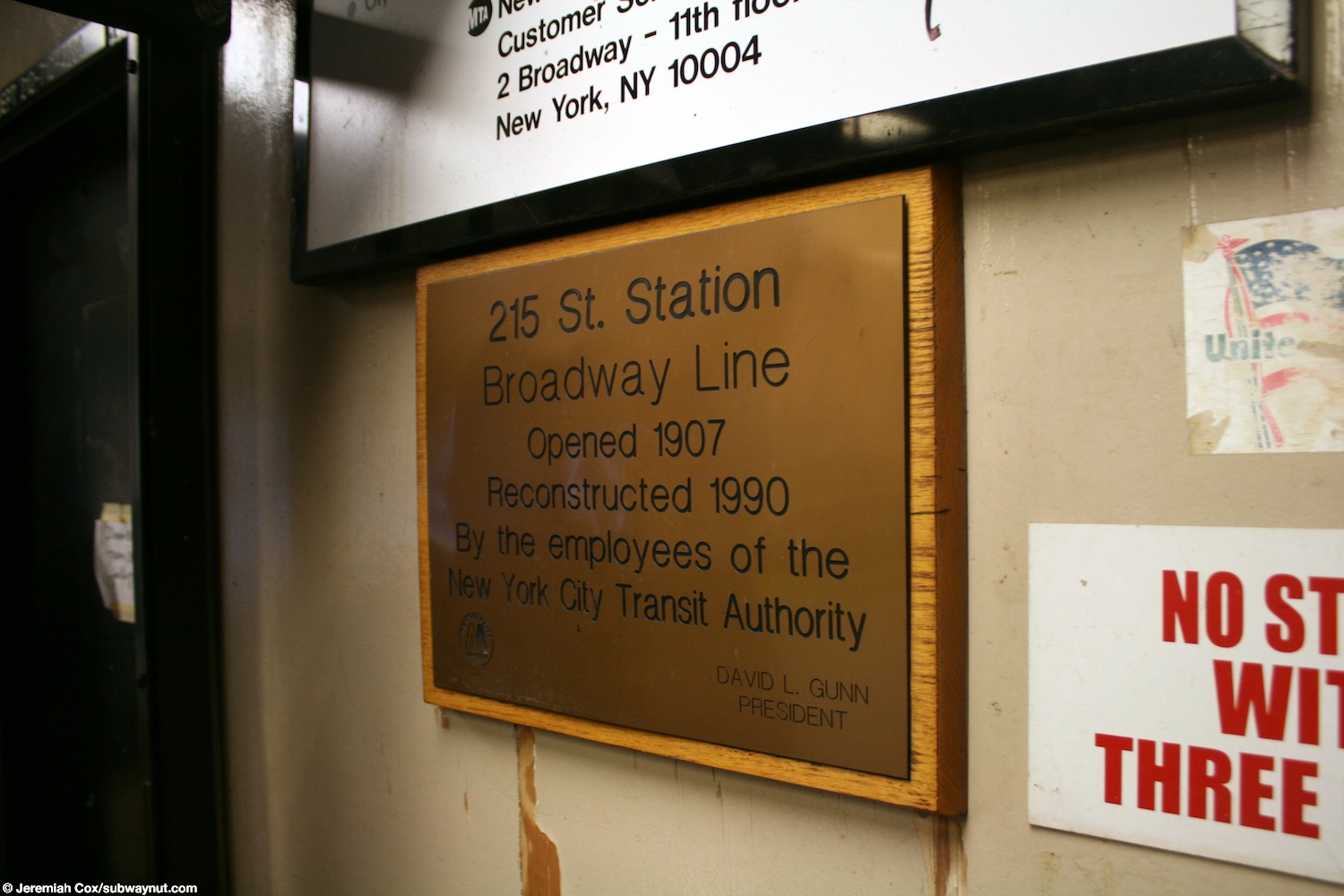
The station was renovated by an in-house crew of New York City Transit Authority employees in 1990.[11]
Station layout
| P Platform level |
Side platform | |
| Northbound local | ← ← | |
| Peak-direction express | No regular service | |
| Southbound local | | |
| Side platform | ||
| M | Mezzanine | Fare control, station agent, MetroCard machines |
| G | Street level | Entrances/exits |
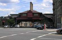
This elevated station has two side platforms and three tracks with the center track not used in revenue service.[12] Both platforms have beige windscreens and dark canopies in the center, which were replaced as part of a renovation project in 2012. At either ends of the platforms, black steel waist-high fences are installed. The station name plates are in the standard black with white lettering.
The 1991 artwork here is called Elevated Nature I-IV by Wopo Holup. It consists of two concrete panels with wooden frames on the southbound platform's station house. Each panel consists of eight squares depicting tree limbs. This artwork is also located at four other stations on this line.
The station is near the northern end of the 207th Street Yard, which includes the 215th Street Signal Shop, and the MTA Buses Kingsbridge Depot which is just slightly north of this station. It is also four blocks along 218th Street from Inwood Hill Park and, also on 218th Street, provides access to Columbia University's Baker Field athletic complex, as well as the Allen Hospital, a satellite facility of NewYork–Presbyterian Hospital. North of the station, the line crosses over the Harlem River Ship Canal via the Broadway Bridge into the mainland of New York.
Exits
Both platforms have one wooden adjacent station house in the center. However, only the southbound one is used for passenger service. Three doors from the platform lead to a small waiting area, where a turnstile bank provides access to and from the station. Outside fare control, there is a token booth and two staircases going down to either western corners of Tenth Avenue and 215th Street.[13]
The station house on the northbound platform is used for employees only. One exit-only turnstile at platform level leads to a staircase that goes down to the northeast corner of 215th Street and Tenth Avenue while a High Entry/Exit Turnstile, also at platform level, leads to a staircase going down to the southeast corner.[13][14]
Ridership
In 2018, the station had 553,050 boardings, making it the 402nd most used station in the 424-station system. This amounted to an average of 1,787 passengers per weekday. In terms of annual passenger ridership and in terms of weekday daily ridership, this is the least used station in Manhattan.[2]
References
- "Station Developers' Information". Metropolitan Transportation Authority. Retrieved June 13, 2017.
- "Facts and Figures: Annual Subway Ridership 2014–2019". Metropolitan Transportation Authority. 2020. Retrieved May 26, 2020.
- "Farthest North in Town by the Interborough" (PDF). The New York Times. January 14, 1907. p. 18.
- Report of the Public Service Commission for the First District of the State of New York. New York State Public Service Commission. 1913.
- "Trains To Ship Canal: But They Whiz by Washington Heights Station" (PDF). The New York Times. March 13, 1906. p. 16. Retrieved August 16, 2015.
- Interborough Rapid Transit Company (1906). Subway Division - New York City (Map).
- "Express to 221st Street: Will Run In the Subway To-day–New 181st Street Station Ready" (PDF). The New York Times. May 30, 1906. p. 1.
- Report for the three and one-half years ending June 30, 1949. New York City Board of Transportation. 1949. hdl:2027/mdp.39015023094926.
- "More Long Platforms – Five Subway Stations on IRT to Accommodate 10-Car Trains" (PDF). The New York Times. July 10, 1948. p. 8. ISSN 0362-4331. Retrieved March 27, 2016.
- Minutes and Proceedings. New York City Transit Authority. 1969. p. 1217.
- Cox, Jeremiah (December 31, 2010). "A plaque for the station opened in 1907 and rehabilitated in 1991". subwaynut.com. Retrieved January 26, 2020.
- Dougherty, Peter (2006) [2002]. Tracks of the New York City Subway 2006 (3rd ed.). Dougherty. OCLC 49777633 – via Google Books.
- "MTA Neighborhood Maps: Inwood" (PDF). Metropolitan Transportation Authority. 2015. Retrieved July 29, 2016.
- "Inwood Rezoning Proposal Chapter 14: Transportation" (PDF). edc.nyc. 2017. p. 14-47, 14-48. Retrieved January 26, 2020.
External links
| Wikimedia Commons has media related to 215th Street (IRT Broadway – Seventh Avenue Line). |
- nycsubway.org – IRT West Side Line: 215th Street
- Station Reporter – 1 Train
- The Subway Nut – 215th Street Pictures
- 215th Street entrance from Google Maps Street View
- Platforms from Google Maps Street View