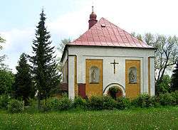
Čachotín
Čachotín [ˈtʃaxociːn] is a village and municipality (obec) in Havlíčkův Brod District in the Vysočina Region of the Czech Republic.
Čachotín | |
|---|---|
Municipality | |
 | |
 Čachotín | |
| Coordinates: 49°41′34″N 15°36′35″E | |
| Country | |
| Region | Vysočina |
| District | Havlíčkův Brod |
| Area | |
| • Total | 6.3 km2 (2.4 sq mi) |
| Elevation | 572 m (1,877 ft) |
| Population (1.1.2014) | |
| • Total | 180 |
| • Density | 29/km2 (74/sq mi) |
| Postal code | 583 01 |
The municipality covers an area of 6.3 square kilometres (2.4 sq mi), and has a population of 182 (as at 3 July 2006).
Čachotín lies approximately 10 kilometres (6 mi) north of Havlíčkův Brod, 33 km (21 mi) north of Jihlava, and 96 km (60 mi) south-east of Prague.
Gallery
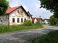 Main street
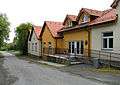 Municipal office
gollark: Denied.
gollark: I'm beginning to slightly forget what day of the week it is.
gollark: Imagine sleeping as opposed to not not not sleeping.
gollark: No.
gollark: They'll also probably be satisfied with something vaguely functional which does the job but is bad. See: 14917489124 bad electron apps.
This article is issued from Wikipedia. The text is licensed under Creative Commons - Attribution - Sharealike. Additional terms may apply for the media files.