Þórshöfn
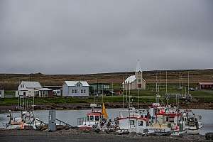
Þórshöfn is a small fishing village in northeast Iceland, located on the northern coast of the Langanes peninsula on the Þistilfjörður bay.
Þórshöfn | |
|---|---|
Village | |
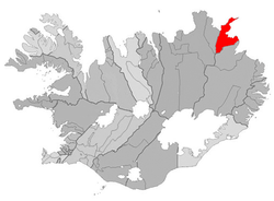
 Location of the Municipality of Langanesbyggð | |
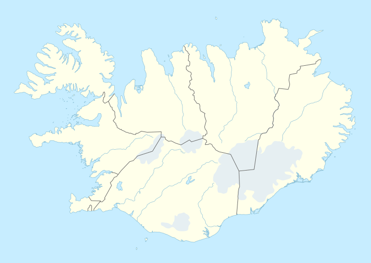
 Þórshöfn Location of Þórshöfn in Iceland | |
| Coordinates: 66°12′N 15°20′W | |
| Country | |
| Constituency[1] | Northeast Constituency |
| Region[2] | Northeastern Region |
| Municipality | Langanesbyggð |
| Population (2011) | |
| • Total | 380 |
| Time zone | UTC+0 (GMT) |
| Post Code | 680 |
| Website | Official website |

Þórshöfn in Iceland
The village has a population of 380 people. It is the administrative centre of Langanesbyggð municipality and of the neighbouring Svalbarðshreppur municipality. In Þórshöfn there is a year-round service to tourists, and Air Iceland connects the village to Akureyri and Reykjavík with seasonal flights from Þórshöfn Airport.
Þórshöfn is also the Icelandic name of Tórshavn (capital of the Faroe Islands).
Climate
The climate is arctic (Koppen: ET) with cold winters and cool summers.
| Climate data for Miðfjarðarnes, Langanesbyggð (2000–2014) | |||||||||||||
|---|---|---|---|---|---|---|---|---|---|---|---|---|---|
| Month | Jan | Feb | Mar | Apr | May | Jun | Jul | Aug | Sep | Oct | Nov | Dec | Year |
| Record high °C (°F) | 12.2 (54.0) |
14.0 (57.2) |
13.1 (55.6) |
20.8 (69.4) |
20.2 (68.4) |
22.5 (72.5) |
25.0 (77.0) |
25.9 (78.6) |
21.0 (69.8) |
16.8 (62.2) |
14.5 (58.1) |
14.8 (58.6) |
25.9 (78.6) |
| Average high °C (°F) | 2.9 (37.2) |
2.8 (37.0) |
2.8 (37.0) |
5.0 (41.0) |
7.2 (45.0) |
10.5 (50.9) |
12.7 (54.9) |
12.5 (54.5) |
10.7 (51.3) |
6.2 (43.2) |
3.4 (38.1) |
2.8 (37.0) |
6.7 (44.1) |
| Daily mean °C (°F) | −0.1 (31.8) |
−0.7 (30.7) |
−0.6 (30.9) |
1.2 (34.2) |
3.8 (38.8) |
7.1 (44.8) |
9.3 (48.7) |
9.4 (48.9) |
7.0 (44.6) |
3.1 (37.6) |
0.8 (33.4) |
−0.5 (31.1) |
3.3 (37.9) |
| Average low °C (°F) | −3.5 (25.7) |
−3.8 (25.2) |
−3.6 (25.5) |
−1.8 (28.8) |
0.7 (33.3) |
4.1 (39.4) |
6.4 (43.5) |
6.3 (43.3) |
3.8 (38.8) |
0.5 (32.9) |
−2.3 (27.9) |
−4.0 (24.8) |
0.2 (32.4) |
| Record low °C (°F) | −20.5 (−4.9) |
−16.9 (1.6) |
−18.7 (−1.7) |
−18.4 (−1.1) |
−10.5 (13.1) |
−4.2 (24.4) |
−1.2 (29.8) |
−2.1 (28.2) |
−6.1 (21.0) |
−14.0 (6.8) |
−19.3 (−2.7) |
−19.1 (−2.4) |
−20.5 (−4.9) |
| Average precipitation mm (inches) | 46 (1.8) |
33 (1.3) |
40 (1.6) |
37 (1.5) |
46 (1.8) |
36 (1.4) |
49 (1.9) |
66 (2.6) |
90 (3.5) |
93 (3.7) |
80 (3.1) |
44 (1.7) |
660 (26.0) |
| Source: Veðurstofa Íslands[3] | |||||||||||||
gollark: I see. Well, you are to rejoin at some point.
gollark: But we have SSL and ApioServ now!
gollark: ylpsqwIcan'tremember is up but unlinked‽
gollark: IRC good, however, being a simple open protocol?
gollark: <@!319753218592866315> <@!319753218592866315> <@!319753218592866315> <@!319753218592866315> <@!319753218592866315> <@!319753218592866315> <@!319753218592866315> <@!319753218592866315> <@!319753218592866315> <@!319753218592866315> <@!319753218592866315> <@!319753218592866315> <@!319753218592866315> <@!319753218592866315> What is <@!319753218592866315> <@!319753218592866315> <@!319753218592866315> <@!319753218592866315> <@!319753218592866315> <@!319753218592866315> <@!319753218592866315> your objection <@!319753218592866315> <@!319753218592866315> <@!319753218592866315> <@!319753218592866315> <@!319753218592866315> to APIONET?
References
- Political division
- Mainly statistical division
- "Mánaðarmeðaltöl fyrir stöð 515 - Miðfjarðarnes". Veðurstofa Íslands.
External links
This article is issued from Wikipedia. The text is licensed under Creative Commons - Attribution - Sharealike. Additional terms may apply for the media files.