Lavaltrie, Quebec
Lavaltrie is a city located within the D'Autray Regional County Municipality in the southern part of the region of Lanaudière, Quebec, Canada, northeast of Montreal outside the suburban sprawl of the northern crown (i.e., the suburbs located north of Laval). The population was 13,267 as of the Canada 2011 Census within a land surface area of about 70 square kilometres, with the majority of the territory being used for agricultural activities. .
Lavaltrie | |
|---|---|
City | |
 | |
 Location within D'Autray RCM | |
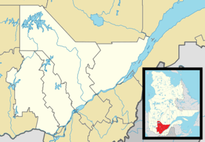 Lavaltrie Location in central Quebec | |
| Coordinates: 45°53′N 73°17′W[1] | |
| Country | Canada |
| Province | Quebec |
| Region | Lanaudière |
| RCM | D'Autray |
| Constituted | May 16, 2001 |
| Government | |
| • Mayor | Christian Goulet |
| • Federal riding | Berthier—Maskinongé |
| • Prov. riding | Berthier |
| Area | |
| • Total | 79.50 km2 (30.70 sq mi) |
| • Land | 68.39 km2 (26.41 sq mi) |
| Population (2016)[3] | |
| • Total | 13,657 |
| • Density | 199.7/km2 (517/sq mi) |
| • Pop 2011-2016 | |
| • Dwellings | 5,351 |
| Time zone | UTC−5 (EST) |
| • Summer (DST) | UTC−4 (EDT) |
| Postal code(s) | J5T |
| Area code(s) | 450 and 579 |
| Highways | |
| Website | www |
History
The origins of Lavaltrie go back to the 17th century. Jean Talon, the intendant of New France, gave parcels of land (known as manors) to various lords. The land where Lavaltrie is now situated was given to a lieutenant, Sieur la Valtrie, by Talon in 1672. In the 18th century, land occupants built a new roadway along the Saint Lawrence River linking Montreal and Quebec City, named the Chemin Du Roy and now known as Quebec Route 138. For many decades, Lavaltrie was located in the centre of a large series of manors owned by lords intended to develop the agricultural sector.
Mostly a rural area until the second half of the 20th century, Lavaltrie has developed steadily due to the growing suburbs of Montreal.
Transportation
Lavaltrie's location near Autoroute 40 and Route 138 gives easy access to Montreal, Laval and the northern crown area of the Greater Montreal area. A-40 also gives Lavaltrie direct links to Trois-Rivières and Quebec City to the east and Ottawa to the west. Autoroute 31 and Route 131 which ends at the junction of the A-40 in Lavaltrie gives the area easy access to more remote and rural regions of the Lanaudière region. However, even though located beside the Saint Lawrence River on its north, the city does not have a direct access to the south with the closest links being Autoroute 25 via the Louis-Hippolyte Lafontaine Tunnel in Montreal to the west or the Berthierville-Sorel ferry to the east (Autoroute 55 in Trois-Rivières via the Laviolette Bridge being the closest roadway link to its east).

Education
Commission scolaire des Samares operates francophone public schools:
- École primaire de la Source[4]
- École primaire des Eaux-Vives[5]
- École primaire Jean-Chrysostôme-Chaussé[6]
- École primaire des Amis-Soleils[7]
- École Secondaire de la Rive
The Sir Wilfrid Laurier School Board operates anglophone public schools, including:
- Joliette Elementary School in Saint-Charles-Borromée[8]
- Joliette High School in Joliette[9]
References
- Reference number 368210 of the Commission de toponymie du Québec (in French)
- Geographic code 52007 in the official Répertoire des municipalités (in French)
- Statistics Canada 2016 Census - Lanoraie census profile
- "de la Source." Commission scolaire des Samares. Retrieved on September 23, 2017.
- "des Eaux-Vives." Commission scolaire des Samares. Retrieved on September 23, 2017.
- "Jean-Chrysostôme-Chaussé." Commission scolaire des Samares. Retrieved on September 23, 2017.
- "des Amis-Soleils." Commission scolaire des Samares. Retrieved on September 23, 2017.
- "JOLIETTE ELEMENTARY ZONE." Sir Wilfrid Laurier School Board. Retrieved on September 17, 2017.
- "Joliette High School Zone Sec 1-5." Sir Wilfrid Laurier School Board. Retrieved on September 5, 2017.
External links

- Website of the City of Lavaltrie (in French)
Adjacent Municipal Subdivisions | |
|---|---|
| Cities & Towns | |
|---|---|
| Municipalities |
|
| Parishes | |
| |
| Authority control |
|
|---|