Bomi County
Bomi is a county in the northwestern portion of the West African nation of Liberia. The county was established in 1984. The county's area is 746 square miles (1,900 km2).
Bomi County | |
|---|---|
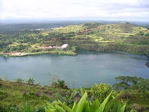 Bomi Lake | |
 Flag | |
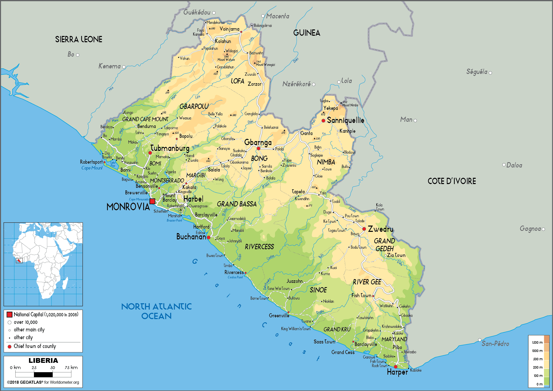
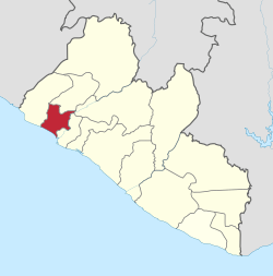 Location in Liberia | |
| Coordinates: 6°45′N 10°45′W | |
| Country | |
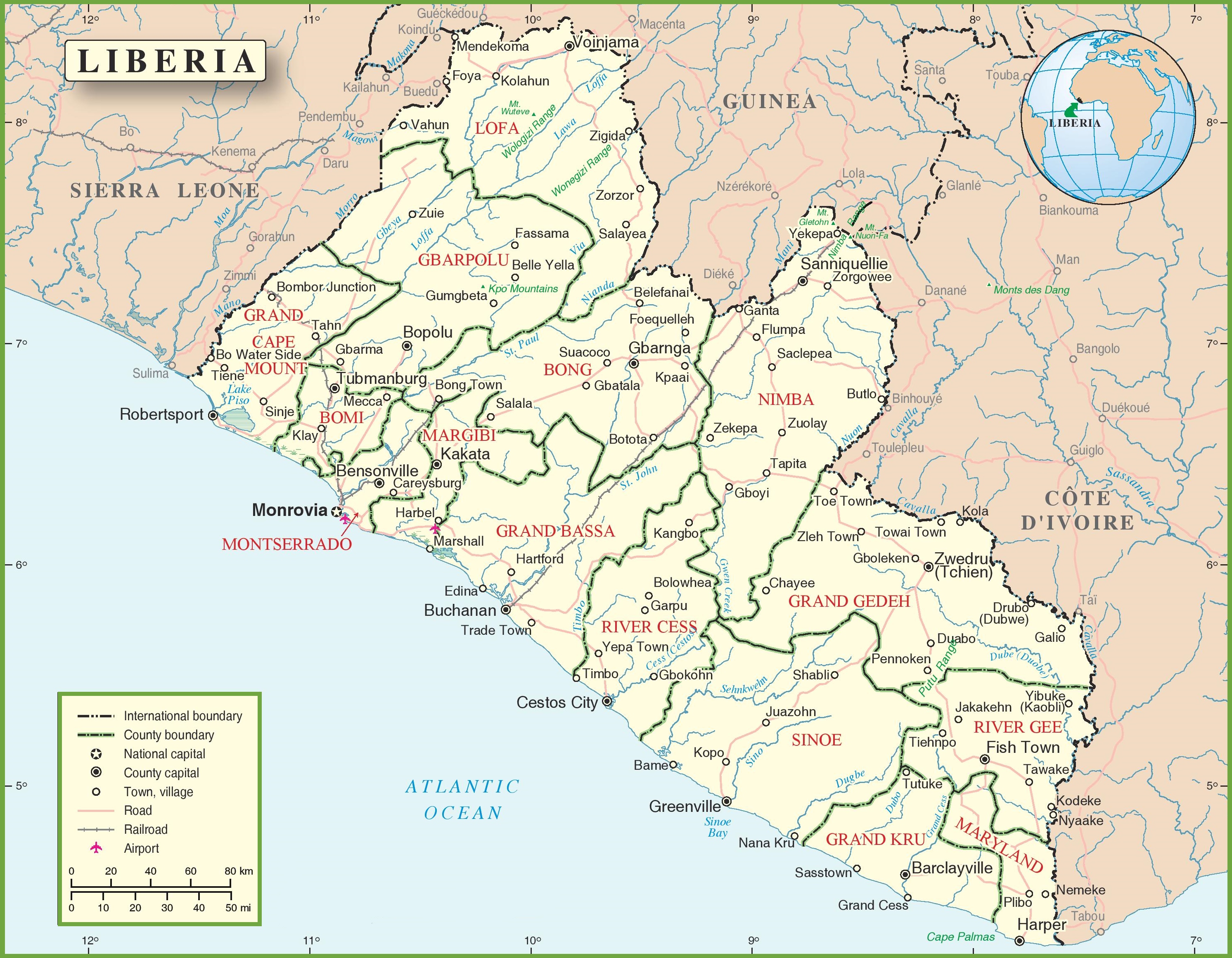
| Capital | Tubmanburg |
| Districts | Dewoin District Klay District Senjeh District Seuhn Mecca District |
| Established | 1984 |
| Government | |
| • Superintendent | Haja Washington |
| Area | |
| • Total | 1,932 km2 (746 sq mi) |
| Population (2008) | |
| • Total | 84,119 |
| • Density | 44/km2 (113/sq mi) |
| Time zone | UTC+0 (GMT) |
| ISO 3166 code | LR-BM |
| HDI (2018) | 0.427[1] low · 6th of 15 |
Bomi is one of 15 counties that comprise the first-level of administrative division in the nation. Tubmanburg serves as the county's capital. The County has four administrive districts.
Bomi is bordered on the northwest by Grand Cape Mount County, on the northeast by Gbarpolu and Bong Counties, on the southeast by Montserrado County and on the southwest by the Atlantic Ocean. As of the 2008 Liberian census, Bomi had a population of 84,119, making it the nation's eleventh most populous county.
History
From 1822 until the Liberian Declaration of Independence from the American Colonization Society on July 26, 1847 some 3,198 freed slaves and slaves from the Lesser Antilles, who had escaped from their slaveholders or born free left the Caribbean islands and came to Liberia with the help and support from the American Colonization Society and other organizations establishment. The former Caribbean slaves came to Liberia to live a better life, to be free and for self-government. The first batch of slaves who left the Caribbean islands was from Barbados, some 500 to 1,000 freed Caribbean slaves arrived as settlers to Liberia. The second set of settlers who came from the Caribbean islands was 345 from Trinidad and Tobago, followed by 620 from Saint Vincent and the Grenadines, another 350 from Saint Kitts and Nevis, the last two groups of settlers who left the Caribbean islands was 483 from Grenada, and the last group of settlers from Saint Lucia 400 former Caribbean slaves. As job opportunities and development growth increase the former slaves moved through Grand Cape Mount, Bomi, Montserrado County, Margibi County and other regions of Liberia.
Bomi County, formerly known as Bomi Territory, was once part of Montserrado County. The military regime of Samuel Doe established Bomi County in 1983. A legislative act later confirmed the County as being a separate entity. Bomi means “LIGHT” in the Gola language, recognizing the County's status as the first site for iron ore mining in Liberia.[2]
The Liberia Mining Company extracted iron ore in the territory during the 1950s and 1960s. The company closed its operations in 1979.[3]
Geography, climate and seasons
Bomi County has an area of 746 square miles (1,900 km2).[4] The County is bordered on the northwest by Grand Cape Mount County, on the northeast by Gbarpolu and Bong Counties, on the southeast by Montserrado County and on the southwest by the Atlantic Ocean.[2][5][6]
The Lofa River forms the boundary between Bomi and Grand Cape Mount Counties. A tributary of the river forms part of the boundary between Bomi and Gbarpolu Counties. The Saint Paul River forms part of the boundary between Bomi and Montserrado Counties. [7]
Bomi County's climate is generally warm throughout the year. There are two seasons in the year - the rainy season which begins in April and ends in October and the dry season from November to March.[2]
Demographics
The 2008 Liberian census showed that Bomi County had a population of 84,119, making it the eleventh most populous county in Liberia.[4] The County had at that time a population density of 113 persons per square mile (44 persons per km2).[4]
Bomi contains five chiefdoms and 18 clans.[8] The County's principal ethnic groups are Gola, Dei, Mandinka and Kpelle.[3]
Resources and economy
Bomi County's resources include diamond, rubber, timber, iron ore, gold, water, stone, sand and fertile agriculture land. 70% of the population engage in agricultural activities, including the production or exploitation of rice (the staple food), cassava, sweet potatoes, eddoes, plantains, vegetables, rubber, palm oil and livestock or in fisheries. 20% participate in business and trading. Local governments employ 10%. The Sime Darby rubber plantation, the second largest in Liberia, is located within the County.[3]
Administrative districts
References
- "Sub-national HDI - Area Database - Global Data Lab". hdi.globaldatalab.org. Retrieved 13 September 2018.
- "Bomi County Profile". Monrovia, Liberia: Republic of Liberia: Liberia Institute of Statistics and Geo (LISGIS) — Information Services. 2020. Retrieved 24 June 2020. Archived 24 June 2020 at the Wayback Machine.
- "Bomi County". Counties of Liberia. Liberia Institute of Politics and Democracy. Retrieved 24 June 2020. Archived 24 June 2020 at the Wayback Machine.
- "Table 5: Distribution of Population by County, Area and Density" (PDF). Republic of Liberia 2008 Population and Housing Census: Final Results. Monrovia, Liberia: Republic of Liberia: Liberia Institute of Statistics and Geo (LISGIS). May 2009. p. 10. Retrieved 24 June 2020. Archived 24 June 2020 at the Wayback Machine.
- "Bomi County Map Showing Districts and Population Figures" (PDF). Monrovia, Liberia: Republic of Liberia: Liberia Institute of Statistics and Geo (LISGIS). 2008. Retrieved 24 June 2020. Archived 24 June 2020 at the Wayback Machine.
- "Liberia Political Map". OnTheWorldMap. Retrieved 24 June 2020. Archived 24 June 2020 at the Wayback Machine.
- (1) "Pictures from Bomi County". TLC Africa 2008. Retrieved 23 June 2020. Archived 23 June 2020 at the Wayback Machine.
(2) "Liberia Physical Map". Worldometers. Retrieved 24 June 2020. Archived 24 June 2020 at the Wayback Machine.
(3) "Liberia Political Map". OnTheWorldMap. Retrieved 24 June 2020. Archived 24 June 2020 at the Wayback Machine. - "Bomi County". Counties Statistics Info. Monrovia, Liberia: Republic of Liberia: Liberia Institute of Statistics and Geo (LISGIS) — Information Services. 2020. Retrieved 24 June 2020. Archived 24 June 2020 at the Wayback Machine
External links
- "Bomi County: A Profile (DOC)". National Transitional Government of Liberia: United Nations Mission in Liberia: UNMIL Civil Affairs Section: Bomi County. 1 June 2005. Archived from the original on 30 November 2006.
- Voting Among the Ruins
- Liberia: Bomi County Launches "Operation Breakthrough"