Zemplín (village)
Zemplín (Hungarian: Zemplén) is a village and municipality in Trebišov District of the Košice Region.
Zemplín | |
|---|---|
Municipality | |
 | |
| Country | Slovakia |
| Region | Košice |
| District | Trebišov |
| First mentioned | 1214 |
| Area | |
| • Total | 14.67 km2 (5.66 sq mi) |
| Elevation | 106 m (348 ft) |
| Population (2019) | |
| • Total | 368 |
| • Density | 25/km2 (65/sq mi) |
| Postal code | 076 34 |
| Car plate | TV |
History
In historical records the village was first mentioned in 1214.[1]
Geography
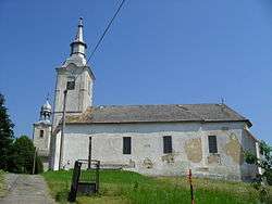
The village lies at an altitude of 106 metres and covers an area of 14,67 km².[2] It is located near the junction point of the rivers Ondava and Latorica (tributaries of the river Bodrog) in eastern Slovakia. Zemplín is also the location of Zemplín Castle, former administrative center of the former Zemplén County during the time the Kingdom of Hungary ruled the area.
Ethnicity
According to the 2001 census, 64.2% of inhabitants were Hungarians and 35.8% were Slovaks.
In 2019 the village had a population of 368.[3]
References
This article is issued from Wikipedia. The text is licensed under Creative Commons - Attribution - Sharealike. Additional terms may apply for the media files.