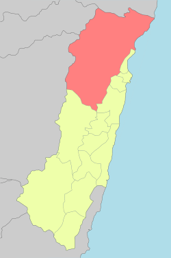
Xiulin, Hualien
Xiulin Township (Chinese: 秀林鄉; pinyin: Xiùlín Xiāng) or Sioulin Township is a mountain indigenous township of Hualien County, Taiwan. It is located northwest of Hualien City, and is the largest township in Taiwan by area (1,641.86 km²) with 9 villages. It has a population of 15,494, most of which are the indigenous Taroko people.[1][2]
Xiulin Township 秀林鄉 Sioulin | |
|---|---|
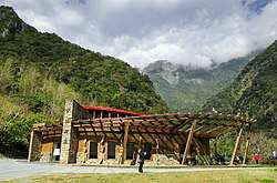 Buluowan in Taroko National Park | |
 | |
 Xiulin Township | |
| Coordinates: 24°13′00″N 121°32′00″E | |
| Country | Taiwan |
| Region | Eastern Taiwan |
| Government | |
| • Type | Township |
| Area | |
| • Total | 1,641.8555 km2 (633.9240 sq mi) |
| Population (December 2014) | |
| • Total | 15,494 |
| • Density | 9.201/km2 (23.83/sq mi) |
| Time zone | UTC+8 (CST) |
| Post code | 972 |
| Subdivision | 9 villages, 128 neighborhoods |
| Website | www.shlin.gov.tw |
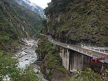
Because of its location beside the Central Mountain Range, the climate changes by altitude. Taroko National Park is located in Xiulin Township. In recent years, people in Xiulin have lobbied to change its name to "Taroko Township" (太魯閣鄉).
Administrative divisions
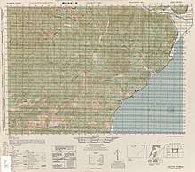
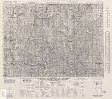
Map of northeastern Xiulin area (1944)
Map of southwestern Xiulin area (1944)
The township comprises nine villages: Chongde, Fushi, Heping, Jiamin, Jingmei, Shuiyuan, Tongmen, Wenlan and Xiulin.
Tourist attractions
- Taroko National Park
- Qingshui Cliff
- Sanchan Creek Scenic Area
- Mukumugi ecological Trail and preserve area
- Kilai Mountain (3607 m)
- Dayu Mountain (2565 m)
- Hehuanshan (3416 m)
- Pingfeng Mountain
- Xiangde Temple
- Shimen Mountain
- Wuming Mountain
Infrastructure
Transportation
- TRA Heping Station, Heren Station, Jingmei Station, Chongde Station (North-link line)
- Provincial Highway 8 (Central Cross-Island Highway)
- Provincial Highway 9 (Suhua Highway)
- Heping Cement Port
References
External links
| Wikimedia Commons has media related to Xiulin Township, Hualien. |
| Highland aboriginal Townships and Districts |
|  | ||||||||||||||||||||||||
|---|---|---|---|---|---|---|---|---|---|---|---|---|---|---|---|---|---|---|---|---|---|---|---|---|---|---|
| Plains aboriginal Townships and County-Controlled Cities | ||||||||||||||||||||||||||
Note: On the map, "Mountain Indigenous Areas" are in dark green and "Plains Indigenous Areas" are in light green. | ||||||||||||||||||||||||||
This article is issued from Wikipedia. The text is licensed under Creative Commons - Attribution - Sharealike. Additional terms may apply for the media files.