Wittenberg Mountain
Wittenberg Mountain, locally "the Wittenberg,[6]" is a mountain located in Ulster County, New York. The mountain is part of the Burroughs Range of the Catskill Mountains. Wittenberg is flanked to the southwest by Cornell Mountain and to the northeast by Terrace Mountain.
| Wittenberg Mountain | |
|---|---|
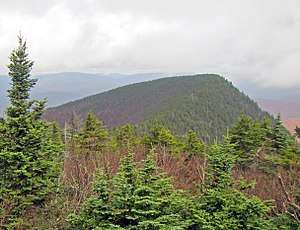 Wittenberg from near the summit of neighboring Cornell Mountain | |
| Highest point | |
| Elevation | 3780+ ft (1152+ m) NGVD 29[1] |
| Prominence | 200 ft (61 m) [1] |
| Listing | Catskill High Peaks 14th |
| Coordinates | 42°00′29″N 74°20′51″W [2] |
| Geography | |
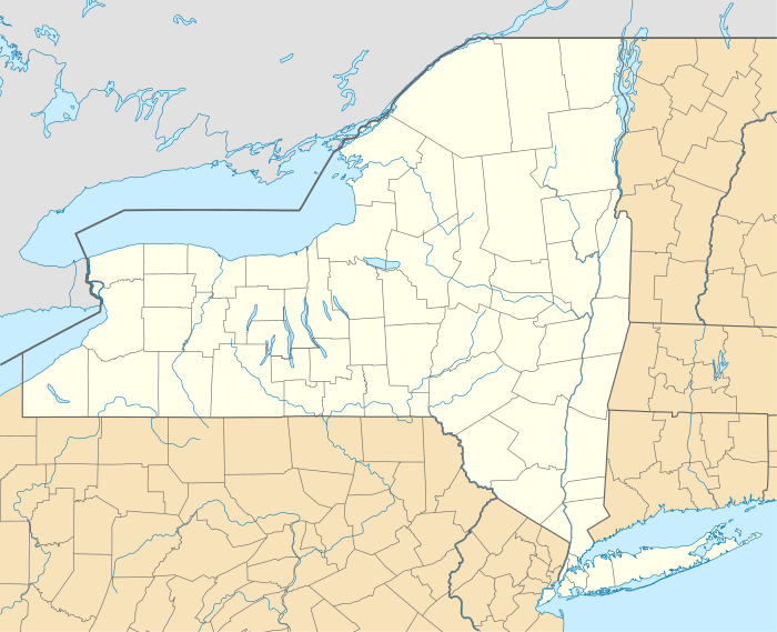 Wittenberg Mountain  Wittenberg Mountain Wittenberg Mountain (the United States) | |
| Parent range | Burroughs Range[3] |
| Topo map | USGS Phoenicia |
| Geology | |
| Age of rock | Late Devonian[4][5] |
| Mountain type | Pyramidal peak, with roche moutonnée summit |
Wittenberg Mountain stands within the watershed of Esopus Creek, which drains into the Hudson River, and into New York Bay. The northwest and northeast slopes of Wittenberg Mtn. drain into Woodland Creek, thence into Esopus Creek. The southeast side of Wittenberg drains into Wittenberg Brook, thence into Maltby Hollow Brook, Bush Kill, and Esopus Creek at Ashokan Reservoir.
Wittenberg Mountain is within the Slide Mountain Wilderness of New York's Catskill State Park. The Long Path, a 350-mile (560 km) long-distance hiking trail from New York City to Albany, is contiguous with the section of the Burroughs Range Trail crossing the summits of Slide, Cornell, and Wittenberg. Wittenberg Mountain is one of the 35 peaks in the Catskills greater than 3,500 feet elevation, and is a required ascent for membership in the Catskill Mountain 3500 Club.

See also
- List of mountains in New York
Notes
- "Wittenberg Mountain, New York". Peakbagger.com.
- "Wittenberg Mountain". Geographic Names Information System. United States Geological Survey.
- "Burroughs Range". Geographic Names Information System. United States Geological Survey.
- Ashokan Basin Bedrock Geology
- Geologic units in Ulster county, New York
- https://hikethehudsonvalley.com/hikes/wittenberg-mountain/
External links
| Wikimedia Commons has media related to Wittenberg Mountain. |
- "Wittenberg Mountain". SummitPost.org.
- "Wittenberg Mountain". Catskill 3500 Club.
| Northwest Catskills |  | |
|---|---|---|
| Blackhead Mountains | ||
| Other northeast Catskills | ||
| Devil's Path | ||
| Other central Catskills | ||
| Southwest Catskills | ||
| Burroughs Range | ||
| Other southern Catskills | ||