Williamstown Township, Michigan
Williamstown Township is a civil township of Ingham County in the U.S. state of Michigan, located east of Lansing(12.42 mi (19.98 km)), East Lansing(8.83 mi (14.21 km)) and directly to the east of Meridian Charter Township. The city of Williamston is at the southeast corner of the township, but is politically independent. As of the 2010 census, the township population was 4,978.
Williamstown Township, Michigan | |
|---|---|
 Williamstown Township  Williamstown Township | |
| Coordinates: 42°43′21″N 84°18′39″W | |
| Country | United States |
| State | Michigan |
| County | Ingham |
| Area | |
| • Total | 29.4 sq mi (76.3 km2) |
| • Land | 29.4 sq mi (76.2 km2) |
| • Water | 0.0 sq mi (0.1 km2) |
| Elevation | 922 ft (281 m) |
| Population (2010) | |
| • Total | 4,978 |
| • Estimate (2014[1]) | 5,027 |
| • Density | 164.3/sq mi (63.5/km2) |
| Time zone | UTC-5 (Eastern (EST)) |
| • Summer (DST) | UTC-4 (EDT) |
| FIPS code | 26-87440[2] |
| GNIS feature ID | 1627275[3] |
Communities
- Africa was a section of Williamstown Township settled by the Webb family. They were vocal abolitionists and so other residents of the area called where they lived Africa.[4]
- Alverson was the name of a post office in Williamstown Township. Samuel Alverson was a large landowner and he became the first postmaster and his home the post office in September 1852. The office closed in October 1867 and reopened in June 1868 with William Alverson as postmaster. It closed again in November 1874, but was reopened again in December 1874 and operated until January 1896.[4]
Politics and organization
The township hall is located on North Zimmer Road at the corner of Germany Road, at 4990 N Zimmer. Williamstown is a "general law" township with a supervisor, clerk, treasurer and four trustees. The current Township Supervisor is Wanda Bloomquist.[5]
See the related article on Williamston, Michigan for additional history of the area.
Geography
According to the United States Census Bureau, the township has a total area of 29.4 square miles (76 km2), of which 29.4 square miles (76 km2) is land and 0.04 square miles (0.10 km2) (0.10%) is water.[6]
Demographics
2000 Census
As of the census[2] of 2000, there were 4,834 people, 1,692 households, and 1,416 families residing in the township. The population density was 164.3 per square mile (63.5/km2). There were 1,732 housing units at an average density of 58.9 per square mile (22.7/km2). The racial makeup of the township was 97.56% White, 0.62% African American, 0.19% Native American, 0.56% Asian, 0.12% from other races, and 0.95% from two or more races. Hispanic or Latino of any race were 1.03% of the population.
There were 1,692 households out of which 40.0% had children under the age of 18 living with them, 75.9% were married couples living together, 5.0% had a female householder with no husband present, and 16.3% were non-families. 12.9% of all households were made up of individuals and 4.0% had someone living alone who was 65 years of age or older. The average household size was 2.85 and the average family size was 3.12.
In the township the population was spread out with 28.9% under the age of 18, 4.6% from 18 to 24, 24.6% from 25 to 44, 32.7% from 45 to 64, and 9.1% who were 65 years of age or older. The median age was 41 years. For every 100 females, there were 100.6 males. For every 100 females age 18 and over, there were 100.3 males.
The median income for a household in the township was $79,778, and the median income for a family was $86,169. Males had a median income of $54,647 versus $38,854 for females. The per capita income for the township was $30,710. About 1.4% of families and 2.0% of the population were below the poverty line, including 1.8% of those under age 18 and 3.4% of those age 65 or over.
Education
The Williamston Community Schools serve most of Williamstown Township. However portions of the Township are also served by Haslett Public Schools in the northwest, Okemos Public Schools in the southwest, and Perry Public Schools in the northeast.
Transportation
The southern portion of the Township is traversed by state highway M-43. Major north-south county roads are Meridian, Shoeman, Zimmer, and Williamston Roads. Major east-west roads are Sherwood and Haslett Roads. Interstate highways are north and south of the Township. Interstate 69 to the north interchanges with Shoeman/Woodsbury Road and Interstate 96 to the south interchanges with Williamston Road.
References
Notes
- "Population Estimates". United States Census Bureau. Retrieved 2015-05-22.
- "U.S. Census website". United States Census Bureau. Retrieved 2008-01-31.
- U.S. Geological Survey Geographic Names Information System: Williamstown Township, Michigan
- Romig 1986, p. 12.
- "Meeting Minutes Aug 12, 2015". American Legal Publishing Corporation.
- An additional reference is the United States Census Bureau's 2013 BOUNDARY AND ANNEXATION SURVEY (BAS): Williamstown township, MI (32606587440) map.
Sources
- Romig, Walter (October 1, 1986) [1973]. Michigan Place Names: The History of the Founding and the Naming of More Than Five Thousand Past and Present Michigan Communities. Great Lakes Books Series (Paperback). Detroit, Michigan: Wayne State University Press. ISBN 978-0814318386.CS1 maint: ref=harv (link)
External links
- Williamstown Township, Ingham County, Michigan web site
- History of Williamstown
- Similar to the above, and from the same public domain book.
- Williamston Grand River/Zimmer Intersection
- Williamston Branch of the Capital Area District Library
Municipalities and communities of Ingham County, Michigan, United States | ||
|---|---|---|
| Cities | 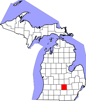 Map of Michigan highlighting Ingham County | |
| Villages | ||
| Charter townships | ||
| General law townships | ||
| CDPs | ||
| Other unincorporated communities | ||
| Footnotes | ‡This populated place also has portions in an adjacent county or counties | |