West End station (MARTA)
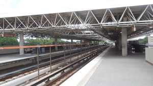
West End is an elevated rail station on the Red and Gold lines of the Metropolitan Atlanta Rapid Transit Authority (MARTA) rail system servicing the West End and most of Southwest Atlanta, including neighborhoods bordering Cascade Road and Metropolitan Parkway. The West End station opened on September 11, 1982.
S2
West End
| |||||||||||||||
|---|---|---|---|---|---|---|---|---|---|---|---|---|---|---|---|
| MARTA rapid transit station | |||||||||||||||
 West End (MARTA station) | |||||||||||||||
| Location | 680 Lee Street SW Atlanta, Georgia 30310 | ||||||||||||||
| Coordinates | 33.73581°N 84.41296°W | ||||||||||||||
| Platforms | 2 side platforms | ||||||||||||||
| Tracks | 2 | ||||||||||||||
| Connections | |||||||||||||||
| Construction | |||||||||||||||
| Structure type | Elevated | ||||||||||||||
| Parking | 547 spaces; daily parking | ||||||||||||||
| Bicycle facilities | 10 spaces | ||||||||||||||
| Disabled access | Yes | ||||||||||||||
| Other information | |||||||||||||||
| Station code | S2 | ||||||||||||||
| History | |||||||||||||||
| Opened | September 11, 1982 | ||||||||||||||
| Traffic | |||||||||||||||
| Passengers (2013) | 7,056 (avg. weekday)[1] | ||||||||||||||
| Services | |||||||||||||||
| |||||||||||||||
This station provides access to The Mall at Westend and the Woodruff Library Shuttle to Clark Atlanta University.
Bus service is provided at this station to Westend Medical Center, The Wren's Nest, Hammonds House, The Salvation Army Evangeline Booth College, The Salvation Army Ray and Joan Kroc Center Atlanta, Atlanta Technical College, Atlanta Metropolitan College, The Salvation Army Firecrest Missioners Center, Spelman College, Morehouse School of Medicine, Morehouse College, Hapeville, Interdenominational Theological Center (ITC) and The Atlanta University Center.
Station layout
| P Platform level |
Side platform, doors will open on the right | |
| Southbound | ← Red Line, Gold Line toward Airport (Oakland City) | |
| Northbound | → Gold Line toward Doraville (Garnett) → → Red Line toward North Springs (Garnett) → | |
| Side platform, doors will open on the right | ||
| G | Street Level | Entrance/Exit, fare barriers, station house, bus loops |
Bus routes
The station is served by the following MARTA bus routes:
- Route 1 - Marietta Blvd. / Joseph E Lowery Blvd.
- Route 40 - Peachtree Street / Downtown
- Route 58 - West Lake Avenue / Hollywood Road
- Route 68 - Benjamin E. Mays Drive
- Route 71 - Cascade Road
- Route 81 - Venetian Hills / Delowe Drive
- Route 94 - Northside Drive
- Route 95 - Metropolitan Parkway
- Route 155 - Pittsburgh
- Route 832 - Grant Park
References
- "2014 Transportation Fact Book" (PDF). Atlanta Regional Commission. Retrieved 9 January 2016.
External links
| Red Line | |
|---|---|
| Gold Line | |
| Blue Line |
|
| Green Line |
|
| Atlanta Streetcar |
|
| Other |
|