Wayland, Kentucky
Wayland is a home rule-class city in Floyd County, Kentucky, United States. The population was 426 at the 2010 census,[3] up from 298 at the 2000 census.
Wayland, Kentucky | |
|---|---|
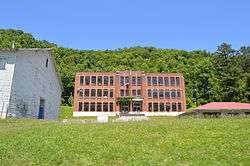 The former Wayland High School | |
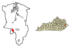 Location of Wayland in Floyd County, Kentucky. | |
| Coordinates: 37°26′43″N 82°48′4″W | |
| Country | United States |
| State | Kentucky |
| County | Floyd |
| Incorporated | 1923 |
| Government | |
| • Type | City Commission |
| • Mayor | Jerry Fultz |
| Area | |
| • Total | 2.63 sq mi (6.80 km2) |
| • Land | 2.62 sq mi (6.80 km2) |
| • Water | 0.00 sq mi (0.01 km2) |
| Elevation | 722 ft (220 m) |
| Population (2010) | |
| • Total | 426 |
| • Estimate (2019)[2] | 381 |
| • Density | 145.20/sq mi (56.07/km2) |
| Time zone | UTC-5 (Eastern (EST)) |
| • Summer (DST) | UTC-4 (EDT) |
| ZIP code | 41666 |
| Area code(s) | 606 |
| FIPS code | 21-81012 |
| GNIS feature ID | 0506308 |
History
In 1913, the Elk Horn Coal Company established the town of Wayland, which they named after Clarence Wayland Watson, the president of the company. The next year on May 18, the town post office was established. Wayland was incorporated as a sixth-class city in 1923.[4]
Geography
Wayland is located in southwestern Floyd County at 37°26′43″N 82°48′4″W (37.445289, -82.801131),[5] in the valleys of the Right Fork Beaver Creek and its tributary, Steele Creek. Kentucky Route 7 passes through the city, leading north (downstream along the Right Fork) 3.5 miles (5.6 km) to Garrett and south (upstream) 9 miles (14 km) to Topmost.
According to the United States Census Bureau, the city has a total area of 2.6 square miles (6.8 km2), all land.[3]
Education
The city's public schools are operated by the Floyd County Schools system. Most students residing in Wayland attend:
Demographics
| Historical population | |||
|---|---|---|---|
| Census | Pop. | %± | |
| 1920 | 1,862 | — | |
| 1930 | 2,436 | 30.8% | |
| 1940 | 2,888 | 18.6% | |
| 1950 | 1,807 | −37.4% | |
| 1960 | 1,340 | −25.8% | |
| 1970 | 384 | −71.3% | |
| 1980 | 601 | 56.5% | |
| 1990 | 359 | −40.3% | |
| 2000 | 298 | −17.0% | |
| 2010 | 426 | 43.0% | |
| Est. 2019 | 381 | [2] | −10.6% |
| U.S. Decennial Census[6] | |||
At the 2000 census there were 298 people, 118 households, and 86 families living in the city. The population density was 430.6 people per square mile (166.8/km2). There were 133 housing units at an average density of 192.2 per square mile (74.4/km2). The racial makeup of the city was 99.66% White, and 0.34% from two or more races.[7] Of the 118 households 32.2% had children under the age of 18 living with them, 55.9% were married couples living together, 15.3% had a female householder with no husband present, and 27.1% were non-families. 25.4% of households were one person and 13.6% were one person aged 65 or older. The average household size was 2.53 and the average family size was 3.07.
The age distribution was 26.5% under the age of 18, 10.1% from 18 to 24, 25.2% from 25 to 44, 23.8% from 45 to 64, and 14.4% 65 or older. The median age was 35 years. For every 100 females, there were 88.6 males. For every 100 females age 18 and over, there were 79.5 males.
The median household income was $14,688 and the median family income was $20,938. Males had a median income of $24,625 versus $25,625 for females. The per capita income for the city was $7,886. About 30.4% of families and 38.4% of the population were below the poverty line, including 59.6% of those under the age of eighteen and 36.7% of those sixty five or over.
References
- "2019 U.S. Gazetteer Files". United States Census Bureau. Retrieved July 24, 2020.
- "Population and Housing Unit Estimates". United States Census Bureau. May 24, 2020. Retrieved May 27, 2020.
- "Geographic Identifiers: 2010 Census Summary File 1 (G001), Wayland city, Kentucky". American FactFinder. U.S. Census Bureau. Archived from the original on February 13, 2020. Retrieved May 23, 2016.
- Rennick, Robert M. (1988). "Place Names". Kentucky Place Names. Lexington, Kentucky: The University Press of Kentucky. ISBN 0-8131-0179-4. Retrieved on 2010-04-17
- "US Gazetteer files: 2010, 2000, and 1990". United States Census Bureau. 2011-02-12. Retrieved 2011-04-23.
- "Census of Population and Housing". Census.gov. Retrieved June 4, 2015.
- "U.S. Census website". United States Census Bureau. Retrieved 2008-01-31.
Municipalities and communities of Floyd County, Kentucky, United States | ||
|---|---|---|
| Cities |  Location of Floyd County, Kentucky | |
| CDPs | ||
| Other unincorporated communities |
| |
| Footnotes | ‡This populated place also has portions in an adjacent county or counties. | |