Watkins, Colorado
Watkins (also once called Box Elder) is a census-designated place (CDP)[3] in Arapahoe[4] and Adams counties, Colorado, United States, adjacent to the city of Aurora. It was formerly an incorporated town.[5][6] The post office serving Watkins, which actually lies within the Aurora city limits, has the ZIP Code 80137.[2] As of the 2010 census Watkins had a population of 653.[7]
Watkins, Colorado | |
|---|---|
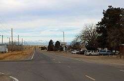 Watkins, looking west along Colfax Avenue. | |
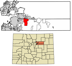 Location of Watkins in Adams County and Arapahoe County, Colorado. | |
 Location in Adams County and the state of Colorado | |
| Coordinates: 39°44′42″N 104°36′25″W | |
| Country | |
| State | |
| Counties | Adams, Arapahoe |
| Area | |
| • Total | 27.1 sq mi (70.2 km2) |
| • Land | 27.1 sq mi (70.2 km2) |
| • Water | 0 sq mi (0 km2) |
| Elevation | 5,525 ft (1,684 m) |
| Population (2010) | |
| • Total | 653 |
| • Density | 24/sq mi (9.3/km2) |
| Time zone | UTC-7 (MST) |
| • Summer (DST) | UTC-6 (MDT) |
| ZIP code[2] | 80137 |
| GNIS feature ID | 0184998 |
A post office called Watkins has been in operation since 1878.[8] The community was named after L. A. Watkins, a cattleman.[9] Long an unincorporated community, Watkins incorporated as a town on June 15, 2004.[6] However, on November 7, 2006, the town voted to revert to being an unincorporated community by a margin of 308-184.
Watkins is involved in trying to build the First Park in Adams County, and the Watkins Historical Preservation Society is co-operating with the town on some historical buildings for installation in the park as well. Front Range Airport is located near Watkins.
Geography
Watkins is located at 39°44′42″N 104°36′25″W (39.744946,-104.606838).
See also
- Outline of Colorado
- State of Colorado
- Colorado cities and towns
- Colorado census designated places
- Colorado counties
- Colorado metropolitan areas
- Front Range Urban Corridor
- North Central Colorado Urban Area
- Denver-Aurora-Boulder, CO Combined Statistical Area
- Denver-Aurora-Broomfield, CO Metropolitan Statistical Area
- Colorado cities and towns
References
- "US Board on Geographic Names". United States Geological Survey. 2007-10-25. Retrieved 2008-01-31.
- "ZIP Code Lookup" (JavaScript/HTML). United States Postal Service. January 3, 2007. Retrieved January 3, 2007.
- STUSPS:CO GEOID:0882905 ANSICODE:02583314 NAME:Watkins CDP ALAND:70172718 AWATER:215 ALAND_SQMI27.094 AWATER_SQMI:0.000 INTPTLAT:39.703135 INTPTLONG:-104.576754 from "Gazetteer Places National" 2010 Census U.S. Gazetteer Files
- http://www2.census.gov/geo/pvs/bas/bas11/st08_co/cou/c08005_arapahoe/BAS11C20800500000_004.pdf http://www2.census.gov/geo/pvs/bas/bas11/st08_co/cou/c08005_arapahoe/BAS11C20800500000_005.pdf http://www2.census.gov/geo/pvs/bas/bas11/st08_co/cou/c08005_arapahoe/BAS11C20800500000_015.pdf http://www2.census.gov/geo/pvs/bas/bas11/st08_co/cou/c08005_arapahoe/BAS11C20800500000_016.pdf U.S. Census 2011 Boundary and Annexation Survey (BAS): Arapahoe County, CO
- U.S. Geological Survey Geographic Names Information System: Watkins, Colorado
- "ALEA Fact Sheet: Arapahoe Law Enforcement Authority; What is it?" Arapahoe County, Colorado
- "Geographic Identifiers: 2010 Demographic Profile Data (G001): Watkins CDP, Colorado". U.S. Census Bureau, American Factfinder. Archived from the original on February 12, 2020. Retrieved May 1, 2013.
- "Post offices". Jim Forte Postal History. Retrieved 11 July 2016.
- Dawson, John Frank. Place names in Colorado: why 700 communities were so named, 150 of Spanish or Indian origin. Denver, CO: The J. Frank Dawson Publishing Co. p. 51.
- "Census of Population and Housing". Census.gov. Retrieved June 4, 2016.
External links
- Watkins on Adams County website
- Watkins on Arapahoe County website
- Watkins residents say "no" to city living
- Watkins' "U-turn" on incorporation
Municipalities and communities of Adams County, Colorado, United States | ||
|---|---|---|
| Cities | 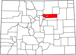 Map of Colorado highlighting Adams County | |
| Towns | ||
| CDPs | ||
| Unincorporated communities | ||
| Footnotes | ‡This populated place also has portions in an adjacent county or counties | |
Municipalities and communities of Arapahoe County, Colorado, United States | ||
|---|---|---|
| Cities | 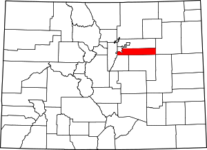 Map of Colorado highlighting Arapahoe County | |
| Towns | ||
| CDPs | ||
| Footnotes | ‡This populated place also has portions in an adjacent county or counties | |