Wainwright, Alaska
Wainwright (/ˈweɪnraɪt/;[6] Ulġuniq in Iñupiaq), also known as Ulguniq or Kuuk, is a city[4][7] in North Slope Borough, Alaska, United States. At the 2010 census the population was 556,[4] making it the third largest city in the North Slope Borough, up from 546 in 2000. The community was named after Wainwright Lagoon, which in turn was named after Lt. John Wainwright, an officer under Capt. F.W. Beechey, who were the first non-native people to travel to the lagoon in 1826. An unincorporated area known as Wainwright Inlet by 1890, Wainwright was founded as an incorporated municipality in 1904.
Wainwright Ulġuniq | |
|---|---|
City | |
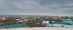 Wainwright during the summer months with the Arctic Ocean in the background | |
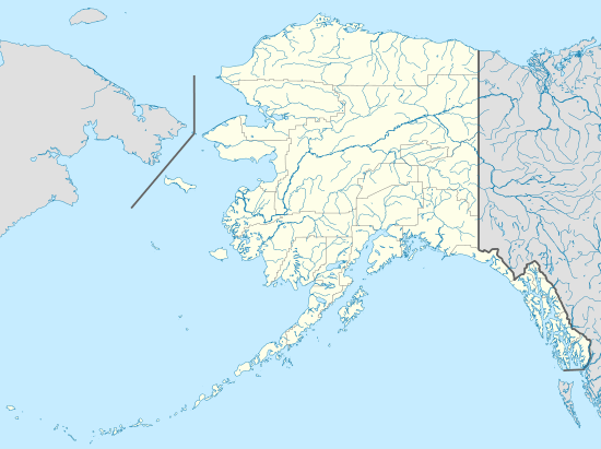 Wainwright Location in Alaska | |
| Coordinates: 70°38′50″N 160°00′58″W | |
| Country | United States |
| State | Alaska |
| Borough | North Slope |
| Incorporated | December 31, 1962[1] |
| Government | |
| • Mayor | Raymond Henry Savik Nashookpuk.[2] |
| • State senator | Donny Olson (D) |
| • State rep. | John Lincoln (D) |
| Area | |
| • Total | 28.04 sq mi (72.61 km2) |
| • Land | 10.31 sq mi (26.71 km2) |
| • Water | 17.72 sq mi (45.90 km2) |
| Elevation | 26 ft (8 m) |
| Population | |
| • Total | 556 |
| • Estimate (2019)[5] | 587 |
| • Density | 56.91/sq mi (21.97/km2) |
| Time zone | UTC−9 (Alaska (AKST)) |
| • Summer (DST) | UTC−8 (AKDT) |
| ZIP code | 99782 |
| Area code | 907 |
| FIPS code | 02-82750 |
| GNIS feature ID | 1411728, 2418869 |
Geography and climate
Wainwright is located on the Chukchi Sea about 72 miles southwest of Utqiagvik.
According to the United States Census Bureau, the city has a total area of 42.5 square miles (110 km2), of which, 17.6 square miles (46 km2) of it is land and 24.9 square miles (64 km2) of it (58.63%) is water.
Wainwright has an Arctic climate with temperatures ranging from −56 to 80 °F (−49 to 27 °C). There is little precipitation, mostly snow. The Chukchi Sea is unfrozen from mid-July to September.
| Climate data for Wainwright 1985-2015 averages | |||||||||||||
|---|---|---|---|---|---|---|---|---|---|---|---|---|---|
| Month | Jan | Feb | Mar | Apr | May | Jun | Jul | Aug | Sep | Oct | Nov | Dec | Year |
| Record high °F (°C) | 40 (4) |
45 (7) |
50 (10) |
40 (4) |
61 (16) |
74 (23) |
80 (27) |
76 (24) |
70 (21) |
44 (7) |
37 (3) |
35 (2) |
80 (27) |
| Average high °F (°C) | −7 (−22) |
−7 (−22) |
−6 (−21) |
10 (−12) |
28 (−2) |
44 (7) |
51 (11) |
47 (8) |
38 (3) |
25 (−4) |
8.0 (−13.3) |
−2 (−19) |
19.1 (−7.2) |
| Daily mean °F (°C) | −13.5 (−25.3) |
−13.5 (−25.3) |
−13 (−25) |
3.0 (−16.1) |
23.0 (−5.0) |
38.0 (3.3) |
44.5 (6.9) |
42.0 (5.6) |
34.0 (1.1) |
20.0 (−6.7) |
2.0 (−16.7) |
−8.5 (−22.5) |
13.2 (−10.5) |
| Average low °F (°C) | −19 (−28) |
−20 (−29) |
−20 (−29) |
−4 (−20) |
18 (−8) |
32 (0) |
38 (3) |
37 (3) |
30 (−1) |
15 (−9) |
−4 (−20) |
−15 (−26) |
7 (−14) |
| Record low °F (°C) | −50 (−46) |
−56 (−49) |
−49 (−45) |
−38 (−39) |
−14 (−26) |
14 (−10) |
22 (−6) |
21 (−6) |
6 (−14) |
−19 (−28) |
−37 (−38) |
−50 (−46) |
−56 (−49) |
| Average rainfall inches (mm) | 0.15 (3.8) |
0.1 (2.5) |
0.15 (3.8) |
0.3 (7.6) |
0.2 (5.1) |
0.26 (6.6) |
1.57 (40) |
2.06 (52) |
0.56 (14) |
0.77 (20) |
0.17 (4.3) |
0.08 (2.0) |
6.37 (161.7) |
| Average precipitation days | 3 | 2 | 3 | 5 | 5 | 4 | 9 | 12 | 8 | 9 | 5 | 2 | 67 |
| Source: WRCC NOAA[8] https://www.timeanddate.com/weather/usa/wainwright/climate | |||||||||||||
Demographics
| Historical population | |||
|---|---|---|---|
| Census | Pop. | %± | |
| 1890 | 72 | — | |
| 1920 | 99 | — | |
| 1930 | 197 | 99.0% | |
| 1940 | 341 | 73.1% | |
| 1950 | 227 | −33.4% | |
| 1960 | 253 | 11.5% | |
| 1970 | 315 | 24.5% | |
| 1980 | 405 | 28.6% | |
| 1990 | 492 | 21.5% | |
| 2000 | 546 | 11.0% | |
| 2010 | 556 | 1.8% | |
| Est. 2019 | 587 | [5] | 5.6% |
| U.S. Decennial Census[9] | |||
Wainwright first appeared on the 1890 U.S. Census as the unincorporated area of "Wainwright Inlet." This included the native settlement Kugmiut, camps on Kug River, Setorokamiut, Nuklwok, Nutnago & Shinnowok. All 72 residents were native.[10] It did not appear again on the census until 1920, this time as Wainwright. It was formally incorporated in 1962.
As of the 2010 United States Census, there were 556 people living in the city. The racial makeup of the city was 90.1% Native American, 7.9% White and 1.6% from two or more races. 0.4% were Hispanic or Latino of any race.
At the 2000 census,[11] there were 546 people, 148 households and 117 families living in the city. The population density was 31.1 per square mile (12.0/km²). There were 179 housing units at an average density of 10.2 per square mile (3.9/km²). The racial makeup of the city was 6.78% White, 0.18% Black or African American, 90.29% Native American, and 2.75% from two or more races.
There were 148 households of which 50.0% had children under the age of 18 living with them, 50.7% were married couples living together, 16.2% had a female householder with no husband present, and 20.3% were non-families. 18.2% of all households were made up of individuals and 3.4% had someone living alone who was 65 years of age or older. The average household size was 3.69 and the average family size was 4.17.
37.7% of the population were under the age of 18, 13.4% from 18 to 24, 27.8% from 25 to 44, 14.3% from 45 to 64, and 6.8% who were 65 years of age or older. The median age was 24 years. For every 100 females, there were 114.1 males. For every 100 females age 18 and over, there were 117.9 males.
The median household income was $54,722 and the median family income was $58,125. Males had a median income of $36,667 versus $40,313 for females. The per capita income for the city was $16,709. About 8.5% of families and 12.5% of the population were below the poverty line, including 18.4% of those under age 18 and 5.3% of those age 65 or over.
Education
There is one school in Wainwright, the Alak School of the North Slope Borough School District, which serves students pre-K through grade 12.[12]
References
- 1996 Alaska Municipal Officials Directory. Juneau: Alaska Municipal League/Alaska Department of Community and Regional Affairs. January 1996. p. 157.
- 2015 Alaska Municipal Officials Directory. Juneau: Alaska Municipal League. 2015. p. 161.
- "2019 U.S. Gazetteer Files". United States Census Bureau. Retrieved June 30, 2020.
- "Wainwright city, Alaska". Profile of General Population and Housing Characteristics: 2010 Demographic Profile Data. United States Census Bureau. Archived from the original on February 12, 2020. Retrieved January 23, 2013.
- "Population and Housing Unit Estimates". United States Census Bureau. May 24, 2020. Retrieved May 27, 2020.
- "Wainwright". Division of Community and Regional Affairs, Alaska Department of Commerce, Community and Economic Development. Archived from the original on April 6, 2012. Retrieved January 23, 2013.
- "Alaska Taxable 2011: Municipal Taxation - Rates and Policies" (PDF). Division of Community and Regional Affairs, Alaska Department of Commerce, Community and Economic Development. January 2012. Archived from the original (PDF) on 2013-04-25. Retrieved 2013-01-24.
- https://w2.weather.gov/climate/xmacis.php?wfo=pafg
- "Census of Population and Housing". Census.gov. Retrieved June 4, 2015.
- http://www2.census.gov/prod2/decennial/documents/1890a_v8-01.pdf
- "U.S. Census website". United States Census Bureau. Retrieved 2008-01-31.
- Alak School / Homepage. N.p., n.d. Web. 08 Aug. 2013. <http://www.nsbsd.org/Domain/12>.
External links
Municipalities and communities of North Slope Borough, Alaska, United States | ||
|---|---|---|
Borough seat: Utqiagvik | ||
| Cities | 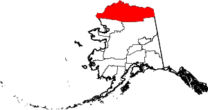 North Slope Borough map | |
| CDPs | ||
| Unincorporated communities | ||
| Ghost towns | ||