Varnado, Louisiana
Varnado is a village in Washington Parish, Louisiana, United States. The population was 1,461 at the 2010 census. It is part of the Bogalusa Micropolitan Statistical Area.
Varnado, Louisiana | |
|---|---|
Village | |
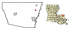 Location of Varnado in Washington Parish, Louisiana. | |
.svg.png) Location of Louisiana in the United States | |
| Coordinates: 30°53′42″N 89°49′54″W | |
| Country | United States |
| State | Louisiana |
| Parish | Washington |
| Area | |
| • Total | 0.85 sq mi (2.20 km2) |
| • Land | 0.85 sq mi (2.20 km2) |
| • Water | 0.00 sq mi (0.00 km2) |
| Elevation | 128 ft (39 m) |
| Population (2010) | |
| • Total | 1,461 |
| • Estimate (2019)[2] | 335 |
| • Density | 394.58/sq mi (152.41/km2) |
| Time zone | UTC-6 (CST) |
| • Summer (DST) | UTC-5 (CDT) |
| Zip Code | 70467 |
| Area code(s) | 985 |
| FIPS code | 22-77910 |
Geography
Varnado is located at 30°53′42″N 89°49′54″W (30.894911, -89.831635).[3]
According to the United States Census Bureau, the village has a total area of 0.9 square miles (2.3 km2), all land.
Demographics
| Historical population | |||
|---|---|---|---|
| Census | Pop. | %± | |
| 1920 | 275 | — | |
| 1930 | 204 | −25.8% | |
| 1940 | 315 | 54.4% | |
| 1950 | 306 | −2.9% | |
| 1960 | 331 | 8.2% | |
| 1970 | 320 | −3.3% | |
| 1980 | 249 | −22.2% | |
| 1990 | 236 | −5.2% | |
| 2000 | 342 | 44.9% | |
| 2010 | 1,461 | 327.2% | |
| Est. 2019 | 335 | [2] | −77.1% |
| U.S. Decennial Census[4] | |||
As of the census[5] of 2000, there were 342 people, 144 households, and 86 families residing in the village. The population density was 402.9 inhabitants per square mile (155.3/km2). There were 163 housing units at an average density of 192.0 per square mile (74.0/km2). The racial makeup of the village was 88.60% White, 9.36% African American, 0.58% Native American, and 1.46% from two or more races.
There were 144 households out of which 27.1% had children under the age of 18 living with them, 41.0% were married couples living together, 16.7% had a female householder with no husband present, and 39.6% were non-families. 34.7% of all households were made up of individuals and 13.2% had someone living alone who was 65 years of age or older. The average household size was 2.38 and the average family size was 3.15.
In the village, the population was spread out with 24.9% under the age of 18, 12.0% from 18 to 24, 26.9% from 25 to 44, 22.8% from 45 to 64, and 13.5% who were 65 years of age or older. The median age was 38 years. For every 100 females, there were 74.5 males. For every 100 females age 18 and over, there were 73.6 males.
The median income for a household in the village was $26,563, and the median income for a family was $30,909. Males had a median income of $30,938 versus $21,000 for females. The per capita income for the village was $14,416. About 21.4% of families and 19.5% of the population were below the poverty line, including 23.4% of those under age 18 and 9.1% of those age 65 or over.
References
- "2019 U.S. Gazetteer Files". United States Census Bureau. Retrieved July 25, 2020.
- "Population and Housing Unit Estimates". United States Census Bureau. May 24, 2020. Retrieved May 27, 2020.
- "US Gazetteer files: 2010, 2000, and 1990". United States Census Bureau. 2011-02-12. Retrieved 2011-04-23.
- "Census of Population and Housing". Census.gov. Retrieved June 4, 2015.
- "U.S. Census website". United States Census Bureau. Retrieved 2008-01-31.
Municipalities and communities of Washington Parish, Louisiana, United States | ||
|---|---|---|
Parish seat: Franklinton | ||
| City |  | |
| Town | ||
| Villages | ||
| Unincorporated communities | ||