Várkerület
The Castle District (Hungarian: Várkerület) is the historical part of the Buda side of Budapest and consists of the Buda Castle Hill and some other neighbourhoods around it, like Tabán, Krisztinaváros and parts of Gellért Hill.
1st District of Budapest Budapest I. kerülete Várkerület, Budavár | |
|---|---|
| District I | |
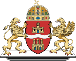
 Flag  Coat of arms | |
 Location of District I in Budapest (shown in grey) | |
| Coordinates: 47°29′51″N 19°02′17″E | |
| Country | Hungary |
| Region | Central Hungary |
| City | Budapest |
| Established | 17 November 1873 |
| Quarters[1] | List
|
| Government | |
| • Mayor | Márta V. Naszályi (Dialogue) |
| • Deputy Mayor | Ferenc Gelencsér (Momentum) Gábor Csobánczy |
| Area | |
| • Total | 3.41 km2 (1.32 sq mi) |
| Area rank | 20th |
| Population (2016)[2] | |
| • Total | 25,196 |
| • Rank | 22nd |
| • Density | 7,388/km2 (19,130/sq mi) |
| Demonym(s) | első kerületi ("1st districter") |
| Time zone | UTC+1 (CET) |
| • Summer (DST) | UTC+2 (CEST) |
| Postal code | 1011 ... 1016 |
| Website | www |
Location
The Castle District is situated on the banks of the Danube, in the Buda side.
Neighbours of District I are (clockwise from north):
- River Danube
- District XI: Újbuda ("New Buda"), which is most known of the universities and student life
- District XII: Hegyvidék ("Highlands")
- District II
Landmarks
- Buda Castle
- Matthias Church
 Matthias Church
 - Hungarian National Gallery
- Castle Hill Funicular
- Sándor Palace
- Fisherman's Bastion
- Labyrinth of Buda Castle
- Gellért Hill
Politics
The current mayor of I. District of Budapest is Márta V. Naszályi (Dialogue).
The District Assembly, elected at the 2019 local government elections, is made up of 15 members (1 Mayor, 10 Individual constituencies MEPs and 4 Compensation List MEPs) divided into this political parties and alliances:[3]
| Party | Seats | Current District Assembly | ||||||||||
|---|---|---|---|---|---|---|---|---|---|---|---|---|
| Opposition coalition[lower-alpha 1] | 10 | M | ||||||||||
| Fidesz-KDNP | 5 | |||||||||||
List of mayors
| Member | Party | Date | |
|---|---|---|---|
| Imre Ligeti | MDF | 1990–1994 | |
| Tamás Katona | MDF[lower-alpha 2] | 1994–1998 | |
| Gábor Tamás Nagy | Fidesz | 1998–2019 | |
| Márta V. Naszályi | PM | 2019– | |
Twin towns – sister cities
Várkerület is twinned with:[4][5]


References
- "94/2012. (XII. 27.) Főv. Kgy. rendelet a közterület- és városrésznevek megállapításáról, azok jelöléséről, valamint a házszám-megállapítás szabályairól" (in Hungarian).
- "A fővárosi kerületek, a megyei jogú városok, a városok területe, lakónépessége és a lakások száma" [The area of districts of the capital, of the towns with county's rights, resident population and number of dwellings]. Magyarország közigazgatási helynévkönyve 2016. január 1 [Gazetteer of Hungary 1 January, 2016] (PDF). Hungarian Central Statistical Office. 2016. p. 21.
- "Városi közgyűlés tagjai 2019-2024 - Budapest I. kerület". valasztas.hu. Retrieved 29 October 2019.
- "Testvérvárosaink". budavar.hu (in Hungarian). Várkerület. Retrieved 23 June 2020.
- "Budavár új testvérvárosa: Savonlinna" (PDF). budavar.hu (in Hungarian). Várnegyet. 16 August 2018. Retrieved 23 June 2020.
External links
| Wikimedia Commons has media related to Budapest District I. |
- Official website

Districts of Budapest | ||
|---|---|---|
|  | |
This article is issued from Wikipedia. The text is licensed under Creative Commons - Attribution - Sharealike. Additional terms may apply for the media files.