Utah's congressional districts
Utah is divided into 4 congressional districts, each represented by a member of the United States House of Representatives. After the 2010 Census, Utah gained one House seat, and a new map was approved by the state legislature and signed into law by Governor Gary Herbert.[2] [3]
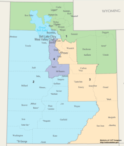
The districts are currently represented in the 116th United States Congress by their elected congresspeople. In 2018, a Democratic challenger defeated a Republican incumbent, and changed the congressional delegation to a 3-1 Republican majority. As a result, the 4th district is the most Republican district that is currently held by a Democrat.
Current districts and representatives
List of members of the Utah United States House delegation, district boundaries, and the district political ratings according to the CPVI. The delegation has a total of four members: three Republicans and one Democrat.
| District | Representative | Party | CPVI | Incumbent time in office | District map |
|---|---|---|---|---|---|
| 1st | 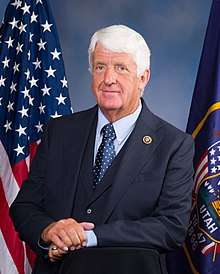 |
Republican | R+26 | January 3, 2003 – present | .tif.png) |
| 2nd | 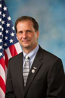
|
Republican | R+16 | January 3, 2013 – present | .tif.png) |
| 3rd | 
|
Republican | R+25 | November 13, 2017 – present | .tif.png) |
| 4th |  |
Democratic | R+13 | January 3, 2019 – present | .tif.png) |
Historical and present district boundaries
Table of United States congressional district boundary maps in the State of Utah, presented chronologically.[4] All redistricting events that took place in Utah between 1973 and 2013 are shown.
| Year | Statewide map | Salt Lake City highlight |
|---|---|---|
| 1973–1982 |  |
%2C_1973_%E2%80%93_1982.tif.png) |
| 1983–1992 |  |
%2C_1983_%E2%80%93_1992.tif.png) |
| 1993–2002 |  |
%2C_1993_%E2%80%93_2002.tif.png) |
| 2003–2013 |  |
%2C_2003_%E2%80%93_2013.tif.png) |
| Since 2013 |  |
%2C_since_2013.tif.png) |
Obsolete districts
References
- "The national atlas". nationalatlas.gov. Archived from the original on February 22, 2014. Retrieved February 22, 2014.
- "Governor OKs new Utah congressional maps". Salt Lake Tribune. October 20, 2011. p. 1.
- "Archived copy". Archived from the original on 2012-10-27. Retrieved 2012-04-12.CS1 maint: archived copy as title (link)
- "Digital Boundary Definitions of United States Congressional Districts, 1789–2012". Retrieved October 18, 2014.