Uitenhage
Uitenhage (/ˈjuːtɪnheɪɡ/; Afrikaans: [œitənˈɦɑːχə]) is a South African town in the Eastern Cape Province. It is well known for the Volkswagen factory located there, which is the biggest car factory on the African continent. Along with the city of Port Elizabeth and the small town of Despatch, it forms the Nelson Mandela Metropolitan Municipality.
Uitenhage | |
|---|---|
 Victoria Tower in Uitenhage | |
 Uitenhage 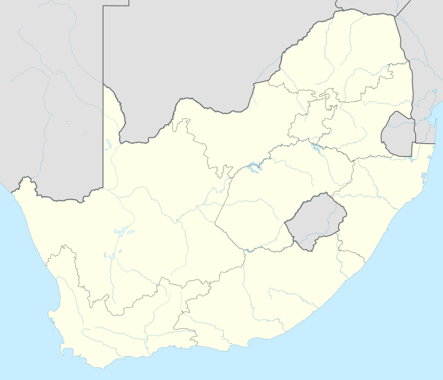 Uitenhage  Uitenhage | |
| Coordinates: 33°46′S 25°24′E | |
| Country | South Africa |
| Province | Eastern Cape |
| Municipality | Nelson Mandela Bay |
| Established | 1804[1] |
| Area | |
| • Total | 75.35 km2 (29.09 sq mi) |
| Elevation | 103 m (338 ft) |
| Population (2011)[2] | |
| • Total | 103,639 |
| • Density | 1,400/km2 (3,600/sq mi) |
| Racial makeup (2011) | |
| • Black African | 23.8% |
| • Coloured | 54.7% |
| • Indian/Asian | 1.2% |
| • White | 18.4% |
| • Other | 1.8% |
| First languages (2011) | |
| • Afrikaans | 68.9% |
| • Xhosa | 17.9% |
| • English | 10.4% |
| • Other | 2.9% |
| Time zone | UTC+2 (SAST) |
| Postal code (street) | 6229 |
| PO box | 6230 |
| Area code | 041 |
History
Uitenhage was founded on 25 April 1804 by landdrost (district magistrate) Jacob Glen Cuyler and named in honour of the Cape's Commissioner-General Jacob Abraham Uitenhage de Mist by the Dutch Cape Colony governor, Jan Willem Janssens.[3] Uitenhage formed from part of the district of Graaff Reinet (shortly after its short-lived secession).
The Cape Colony received a degree of independence when "Responsible Government" was declared in 1872. In 1875, the Cape government of John Molteno took over the rudimentary Uitenhage railway site, incorporated it into the Cape Government Railways (CGR), and began construction of the lines connecting Uitenhage to Port Elizabeth and the Southern African interior. Two years later, in 1877, Uitenhage was declared a municipality.[4]
Nearly a hundred years later, as part of the Republic of South Africa, Uitenhage became a centre for resistance against apartheid. In 1985, police opened fire on a funeral procession in Uitenhage, killing a number of unarmed people, in an event that became notorious as an example of police oppression in South Africa under apartheid.[5][6]
In 2001 it was incorporated with Port Elizabeth and Despatch into the Nelson Mandela Bay Metropolitan Municipality.
Geography
Uitenhage is located 30 km north-west of Port Elizabeth. Its neighbouring town of Despatch, the city of Port Elizabeth and other surrounding areas form the Nelson Mandela Bay Metropolitan Municipality.[7]
Neighbouring towns include Despatch in the south-east and KwaNobuhle in the south.[8]
Suburbs
Suburbs that form part of Uitenhage are:[9]
- Alexander Park Industrial
- Allanridge
- Blikkiesdorp
- Cannon Hill
- Cape Road Industrial
- College Hill
- De Mist
- Eric Dodd
- Fairbridge Heights
- Gerald Smith
- Greenfields
- Janssendal
- Jubilee Park
- Kamehs
- Lapland
- Langa (or KwaLanga)
- Levyvale
- Mosel
- Mandela Village
- Mandelaville
- McNaughton
- Middlestreet
- Mountain View
- Penford
- Riverside Industrial
- Rosedale
- Scheepershoogte (Scheepers Heights)
- Strelitzia Park
- Thomas Gamble
- Tiryville
- Valleisig
- Vanes Estate
- Winterhoek
Industries
Uitenhage is known for the large industries situated there. The largest of these industries are the Volkswagen and Goodyear factories. An automotive supplier park, Alexander Park Industrial, has also been created directly next to the Volkswagen factory, thus allowing automotive component manufacturers to construct their manufacturing plants close by.
Infrastructure
Cemeteries
- Uitenhage Cemetery[10]
Civic Centres
- Allanridge Civic Centre[11]
Hospitals
There are three hospitals in Uitenhage, in which two are public and one is private. The two public hospitals are the Uitenhage Provincial Hospital and Orsmond T. B. Hospital whilst Netcare Cuyler Hospital is the only private hospital in the town.[12][13]
Museums/Historical features
- Cuyler Manor Museum- Built as a homestead for General Jacob Glen Cuyler, Landdrost of Uitenhage from 1806 to 1827, this Cape Dutch style house has been restored and furnished in the style of its day.
- Drostdy Museum- Erected during General Jacob Glen Cuyler’s term in the office as Landdrost of Uitenhage in 1809 and follows the historical development of Uitenhage and surrounding districts.[14]
- Old Railway Station Museum- Built on Market Street in the year of the opening of the railway from Port Elizabeth, it is known to be one of the oldest railway stations in South Africa. [15]
- Uitenhage Town Hall- Was built in 1882 in Market Street and the Public Building between 1896 and 1898 (now called Victoria Tower).[16]
- VW Auto Pavillion- An on-site automotive museum and expo centre situated at the Volkswagen Factory in Uitenhage.[17]
Schools
Primary and high schools include: These schools include those in the townships of Uitenhage.
- Bergsig Special School
- Caritas Primary School
- College Hill Preparatory School
- Dalerose Primary School
- Daniel Pienaar Technical High School
- Illinge Primary School
- James Ndudula Primary School
- John Walton Secondary School
- Laerskool Albertyn
- Limekhaya High School
- Little Flower Primary School
- Gamble Street Secondary School
- Jubilee Park Primary School
- McCarthy Comprehensive School
- Muir College Boys' High School
- Riebeek College Girls' High School
- Seagull Primary School
- St Joseph Primary School
- Strelitzia High School
- Uitenhage High School
- Uitenhage Primary School
- Verite Primary School
- Winterberg Primary School
There is also a TVET college in the southern area of Uitenhage, the Eastcape Midlands TVET College. Volkswagen South Africa has a technical learning academy in Uitenhage because of its manufacturing plant in the town. The Nelson Mandela Bay Science & Technology Centre is also located in Uitenhage.[18][19][20]
Nature & Recreation
The nearest nature reserves is the Groendal Wilderness Area and Springs Nature Reserves.[27][28]
There are also two dams in Uitenhage which are the Strelitzia and Willow dams. Fishermen normally frequent these dams in their leisure time. Strelitizia Dam made headlines when police recovered 18 mortar bombs in the dam.[29][30]
Transport
Air
The Uitenhage Aerodrome/Airfield is located on the southern outskirts of Uitenhage but has no scheduled flights. The nearest airport with scheduled flights is the Port Elizabeth International Airport, 40 km south-east (by road) of Uitenhage in the suburb of Walmer in Port Elizabeth.[31][32]
Rail
Metrorail Eastern Cape operates commuter rail services to Despatch and Port Elizabeth using the Port Elizabeth line.
Road
Uitenhage is at the junction of regional and metropolitan routes routes and has access to many roads. Roads intersecting or running through Uitenhage include the R75, M19, R334 and M10.
- The R75 links to Despatch, Ibhayi and Port Elizabeth in the south and Jansenville and Graaff-Reinet in the north.
- The M19 links to Despatch, Ibhayi and Swartkops.
- The R334 links to Motherwell and Coega to the east and KwaNobuhle and the R102 which also connects to the N2 to Humansdorp and Cape Town.
- The M10 links to Despatch, Bethelsdorp and Port Elizabeth.
Notable people
- Allan Hendrickse - Preacher-teacher-politician from apartheid politics[33]
- Balthazar Johannes Vorster - South African Prime Minister 1966 - 1978
- Bicks Ndoni - former mayor of Uitenhage and ANC politician
- Carel Fourie - Springbok rugby wing; from Die Brandwag Hoërskool.
- Charles Robert Redcliffe - Labour Party politician, community leader and anti-apartheid activist.
- Christo van Rensburg - South African tennis player, ATP-ranked[34]
- Deshun Deysel - international business coach and mountaineer.[35]
- Deon Kayser - rugby player.[36]
- Enoch Sontonga - composer of Nkosi Sikelel' iAfrika which is now part of the national anthem.
- Garth Wright - Springbok rugby scrum-half from Muir College[37]
- Golf Sidekick - Baus Playa in Chief; plants feathers and grows birdies throughout Asia and the world; influences include Didi and Jack Nicholson, aka the golden bare.
- James Wide - Double leg amputee railway signalman and owner of Jack the signal-baboon.
- Joseph Petrus Hendrik Crowe - British Army officer who was awarded the Victoria Cross
- Johan van der Merwe - Springbok rugby centre 1969/70 British tour; from Die Brandwag Hoërskool.
- Lee-Roy Wright - South African actor and television presenter[38]
- Linky Boshoff - South African Tennis player from Riebeek College Girls High School.
- Loyiso Bala - South African R&B singer; part of Bala Brothers ground and TKZee[39]
- Mcebisi Jonas, former deputy Finance Minister, active member of ANC's Uitenhage branch[40]
- Nantie Hayward - South African cricketer who now plays in the Indian Cricket League
- Okkert Brits - Olympic pole vaulter
- Polla Fourie - Springbok rugby flank; from Die Brandwag Hoërskool.
- Sean Burke - musician, composer currently based in Randburg, Gauteng[41]
- Smuts Ngonyama - ANC National Spokesman during Thabo Mbeki's Era. Recently appointed South African Ambassador to Spain
- The Invaders[42] - popular South African music group from the 1960s
Notable animals
- Jack - A chacma baboon trained to assist signalman James Wide, who had both legs amputated.
Coats of arms
Drostdy — In 1804, the Cape colonial government assigned the shield of Jacob Abraham Uitenhage de Mist's arms to the new Uitenhage drostdy. The arms were Sable, a cross moline Argent, i.e. a silver cross moline on a black shield. An anchor was placed behind the shield.[44] The British authorities discontinued the drostdy seals in 1814, and replaced them with the royal coat of arms.[45]
Municipality — In 1881, the Uitenhage municipal council adopted the De Mist arms, complete with a crest consisting of a cross moline issuing from a gold coronet.[46] The arms were registered with the Cape Provincial Administration in September 1956[47] and at the Bureau of Heraldry in June 1994.[48]
Divisional council — The Uitenhage divisional council (the local authority for the rural areas outside the town) assumed a coat of arms in 1968. The arms were granted by the provincial administrator in August 1968[49] and registered at the Bureau of Heraldry in June 1972.[48]
On the arms were stated: "Or, a triple crowned tree Vert, the trunk entwined with the Batavian tricolour; on a chief wavy Sable a cross moline between dexter a pickaxe and hammer in saltire, handles downwards and sinister two scrolls in saltire, Argent." In layman's terms, the design was a golden shield displaying, from top to bottom, a crossed pickaxe and hammer, a cross moline and two crossed scrolls on a black horizontal strip with a wavy edge, and a triple-crowned tree with a Batavian Republic flag wrapped around it.
The crest was an elephant, and the motto Per laborem ad honorem.
References
- "Chronological order of town establishment in South Africa based on Floyd (1960:20-26)" (PDF). pp. xlv–lii.
- "Main Place Uitenhage". Census 2011.
- "This day". South African History. Archived from the original on 15 October 2009. Retrieved 14 February 2010.
- Burman, Jose (1984), Early Railways at the Cape. Cape Town: Human & Rousseau, p.66. ISBN 0-7981-1760-5
- Thornton, R. J. (1990). "The Shooting at Uitenhage, South Africa, 1985: The Context and Interpretation of Violence". American Ethnologist. 17 (2): 217–236. doi:10.1525/ae.1990.17.2.02a00020. JSTOR 645077.
- http://www.doj.gov.za/trc/hrvtrans/uiten/bucwa.htm
- "Distance Port-Elizabeth, Nelson-Mandela-Bay, Eastern-Cape, ZAF > Uitenhage, Nelson-Mandela-Bay-Metropolitan-Municipality, Eastern-Cape, ZAF - Air line, driving route, midpoint". www.distance.to. Retrieved 2020-08-09.
- "Port Elizabeth Map | South Africa Google Satellite Maps". www.maplandia.com. Retrieved 2020-08-09.
- "Census 2011: Main Place: Uitenhage". census2011.adrianfrith.com. Retrieved 2020-08-09.
- "Uitenhage Cemetery in Uitenhage, Eastern Cape - Find A Grave Cemetery". www.findagrave.com. Retrieved 2020-08-09.
- "Allanridge Civic Centre - Uitenhage". Cybo. Retrieved 2020-08-09.
- "South African Doctors Hospitals Medical - State Hospitals - Orsmond TB Hospital, Uitenhage, Eastern Cape, South Africa". doctors-hospitals-medical-cape-town-south-africa.blaauwberg.net. Retrieved 2020-08-09.
- "Netcare Cuyler Hospital". www.netcarehospitals.co.za. Retrieved 2020-08-09.
- "Drostdy Museum - Nelson Mandela Bay (Port Elizabeth)". Nelson Mandela Bay Tourism. Retrieved 2020-08-09.
- "Old Railway Station Museum - Nelson Mandela Bay (Port Elizabeth)". Nelson Mandela Bay Tourism. Retrieved 2020-08-09.
- "Town Hall, 25 Market Street, Uitenhage | South African History Online". www.sahistory.org.za. Retrieved 2020-08-09.
- "AutoPavilion - Nelson Mandela Bay (Port Elizabeth)". Nelson Mandela Bay Tourism. Retrieved 2020-08-09.
- "Nelson Mandela Bay Science & Technology Centre - Nelson Mandela Bay (Port Elizabeth)". Nelson Mandela Bay Tourism. Retrieved 2020-08-09.
- "EMC – Creating New Futures!". Retrieved 2020-08-09.
- "Volkswagen Learning Academy". buype.co.za. Retrieved 2020-08-09.
- "Aloe Mall in Uitenhage - Eastern Cape". nearfinderza.com. Retrieved 2020-08-09.
- "Malls | Mallguide". www.mallguide.co.za. Retrieved 2020-08-09.
- "HERE. Maps for Life". mobile.here.com. Retrieved 2020-08-09.
- "Gardens 'bloom' in its league". News24. Retrieved 2020-08-09.
- "Rosedale Indoor Sport Centre – SA Dance Sport". Retrieved 2020-08-09.
- "Uitenhage Golf Club". Retrieved 2020-08-09.
- "Groendal Wilderness Area - Nelson Mandela Bay (Port Elizabeth)". Nelson Mandela Bay Tourism. Retrieved 2020-08-09.
- "Springs Local Authority Nature Reserve, Location in Port Elizabeth, Eastern Cape, South Africa - Aloeus". www.aloeus.com. Retrieved 2020-08-09.
- TimesLIVE (2019-10-15). "Eastern Cape cops find 15 more bombs in Strelitzia Dam in Uitenhage". GO! & Express. Retrieved 2020-08-09.
- "Willow Dam". www.safarinow.com. Retrieved 2020-08-09.
- "Travel South Africa". distancecalculator.co.za. Retrieved 2020-08-09.
- "Uitenhage Airfield, Nelson Mandela Bay Metropolitan Municipality, Eastern Cape, South Africa". za.geoview.info. Retrieved 2020-08-09.
- McGregor, Liz (21 March 2005). "Obituary: The Rev Allan Hendrickse". UD News. Uitenhage. Retrieved 30 August 2016.
- Christo van Rensburg - South African Airways ATP Rankings History
- Combrinck, Heilie (30 June 2016). "First local TEDx conference hosts famous guests". UD News. Uitenhage. Retrieved 30 August 2016.
- Biyela, Lunga (3 April 2014). "Kayser happy to share". The Witness. Durban. Retrieved 7 October 2017.
- The Captain's Table: Panel: Garth Wright
- "Lee-Roy Wright". tvsa.co.za.
- "Nelson Mandela Bay Municipality : Loyiso Bala". nelsonmandelabay.gov.za.
- Reporter, Citizen. "Details: How Mcebisi Jonas could make his political comeback". The Citizen. Retrieved 2018-03-02.
- Artist hits home with Consciousness Hip Hop Archived 2012-05-28 at the Wayback Machine
- Gedye, Lloyd (22 November 2008). "Rise of The Invaders". The M&G Online. Retrieved 2015-07-16.
- Schalk, le Roux (June 2007). "The First Mosque: Caledon Street, Uitenhage" (PDF). Suid-Afrikaanse Tydskrif vir Kultuurgeskiedenis (South African Journal of Cultural History). 21 (1): 59. Retrieved 24 June 2017.
it is deduced that the mosque in Caledon Street was a completed building by March 1849
- Pama, C. (1965) Lions and Virgins.
- Cape Town Gazette 418 (15 January 1814).
- The arms were depicted on a cigarette card issued in 1931.
- Cape of Good Hope Official Gazette 2833 (28 September 1956).
- National Archives of South Africa : Data of the Bureau of Heraldry
- Cape of Good Hope Official Gazette 3470 (9 August 1968).
Bibliography
- Sellick, W.S.J. (1904). Uitenhage, past and present : souvenir of the Centenary, 1804-1904.
External links
| Wikimedia Commons has media related to Uitenhage. |
| Wikisource has the text of the 1911 Encyclopædia Britannica article Uitenhage. |
Places adjacent to Uitenhage | ||||||||||
|---|---|---|---|---|---|---|---|---|---|---|
| ||||||||||
Note: Distances by tarred road as per SA Explorer – Uitenhage Distances
Municipalities and communities of Nelson Mandela Bay Metropolitan Municipality, Eastern Cape | ||
|---|---|---|
District seat: Port Elizabeth | ||
| Cities and towns | .svg.png) Nelson Mandela Bay within South Africa | |
| Authority control |
|
|---|