U.S. Route 641
U.S. Route 641 (US 641) is a U.S. Route in Tennessee and Kentucky. It runs for 165.45 miles (266.27 km) from US 64 south of Clifton, Tennessee to an intersection with US 60 in Marion, Kentucky. While it is considered a spur route of U.S. Route 41, the two routes no longer connect.
| |||||||
|---|---|---|---|---|---|---|---|
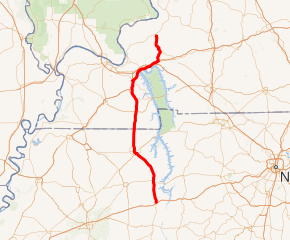
US 641 highlighted in red | |||||||
| Route information | |||||||
| Auxiliary route of US 41 | |||||||
| Length | 165.45 mi (266.27 km) | ||||||
| Major junctions | |||||||
| South end | |||||||
| |||||||
| North end | |||||||
| Location | |||||||
| States | Tennessee, Kentucky | ||||||
| Counties | TN: Wayne, Hardin, Decatur, Benton, Henry KY: Calloway, Marshall, Livingston, Lyon, Caldwell, Crittenden | ||||||
| Highway system | |||||||
| |||||||

Route description
Tennessee
US 641 begins at an interchange with US 64 south of Clifton. North of that city, it runs concurrently with SR 69.[1] US 641 intersects US 412 in Parsons, I-40 near Holladay, and US 70 in Camden.[2] In Paris, US 641 intersects US 79; it also separates from SR 69 and begins a concurrency with SR 54 that it maintains until the Kentucky state line.[3]
Kentucky
US 641 enters Kentucky at Hazel and continues north to Murray, intersecting KY 80 just north of the city limit.[4] Near Benton, a spur route (Spur US 641) provides access to I-69 (the Purchase Parkway) while the main route travels through the city.[5] US 641 has a concurrency with US 62 beginning near Calvert City; the routes cross I-24 / I-69 before separating in Eddyville.[6][7] The route intersects KY 70 in Fredonia.[8] The US 641 designation ends at US 60 in Marion.[9]
History
U.S. Route 641 was created as a 149-mile (240 km) highway from Paris, Tennessee to Evansville, Indiana. In 1972, its route was truncated in the north. Its northern section from Marion, Kentucky to Evansville, which was concurrent with U.S. Route 60, was eliminated and its northern terminus has since remained Marion. In 1977, US 641 was extended southward along the path of Tennessee State Route 69 to its interchange with I-40 (Exit 126) near Holladay, Tennessee with SR 69 continuing south beyond the interchange.
In November 2014, the American Association of State Highway and Transportation Officials approved a southern extension of the US 641 designation along SR 69, from the former southern terminus at I-40 to the current end at US 64 in Wayne County.[10]
Major intersections
The mileposts listed in the following table is only an estimated calculation. Actual mile markers may vary.
| State | County | Location | mi[11][12] | km | Destinations | Notes |
|---|---|---|---|---|---|---|
| Tennessee | Wayne | Clifton Junction | 0.0 | 0.0 | Southern terminus of US 641 and SR 114; Southern end of unsigned SR 114 concurrency | |
| Clifton | 7.34 | 11.81 | Southern end of SR 128 concurrency | |||
| Hardin | | 8.67 | 13.95 | Northern end of SR 128 concurrency | ||
| Tennessee River | 11.12– 11.68 | 17.90– 18.80 | Bridge over Kentucky Lake | |||
| Decatur | | 13.7 | 22.0 | Northern end of unsigned SR 114 concurrency; southern end of unsigned SR 69 concurrency | ||
| | 21.9 | 35.2 | Southern end of SR 202 concurrency | |||
| Decaturville | 25.3 | 40.7 | ||||
| 25.9 | 41.7 | Northern end of SR 202 concurrency | ||||
| | 27.5– 27.6 | 44.3– 44.4 | Arthur F. Tolley Bridge over the Beech River | |||
| Parsons | 30.6 | 49.2 | ||||
| Holladay | 44.6 | 71.8 | Former southern terminus; I-40 exit 126 | |||
| Benton | 46.3 | 74.5 | Southern terminus of SR 192; former US 641/SR 69 through Holladay | |||
| | 53.5 | 86.1 | Northern terminus of SR 192; former US 641/SR 69 through Holladay | |||
| | 58.3 | 93.8 | ||||
| Camden | 59.8 | 96.2 | ||||
| Henry | Paris | 78.6 | 126.5 | Beltway around Paris | ||
| 79.5 | 127.9 | Northern terminus of SR 69A; former routing of US 641/SR 69 | ||||
| 80.2 | 129.1 | Eastern terminus of SR 77 | ||||
| 81.0 | 130.4 | |||||
| 81.9 | 131.8 | Northern end of unsigned SR 69 concurrency; southern end of unsigned SR 54 concurrency; western terminus of SR 356; SR 356 is a former alignment of US 79/SR 76 | ||||
| | 85.7 | 137.9 | Beltway around Paris; current southern terminus of SR 218 | |||
| Puryear | 91.9 | 147.9 | Southern end of SR 140 concurrency | |||
| 92.0 | 148.1 | Northern end of SR 140 concurrency | ||||
| 95.87 0.000 | 154.29 0.000 | Tennessee–Kentucky state line Northern end of unsigned SR 54 concurrency | ||||
| Kentucky | Calloway | Hazel | 0.009 | 0.014 | South end of KY 893 concurrency | |
| 0.069 | 0.111 | North end of KY 893 concurrency | ||||
| Murray | 3.556 | 5.723 | ||||
| Murray | 6.666 | 10.728 | ||||
| 7.169 | 11.537 | |||||
| 7.699 | 12.390 | |||||
| 8.143 | 13.105 | |||||
| 8.633 | 13.893 | |||||
| 9.710 | 15.627 | |||||
| | 10.620 | 17.091 | ||||
| | 11.775 | 18.950 | ||||
| | 12.348 | 19.872 | ||||
| | 13.829 | 22.256 | ||||
| Dexter | 16.929 | 27.245 | ||||
| Marshall | Hardin | 18.668 | 30.043 | |||
| | 22.774 | 36.651 | ||||
| | 23.434 | 37.713 | ||||
| Benton | 25.559 | 41.133 | ||||
| 25.714 | 41.383 | South end of KY 58 concurrency | ||||
| 26.002 | 41.846 | |||||
| 26.259 | 42.260 | |||||
| 26.363 | 42.427 | |||||
| | 28.912 | 46.529 | North end of KY 58 concurrency | |||
| Draffenville | 30.306 | 48.773 | South end of US 68 concurrency | |||
| 30.722 | 49.442 | North end of US 68 concurrency | ||||
| | 32.518 | 52.333 | ||||
| | 36.122 | 58.133 | ||||
| | 37.110 | 59.723 | Interchange; south end of US 62 concurrency | |||
| Livingston | | 39.584 | 63.704 | Interchange | ||
| Lake City | 40.072 | 64.490 | ||||
| | 41.009 | 65.998 | ||||
| Lyon | Suwanee | 44.944 | 72.330 | South end of KY 810 concurrency | ||
| 45.010 | 72.437 | North end of KY 810 concurrency | ||||
| | 47.370 | 76.235 | South end of KY 93 concurrency | |||
| | 47.724 | 76.804 | ||||
| | 48.063 | 77.350 | Interchange | |||
| Eddyville | 49.422 | 79.537 | ||||
| 49.510 | 79.679 | |||||
| 50.193 | 80.778 | North end of KY 93 concurrency | ||||
| 51.739 | 83.266 | North end of US 62 concurrency | ||||
| | 54.407 | 87.560 | ||||
| | 54.894 | 88.343 | ||||
| Caldwell | Fredonia | 60.331 | 97.093 | South end of KY 70/KY 91 concurrency | ||
| 60.535 | 97.422 | South end of KY 902 concurrency | ||||
| 60.656 | 97.616 | North end of KY 902 concurrency | ||||
| Crittenden | | 63.258 | 101.804 | North end of KY 70 concurrency | ||
| Marion | 69.577 | 111.973 | Northern terminus; north end of KY 91 concurrency | |||
1.000 mi = 1.609 km; 1.000 km = 0.621 mi
| ||||||
Special routes
Two special routes of U.S. Route 641 currently exist, and a third has existed in the past, all of which have been in Kentucky.
US Route 641 Business
| |
|---|---|
| Location | Murray, Calloway County |
US Route 641 Business is a business route of US Route 641 located mainly along the east side of Murray, Kentucky, in Calloway County. It follows Kentucky Route 121 east from US 641 along Glendale Road until KY 121 turns south along South Fourth Street, where US BUS 641 turns north. The route makes a sharp left turn at Chestnut Street and heads west before finally terminating at US 641.
US Route 641 Spur
| |
|---|---|
| Location | Benton, Marshall County |
| Length | 3.25 mi (5.23 km) |
US Route 641 Spur is a spur route of US Route 641 located on the south side of Benton, Kentucky, in Marshall County in western Kentucky's Jackson Purchase region. It begins at a junction with US 641 south of Benton, and ends at the Exit 41 interchange with Interstate 69 (formerly the Julian M. Carroll Purchase Parkway).
US Route 641 Truck
| |
|---|---|
| Location | Benton, Marshall County |
| Existed | ?–1990s |
References
- Planning Division (1998). General Highway Map: Decatur County, Tennessee (PDF) (Map). Tennessee Department of Transportation. p. 20. Retrieved November 11, 2012.
- Planning Division (1996). General Highway Map: Benton County, Tennessee (PDF) (Map). Tennessee Department of Transportation. p. 3. Retrieved November 11, 2012.
- Planning Division (2002). General Highway Map: Henry County, Tennessee (PDF) (Map). Tennessee Department of Transportation. p. 40. Retrieved November 11, 2012.
- Division of Planning (January 2012). State Primary Road System: Calloway County (PDF) (Map). Kentucky Transportation Cabinet. p. 18. Retrieved November 11, 2012.
- Division of Planning (February 2012). State Primary Road System: Marshall County (PDF) (Map). Kentucky Transportation Cabinet. p. 79. Retrieved November 11, 2012.
- Division of Planning (March 2011). State Primary Road System: Livingston County (PDF) (Map). Kentucky Transportation Cabinet. p. 70. Retrieved November 11, 2012.
- Division of Planning (March 2011). State Primary Road System: Lyon County (PDF) (Map). Kentucky Transportation Cabinet. p. 72. Retrieved November 11, 2012.
- Division of Planning (May 2011). State Primary Road System: Caldwell County (PDF) (Map). Kentucky Transportation Cabinet. p. 17. Retrieved November 11, 2012.
- Division of Planning (January 2011). State Primary Road System: Crittenden County (PDF) (Map). Kentucky Transportation Cabinet. p. 28. Retrieved November 11, 2012.
- Special Committee on U.S. Route Numbering (November 20, 2014). "Report to SCOH" (PDF) (Report). Washington, DC: American Association of State Highway and Transportation Officials. Archived (PDF) from the original on January 28, 2019. Retrieved December 4, 2014.
- "Official DMI Route Log: District 1". Kentucky Transportation Cabinet. Retrieved November 26, 2012.
- "Official DMI Route Log: District 2". Kentucky Transportation Cabinet. Retrieved November 26, 2012.