Tribes and clans of the Pothohar Plateau
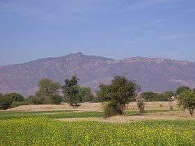
The Potohar plateau, sometimes pronounced Pothohar Plateau (Urdu: سطح مرتفع پوٹھوہار), is a large region of plateau situated in northern Punjab, Pakistan. It is bounded on the east by the Jhelum River, on the west by the Indus River, on the north by the Kala Chitta Range and the Margalla Hills, and on the south by the Salt Range.[1]
The region roughly covers the modern-day Punjab districts of Attock, Chakwal, and Rawalpindi Jhelum District and the Islamabad Capital Territory.
Tribes of the region
The Pothohar region is home to a number of tribal groupings, many of whom occupy distinct tracts.
The anthropologist Pnina Werbner have confirmed the continuing strength of tribal feelings among emigrant Pothoharis in the United Kingdom.[2] This region was and still is an important source of recruitment into the old colonial British Indian army, and its successor, the Pakistan Army.[3] Official recruitment policies have also encouraged the sense of tribal belonging among the Pothoharis.[4]
The present Chakwal District was created out of the merger Talagang Tehsil of Attock District and Chakwal Tehsil of Jhelum District in 1985. The Islamabad Capital Territory was carved out of Rawalpindi District in 1959.
References
- "Salt Range: A Hidden Treasure". Daily Times. Retrieved 2008-06-23.
- The Migration Process: Capital, Gifts and Offerings among British Pakistanis (Berg, 1990 and 2002).
- Mustapha Kamal Pasha, Colonial Political Economy: Recruitment and Underdevelopment in the Punjab, Oxford University Press, 1998, pp. 198–200. ISBN 0 -19-577762-X
- Stephen P. Cohen, The Pakistan Army (1998 edition; paperback), Oxford University Press (July 1, 1998). ISBN 0-19-577948-7