Tourneville
Tourneville is a commune in the Eure department in Normandy in northern France.
Tourneville | |
|---|---|
Location of Tourneville 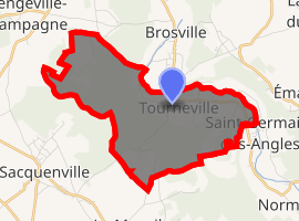
| |
 Tourneville  Tourneville | |
| Coordinates: 49°05′50″N 1°06′52″E | |
| Country | France |
| Region | Normandy |
| Department | Eure |
| Arrondissement | Évreux |
| Canton | Le Neubourg |
| Intercommunality | CA Évreux Portes de Normandie |
| Government | |
| • Mayor | Roland Simler |
| Area 1 | 7.31 km2 (2.82 sq mi) |
| Population (2017-01-01)[1] | 319 |
| • Density | 44/km2 (110/sq mi) |
| Time zone | UTC+01:00 (CET) |
| • Summer (DST) | UTC+02:00 (CEST) |
| INSEE/Postal code | 27652 /27930 |
| Elevation | 37–143 m (121–469 ft) (avg. 42 m or 138 ft) |
| 1 French Land Register data, which excludes lakes, ponds, glaciers > 1 km2 (0.386 sq mi or 247 acres) and river estuaries. | |
Geographical Information
| Municipality | Tourneville |
|---|---|
| Postcode | 27930 |
| Latitude | 49.0972830 (N 49° 5’ 50”) |
| Longitude | 1.1167510 (E 1° 7’ 0”) |
| Altitude | From 37m to 143m |
| Surface area | 7.31 km² |
| Population | 352 inhabitants |
| Density | 48 inhabitants/km² |
| Prefecture | Evreux (6.2 mi, 19 min) |
| Insee code | 27652 |
| Intercommunality | CA Evreux Portes de Normandie |
| Department | Eure |
| Region | Normandy |
Population
| Year | Pop. | ±% |
|---|---|---|
| 1962 | 108 | — |
| 1968 | 118 | +9.3% |
| 1975 | 104 | −11.9% |
| 1982 | 153 | +47.1% |
| 1990 | 228 | +49.0% |
| 1999 | 258 | +13.2% |
| 2008 | 343 | +32.9% |
See also
References
- "Populations légales 2017". INSEE. Retrieved 6 January 2020.
| Wikimedia Commons has media related to Tourneville. |
| Authority control |
|
|---|
This article is issued from Wikipedia. The text is licensed under Creative Commons - Attribution - Sharealike. Additional terms may apply for the media files.