The Hills, Texas
The Hills is a village in Travis County, Texas, United States. The population was 2,472 at the 2010 census, making it the largest village in Texas. It is a suburb of Austin.
The Hills, Texas | |
|---|---|
 | |
| Coordinates: 30°20′49″N 97°58′52″W | |
| Country | United States |
| State | Texas |
| County | Travis |
| Area | |
| • Total | 1.07 sq mi (2.78 km2) |
| • Land | 1.07 sq mi (2.78 km2) |
| • Water | 0.00 sq mi (0.00 km2) |
| Elevation | 817 ft (249 m) |
| Population (2010) | |
| • Total | 2,472 |
| • Estimate (2019)[2] | 2,487 |
| • Density | 2,315.64/sq mi (894.34/km2) |
| Time zone | UTC-6 (Central (CST)) |
| • Summer (DST) | UTC-5 (CDT) |
| Zip Code | 78738 |
| FIPS code | 48-72578[3] |
| GNIS feature ID | 1785535[4] |
| Website | http://www.villageofthehills.org |
Geography
The Hills is located at 30°20′49″N 97°58′52″W (30.346938, -97.981187),[5] 16 miles (26 km) west of downtown Austin.
According to the United States Census Bureau, the village has a total area of 1.1 square miles (2.8 km2), all of it land.
Demographics
| Historical population | |||
|---|---|---|---|
| Census | Pop. | %± | |
| 2000 | 1,492 | — | |
| 2010 | 2,472 | 65.7% | |
| Est. 2019 | 2,487 | [2] | 0.6% |
| U.S. Decennial Census[6] | |||
As of the census[3] of 2000, there were 1,492 people, 585 households, and 503 families residing in the village. The population density was 1,400.6 people per square mile (538.4/km2). There were 657 housing units at an average density of 616.7/sq mi (237.1/km2). The racial makeup of the village was 97.18% White, 1.21% African American, 0.34% Native American, 0.67% Asian, 0.13% from other races, and 0.47% from two or more races. Hispanic or Latino of any race were 2.21% of the population.
There were 585 households out of which 30.4% had children under the age of 18 living with them, 82.1% were married couples living together, 2.1% had a female householder with no husband present, and 14.0% were non-families. 12.6% of all households were made up of individuals and 5.8% had someone living alone who was 65 years of age or older. The average household size was 2.55 and the average family size was 2.77.
In the village, the population was spread out with 22.7% under the age of 18, 3.2% from 18 to 24, 22.5% from 25 to 44, 33.0% from 45 to 64, and 18.6% who were 65 years of age or older. The median age was 46 years. For every 100 females, there were 100.5 males. For every 100 females age 18 and over, there were 97.6 males.
The median income for a household in the village was $114,861, and the median income for a family was $126,252. Males had a median income of $100,000 versus $41,964 for females. The per capita income for the village was $61,363. About 2.8% of families and 2.7% of the population were below the poverty line, including 2.6% of those under age 18 and 2.5% of those age 65 or over.
Education
The Lake Travis Independent School District serves village students.[7] Lakeway Elementary School in Lakeway,[8] Hudson Bend Middle School in an unincorporated area,[9] and Lake Travis High School in an unincorporated area serve The Hills.
Public library
The Lake Travis Community Library (LTCL) in Lakeway serves The Hills. It originally opened in Lake Travis High School in 1985. Area voters approved the creation of the library district serving the library was created in May 2004. Haythem Dawlett donated the land for the library in March 2011, and the library moved into the current location in February 2013.[10]
References
- "2019 U.S. Gazetteer Files". United States Census Bureau. Retrieved August 7, 2020.
- "Population and Housing Unit Estimates". United States Census Bureau. May 24, 2020. Retrieved May 27, 2020.
- "U.S. Census website". United States Census Bureau. Retrieved 2008-01-31.
- "US Board on Geographic Names". United States Geological Survey. 2007-10-25. Retrieved 2008-01-31.
- "US Gazetteer files: 2010, 2000, and 1990". United States Census Bureau. 2011-02-12. Retrieved 2011-04-23.
- "Census of Population and Housing". Census.gov. Retrieved June 4, 2015.
- The Hills village map. U.S. Census Bureau. Retrieved on December 30, 2016.
- "Elementary School Attendance Zone Boundaries Archived 2016-12-29 at the Wayback Machine." Lake Travis Independent School District. Retrieved on December 30, 2016.
- "Middle School Attendance Zone Boundaries Archived 2015-05-31 at the Wayback Machine." Lake Travis Independent School District. Retrieved on December 30, 2016.
- "History." Lake Travis Community Library. Retrieved on April 13, 2017. "Lake Travis Community Library 1938 Lohmans Crossing Austin, TX 78734" - Map of library district
External links
Municipalities and communities of Travis County, Texas, United States | ||
|---|---|---|
| Cities | 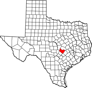 Travis County map | |
| Villages | ||
| CDPs | ||
| Other unincorporated communities | ||
| Footnotes | ‡This populated place also has portions in an adjacent county or counties | |