Tarrant, Alabama
Tarrant is a city in Jefferson County, Alabama, United States, southeast of Fultondale. At the 2010 census the population was 6,397. It is home to the ABC Coke plant owned by the Drummond Company, "the largest single producer of foundry coke in the U.S.".[4]
Tarrant | |
|---|---|
.jpg) Downtown Tarrant, Alabama | |
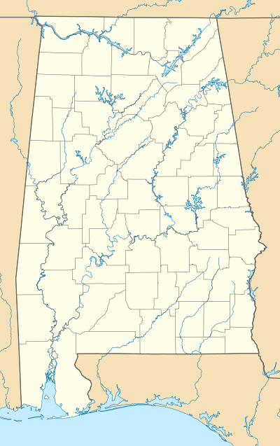
 Location of Tarrant in Jefferson County, Alabama. | |
 Tarrant Location in Alabama. | |
| Coordinates: 33°35′15″N 86°45′58″W | |
| Country | United States |
| State | Alabama |
| County | Jefferson |
| Area | |
| • Total | 6.46 sq mi (16.73 km2) |
| • Land | 6.40 sq mi (16.59 km2) |
| • Water | 0.05 sq mi (0.14 km2) |
| Population | |
| • Total | 6,397 |
| • Estimate (2019)[3] | 6,109 |
| • Density | 953.94/sq mi (368.29/km2) |
| Time zone | UTC-6 (Central (CST)) |
| • Summer (DST) | UTC-5 (CDT) |
| ZIP code | 35217 |
| Area code(s) | 205 & 659 |
| FIPS code | 01-74976 |
| Website | http://www.cityoftarrant.com/ |
Geography
Tarrant is located at 33°35′15″N 86°45′58″W (33.587546, -86.766219).[5]
According to the U.S. Census Bureau, the city has a total area of 6.4 square miles (17 km2), of which 6.4 square miles (17 km2) is land and 0.04 square miles (0.10 km2) (0.63%) is water.
Demographics
| Historical population | |||
|---|---|---|---|
| Census | Pop. | %± | |
| 1920 | 734 | — | |
| 1930 | 7,341 | 900.1% | |
| 1940 | 6,833 | −6.9% | |
| 1950 | 7,571 | 10.8% | |
| 1960 | 7,810 | 3.2% | |
| 1970 | 6,835 | −12.5% | |
| 1980 | 8,148 | 19.2% | |
| 1990 | 8,046 | −1.3% | |
| 2000 | 7,022 | −12.7% | |
| 2010 | 6,397 | −8.9% | |
| Est. 2019 | 6,109 | [3] | −4.5% |
| U.S. Decennial Census[6] 2013 Estimate[7] | |||
At the 2000 census, there were 7,022 people, 2,896 households, and 1,922 families living in the city. The population density was 1,104.7 people per square mile (426.3/km2). There were 3,277 housing units at an average density of 515.5 per square mile (198.9/km2). The racial makeup of the city was 79.14% White, 18.73% Black or African American, 0.37% Native American, 0.14% Asian, 0.01% Pacific Islander, 0.84% from other races, and 0.77% from two or more races. 1.71% of the population were Hispanic or Latino of any race.
Of the 2,896 households 28.3% had children under the age of 18 living with them, 45.5% were married couples living together, 17.0% had a female householder with no husband present, and 33.6% were non-families. 29.7% of households were one person and 15.2% were one person aged 65 or older. The average household size was 2.42 and the average family size was 3.01.
The age distribution was 24.3% under the age of 18, 8.3% from 18 to 24, 28.1% from 25 to 44, 21.9% from 45 to 64, and 17.3% 65 or older. The median age was 38 years. For every 100 females, there were 88.5 males. For every 100 females age 18 and over, there were 85.6 males.
The median household income was $29,380 and the median family income was $32,392. Males had a median income of $30,015 versus $22,215 for females. The per capita income for the city was $14,149. About 14.9% of families and 16.2% of the population were below the poverty line, including 22.8% of those under age 18 and 11.1% of those age 65 or over.
2010 census
At the 2010 census, there were 6,397 people, 2,307 households, and 1,520 families living in the city. The population density was 999.5 people per square mile (385.4/km2). There were 2,804 housing units at an average density of 438.1 per square mile (168.9/km2). The racial makeup of the city was 52.3% Black or African American, 39.0% White, 0.8% Native American, 0.3% Asian, 0.8% Pacific Islander, 5.3% from other races, and 1.5% from two or more races. 9.0% of the population were Hispanic or Latino of any race.
Of the 2,307 households 30.6% had children under the age of 18 living with them, 30.1% were married couples living together, 29.3% had a female householder with no husband present, and 34.1% were non-families. 29.1% of households were one person and 11.7% were one person aged 65 or older. The average household size was 2.72 and the average family size was 3.38.
The age distribution was 28.5% under the age of 18, 9.7% from 18 to 24, 24.6% from 25 to 44, 24.0% from 45 to 64, and 13.2% 65 or older. The median age was 34.1 years. For every 100 females, there were 84.0 males. For every 100 females age 18 and over, there were 88.0 males.
The median household income was $28,385 and the median family income was $30,938. Males had a median income of $25,451 versus $25,521 for females. The per capita income for the city was $13,990. About 25.0% of families and 30.2% of the population were below the poverty line, including 50.3% of those under age 18 and 6.9% of those age 65 or over.
History
A contest was held to name the new town in 1915. Several people suggested Tarrant in honor of Benjamin Tarrant, who had lived in this community most of his life. Other sources claim the city was named for Felix I. Tarrant, President of National Cast Iron Pipe Company, which built the first major industrial plant in the area in 1912.[8] On August 17, 1918 Tarrant became an incorporated city. Its first mayor was George Washington Thomason. The first census was taken in 1920 and gave Tarrant City a population of 734. From its incorporation until the 1980s, the community went by Tarrant City until it was shortened to Tarrant by the 1990 U.S. Census.[9]
Economy
The town is home to the ABC Coke plant owned by the Drummond Company.[4] According to Forbes, it is "the largest single producer of foundry coke in the U.S.".[4]
Notable people
- Jimmy Bryant, singer, arranger, and composer
- James D. Martin (1918-2017), a politician and Representative in the United States House of Representatives
Climate
The climate in this area is characterized by hot, humid summers and generally mild to cool winters. According to the Köppen Climate Classification system, Tarrant has a humid subtropical climate, abbreviated "Cfa" on climate maps.[10]
References
- "2019 U.S. Gazetteer Files". United States Census Bureau. Retrieved June 29, 2020.
- "Population Estimates". United States Census Bureau. Retrieved 2014-06-07.
- "Population and Housing Unit Estimates". United States Census Bureau. May 24, 2020. Retrieved May 27, 2020.
- America's Largest Private Companies: #162 Drummond, Forbes
- "US Gazetteer files: 2010, 2000, and 1990". United States Census Bureau. 2011-02-12. Retrieved 2011-04-23.
- United States Census Bureau. "Census of Population and Housing". Retrieved August 10, 2013.
- "Annual Estimates of the Resident Population: April 1, 2010 to July 1, 2013". Retrieved June 7, 2014.
- The Birmingham District, An Industrial History and Guide,page 174, published 1981, Marjorie L. White.
- https://www.census.gov/prod/cen1990/cph2/cph-2-2.pdf
- Climate Summary for Tarrant, Alabama
External links
| Wikimedia Commons has media related to Tarrant, Alabama. |
- City of Tarrant - Official site.
- Tarrant City Schools
Municipalities and communities of Jefferson County, Alabama, United States | ||
|---|---|---|
| Cities | 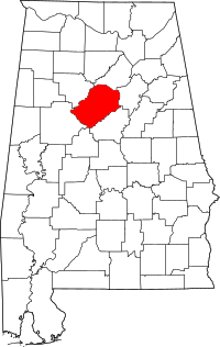 Map of Alabama highlighting Jefferson County | |
| Towns | ||
| CDPs | ||
| Unincorporated communities | ||
| Former towns | ||
| Footnotes | ‡This populated place also has portions in an adjacent county or counties | |
| Authority control |
|---|