Tanga District
Tanga District (or Tanga City Council) is one of the ten districts of the Tanga Region of Tanzania. The district is bordered to the north by Mkinga District and to the south by Muheza District. The administrative capital of the district is Tanga city.
Tanga District | |
|---|---|
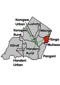 Location within Tanga Region (red) | |
| Coordinates: 05°04′19″S 39°05′58″E | |
| Country | Tanzania |
| Region | Tanga Region |
| Capital | Tanga |
| Population (2012) | |
| • Total | 273,332 |
According to the 2012 Tanzania National Census, the population of Tanga District was 273,332.[1]
Administrative subdivisions
As of 2012, Tanga District was administratively divided into 24 wards.[1]
Wards
- Central
- Chongoleani
- Chumbageni
- Duga
- Kiomoni
- Kirare
- Mabawa
- Mabokweni
- Majengo
- Makorora
- Marungu
- Maweni
- Msambweni
- Mwanzange
- Mzingani
- Mzizima
- Ngamiani Kaskazini
- Ngamiani Kati
- Ngamiani Kusini
- Nguvumali
- Pongwe
- Tangasisi
- Tongoni
- Usagara
References
- "2012 Population and Housing Census" (PDF). Development Partners Group Tanzania. Retrieved 7 August 2019.
- "Tanga Region Roads Network" (PDF). Tanroads. Retrieved 8 August 2019.
This article is issued from Wikipedia. The text is licensed under Creative Commons - Attribution - Sharealike. Additional terms may apply for the media files.