Surbiton, Queensland
Surbiton is a former rural locality in the Barcaldine Region, Queensland, Australia.[2] In the 2016 census, Surbiton had a population of 80 people.[1]
| Surbiton Queensland | |||||||||||||||
|---|---|---|---|---|---|---|---|---|---|---|---|---|---|---|---|
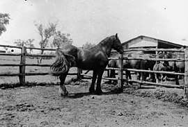 Horses at Surbiton Station, circa 1940 | |||||||||||||||
 Surbiton | |||||||||||||||
| Coordinates | 23.1386°S 146.6544°E | ||||||||||||||
| Population | 80 (2016 census)[1] | ||||||||||||||
| • Density | 0.0368/km2 (0.095/sq mi) | ||||||||||||||
| Postcode(s) | 4724 | ||||||||||||||
| Area | 2,171.5 km2 (838.4 sq mi) | ||||||||||||||
| Time zone | AEST (UTC+10:00) | ||||||||||||||
| Location |
| ||||||||||||||
| LGA(s) | Barcaldine Region | ||||||||||||||
| State electorate(s) | Gregory | ||||||||||||||
| Federal Division(s) | Maranoa | ||||||||||||||
| |||||||||||||||
On 22 November 2019 the Queensland Government decided to amalgamate the localities in the Barcaldine Region, resulting in five expanded localities based on the larger towns: Alpha, Aramac, Barcaldine, Jericho and Muttaburra. Surbiton was incorporated into Alpha.[3][4][5]
Geography
The Belyando River forms the north-western boundary of the locality. Native Companion Creek flows from the south-west (Alpha/Beaufort) through to the north of the locality where it becomes a tributary of the Belyando River.[6]
The Alpha Clermont Road passes through the locality from the south (Alpha) to the north-west (Quetta).[6]
History
The origin of the name is unclear but there has been a Surbiton pastoral run since at least 1866 when it was operated by William Killgour.[7][8]
Education
There are no schools in Surbiton. There is a primary and secondary school in neighbouring Alpha, but only to Year 10. For Years 11 and 12 of secondary schooling, the nearest schools are in Clermont, Barcaldine and Emerald.[6] Boarding schools and distance education are other options.
References
| Wikimedia Commons has media related to Surbiton, Queensland. |
- Australian Bureau of Statistics (27 June 2017). "Surbiton (SSC)". 2016 Census QuickStats. Retrieved 20 October 2018.

- "Surbiton - locality in Barcaldine Region (entry 47097)". Queensland Place Names. Queensland Government. Retrieved 10 June 2019.
- "Recent place name decisions". Queensland Government. 22 November 2019. Archived from the original on 22 October 2019. Retrieved 15 January 2020.
- "Proposed Locality Boundaries and Names: Barcaldine Regional: Alpha, Aramac, Barcaldine, Jericho and Muttaburra" (PDF). Queensland Government. 17 May 2019. Archived (PDF) from the original on 15 January 2020. Retrieved 15 January 2020.
- "Locality Boundaries and Names: Barcaldine Regional Council: Alpha, Aramac, Barcaldine, Jericho and Muttaburra" (PDF). Queensland Government. 17 May 2019. Archived (PDF) from the original on 15 January 2020. Retrieved 15 January 2020.
- "Queensland Globe". State of Queensland. Retrieved 13 August 2019.
- "CLERMONT". The Queenslander. I (36). Queensland, Australia. 6 October 1866. p. 8. Retrieved 14 August 2019 – via National Library of Australia.
- "Classified Advertising". The Brisbane Courier. XXI (2, 656). Queensland, Australia. 1 August 1866. p. 1. Retrieved 14 August 2019 – via National Library of Australia.