Stedman, North Carolina
Stedman is a town in Cumberland County, North Carolina, United States. The population was 1,028 at the 2010 census.[5] It is named for Civil War Major Charles Manly Stedman.[6]
Stedman, North Carolina | |
|---|---|
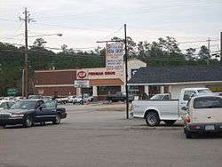 Stedman Soda Shop and Stedman Drug | |
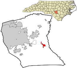 Location in Cumberland County and the state of North Carolina. | |
| Coordinates: 35°0′51″N 78°41′50″W | |
| Country | United States |
| State | North Carolina |
| County | Cumberland |
| Settled | 1841 |
| Incorporated | 1917 |
| Government | |
| • Mayor | Martin L. Jones |
| Area | |
| • Total | 2.08 sq mi (5.39 km2) |
| • Land | 2.08 sq mi (5.39 km2) |
| • Water | 0.00 sq mi (0.00 km2) |
| Elevation | 125 ft (38 m) |
| Population (2010) | |
| • Total | 1,028 |
| • Estimate (2019)[2] | 1,076 |
| • Density | 517.31/sq mi (199.69/km2) |
| Time zone | UTC-5 (Eastern (EST)) |
| • Summer (DST) | UTC-4 (EDT) |
| ZIP code | 28391 |
| Area code(s) | 910 |
| FIPS code | 37-64840[3] |
| GNIS feature ID | 0995445[4] |
History
Stedman was settled in 1841 when John Culbreth Blocker built a stagecoach house and post office on land that he had purchased. The town was incorporated in 1917.[7]
The Maxwell House was listed on the National Register of Historic Places in 1985.[8]
Geography
Stedman is located in eastern Cumberland County at 35°0′51″N 78°41′50″W (35.014080, -78.697312).[9] North Carolina Highway 24 passes through the town, leading west 11 miles (18 km) to Fayetteville, the county seat, and east 22 miles (35 km) to Clinton.
According to the United States Census Bureau, the town has a total area of 2.1 square miles (5.4 km2), all land.[5]
Demographics
| Historical population | |||
|---|---|---|---|
| Census | Pop. | %± | |
| 1920 | 121 | — | |
| 1930 | 289 | 138.8% | |
| 1940 | 356 | 23.2% | |
| 1950 | 424 | 19.1% | |
| 1960 | 458 | 8.0% | |
| 1970 | 505 | 10.3% | |
| 1980 | 723 | 43.2% | |
| 1990 | 577 | −20.2% | |
| 2000 | 664 | 15.1% | |
| 2010 | 1,028 | 54.8% | |
| Est. 2019 | 1,076 | [2] | 4.7% |
| U.S. Decennial Census[10] | |||
As of the census[3] of 2000, there were 664 people, 261 households, and 196 families residing in the town. The population density was 484.0 people per square mile (187.1/km2). There were 286 housing units at an average density of 208.5 per square mile (80.6/km2). The racial makeup of the town was 82.53% White, 12.50% African American, 1.05% Native American, 0.45% Asian, 0.15% Pacific Islander, 1.20% from other races, and 2.11% from two or more races. Hispanic or Latino of any race were 2.41% of the population.
There were 261 households, out of which 32.2% had children under the age of 18 living with them, 57.1% were married couples living together, 12.6% had a female householder with no husband present, and 24.9% were non-families. 20.7% of all households were made up of individuals, and 7.7% had someone living alone who was 65 years of age or older. The average household size was 2.54 and the average family size was 2.93.
In the town, the population was spread out, with 23.8% under the age of 18, 7.1% from 18 to 24, 28.8% from 25 to 44, 28.2% from 45 to 64, and 12.2% who were 65 years of age or older. The median age was 40 years. For every 100 females, there were 96.4 males. For every 100 females age 18 and over, there were 89.5 males.
The median income for a household in the town was $47,321, and the median income for a family was $55,294. Males had a median income of $36,250 versus $21,875 for females. The per capita income for the town was $19,233. About 4.3% of families and 10.0% of the population were below the poverty line, including 18.8% of those under age 18 and 12.3% of those age 65 or over.
References
- "2019 U.S. Gazetteer Files". United States Census Bureau. Retrieved July 27, 2020.
- "Population and Housing Unit Estimates". United States Census Bureau. May 24, 2020. Retrieved May 27, 2020.
- "U.S. Census website". United States Census Bureau. Retrieved 2008-01-31.
- "US Board on Geographic Names". United States Geological Survey. 2007-10-25. Retrieved 2008-01-31.
- "Geographic Identifiers: 2010 Demographic Profile Data (G001): Stedman town, North Carolina". U.S. Census Bureau, American Factfinder. Archived from the original on February 12, 2020. Retrieved January 6, 2015.
- Rodger Mullen. "Business replaces farms". The Fayetteville Observer. Retrieved 2008-11-01.
- "Living Here" (Newspaper magazine insert)
|format=requires|url=(help). The Fayetteville Observer. August 15, 2009. p. 16. - "National Register Information System". National Register of Historic Places. National Park Service. July 9, 2010.
- "US Gazetteer files: 2010, 2000, and 1990". United States Census Bureau. 2011-02-12. Retrieved 2011-04-23.
- "Census of Population and Housing". Census.gov. Retrieved June 4, 2015.
Municipalities and communities of Cumberland County, North Carolina, United States | ||
|---|---|---|
| City | 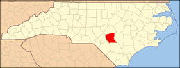 | |
| Towns | ||
| CDP | ||
| Unincorporated communities | ||
| Military bases |
| |
| Footnotes | ‡This populated place also has portions in an adjacent county or counties | |