South River, Newfoundland and Labrador
South River is a town in the Canadian province of Newfoundland and Labrador, located at the junction of Cupids, Roaches Line, Makinsons and Clarke's Beach at the head of Bay de Grave. The town had a population of 647 in the 2016 Canadian Census.[1] South River is the site of the western terminus of Newfoundland and Labrador Route 60, also known as the Conception Bay Highway, which proceeds eastward to downtown St. John's. The river is located on Taylor's road, which is off of Springfield.
South River | |
|---|---|
Town | |
| Coordinates: 47°31′56″N 53°16′05″W | |
| Country | |
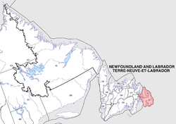
| Province | |
| District | Harbour Main - Whitbourne |
| Established ca. | 1620 |
| Incorporated | 1966 |
| Government | |
| • MHA | Betty Parsley |
| • Mayor | Scott Rose |
| Population (2016) | |
| • Total | 647 |
| Time zone | UTC-3:30 (Newfoundland Time) |
| • Summer (DST) | UTC-2:30 (Newfoundland Daylight) |
| Postal Code | A0A 3W0 |
| Area code(s) | 709 |
| Highways | |
| Website | www |
In addition to the primary settlement at South River, the town also includes the smaller settlements of The Broads and Springfield. Salmon Cove Road occupies the north side of a hill known as Long Harry, the south side of which is occupied by Cupids, the oldest English settlement in North America. As such, Salmon Cove is among the oldest continually inhabited places on the continent.
The first mayor of South River was Mr. Harry L. Shepherd. The first female mayor was Ms. Veronica Rowe, who was the only mayor to die while in office (2004).
See also
- List of cities and towns in Newfoundland and Labrador
References
- "South River, Town [Census subdivision], Newfoundland and Labrador". Statistics Canada. Retrieved 7 January 2019.