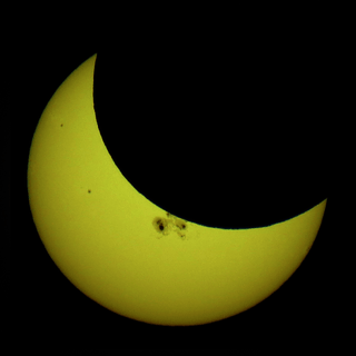
Solar eclipse of January 12, 1823
A partial solar eclipse occurred on January 22, 1823 during summer. A solar eclipse occurs when the Moon passes between Earth and the Sun, thereby totally or partly obscuring the image of the Sun for a viewer on Earth. A partial solar eclipse occurs in the polar regions of the Earth when the center of the Moon's shadow misses the Earth.
| Solar eclipse of January 12, 1823 | |
|---|---|
 Map | |
| Type of eclipse | |
| Nature | Partial |
| Gamma | -1.5413 |
| Magnitude | 0.0484 |
| Maximum eclipse | |
| Coordinates | 64°S 173°W |
| Times (UTC) | |
| Greatest eclipse | 9:20:12 |
| References | |
| Saros | 109 (79 of 81) |
| Catalog # (SE5000) | 9097 |
It was one of four partial eclipses that took place that year, two within the space of two months each, the next one was on February 11 and covered the Northern Hemisphere.[1] It was the three of last of solar saros 109, the next two were on January 22, 1841 and February 5, 1859.[2]
Description
The eclipse was visible in parts of Antarctica including the 180th meridian and the Pacific Ocean.
The eclipse started at sunrise off the shores of peninsular Antarctica, most of it started it at sunset, it finished at sunset around halfway between Antarctica and New Zealand, there it was January 11 being west of the 180th meridian, where the Date Line is located today.
It showed about from 5% to 10% obscurity in a part of Antarctica, about 20% in the Pacific.. The greatest eclipse was in the Pacific Ocean east of the 180th meridian at 64.5 S and 173 W at 9:20:12 UTC (9:20 PM local time) at the furthermost area of the Southwestern Hemisphere (sometimes as the Southwestern Tetrasphere).[1]
The subsolar marking was west of the island of Madagascar.
See also
- List of solar eclipses in the 19th century
- List of solar eclipses visible from Antarctica
References
- "Solar eclipse of January 12, 1823". NASA. Retrieved March 13, 2017.
- "Solar Saros 109". NASA. Retrieved March 13, 2017.
.jpg)
