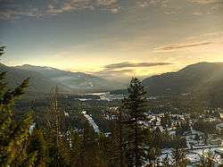
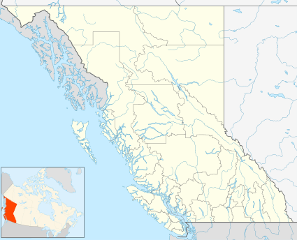
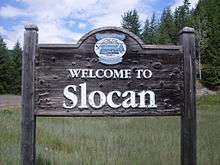
Slocan, British Columbia
The Village of Slocan (/sloʊˈkæn/ sloh-KAN), from Ktunaxa: sⱡuqan, IPA: [sɬuqan]).[2] is a village in the Slocan Valley of the West Kootenay region of the southeastern Interior of British Columbia, Canada. It is located at the southern end of Slocan Lake, to the south of New Denver, which sits mid-way up the lake's eastern shore.
Slocan | |
|---|---|
| Village of Slocan[1] | |
 | |
 Slocan Location of Slocan in British Columbia | |
| Coordinates: 49°45′58″N 117°28′6″W | |
| Country | |
| Province | |
| Region | West Kootenay (Slocan Valley) |
| Regional district | Central Kootenay |
| Incorporated | 1901 |
| Government | |
| • Governing body | Slocan Village Council |
| • Mayor | Jessica Lunn |
| Area | |
| • Total | 0.78 km2 (0.30 sq mi) |
| Elevation | 450 m (1,480 ft) |
| Population (2016) | |
| • Total | 272 |
| • Density | 381.7/km2 (989/sq mi) |
| Time zone | UTC-8 (PST) |
| Highways | 6 |
| Waterways | Slocan Lake, Slocan River |
| Website | Official website |
Name
Slocan should not be confused with Slocan Park, which is farther south along the Slocan River, or South Slocan, which, in turn, should not be confused with Shoreacres, at the Slocan River's confluence with the Kootenay River. The term "the Slocan" refers to the Slocan Valley in general.
History
_SlocanCity.jpg)
The townsite was staked at the lower end of Slocan Lake in 1892 following massive silver strikes nearby. The site was conveniently close to three principal ore producing areas. By 1900, there were 12 hotels in Slocan; by 1920 there were only three. Slocan became a city in June 1901 and reverted to village status in June 1958.
During the 1890s, Slocan City was a bustling, boisterous, boomtown filled with hotels, saloons, pack teams, rail cars filled with ore, and miners in pursuit of the ever elusive mother lode.
During World War II, Slocan had one of the Japanese Canadian internment camps called Bay Farm in British Columbia. Among those interned at the Slocan camp were celebrity scientist David Suzuki, and author Joy Kogawa.[3] Other internment camps in the area were at Lemon Creek, just south of Slocan, and at New Denver.
Climate
| Climate data for Slocan | |||||||||||||
|---|---|---|---|---|---|---|---|---|---|---|---|---|---|
| Month | Jan | Feb | Mar | Apr | May | Jun | Jul | Aug | Sep | Oct | Nov | Dec | Year |
| Record high °C (°F) | 10 (50) |
14.5 (58.1) |
22.5 (72.5) |
30 (86) |
35.5 (95.9) |
38 (100) |
41 (106) |
39.5 (103.1) |
36.1 (97.0) |
26.1 (79.0) |
17.2 (63.0) |
11.7 (53.1) |
41 (106) |
| Average high °C (°F) | −0.2 (31.6) |
3.6 (38.5) |
9.3 (48.7) |
15.5 (59.9) |
20.4 (68.7) |
24.2 (75.6) |
28 (82) |
28.5 (83.3) |
21.7 (71.1) |
13.8 (56.8) |
4.8 (40.6) |
0.2 (32.4) |
14.1 (57.4) |
| Average low °C (°F) | −7.1 (19.2) |
−4.9 (23.2) |
−2.3 (27.9) |
1 (34) |
4.9 (40.8) |
8.5 (47.3) |
10.1 (50.2) |
10 (50) |
5.8 (42.4) |
1.4 (34.5) |
−1.9 (28.6) |
−5.9 (21.4) |
1.6 (34.9) |
| Record low °C (°F) | −31.7 (−25.1) |
−30.6 (−23.1) |
−22.2 (−8.0) |
−7.8 (18.0) |
−6.1 (21.0) |
0 (32) |
2.8 (37.0) |
2.2 (36.0) |
−4.4 (24.1) |
−11 (12) |
−23.5 (−10.3) |
−35 (−31) |
−35 (−31) |
| Average precipitation mm (inches) | 94 (3.7) |
69.8 (2.75) |
62.4 (2.46) |
61 (2.4) |
68.2 (2.69) |
71.1 (2.80) |
54.4 (2.14) |
49.4 (1.94) |
51.4 (2.02) |
61.6 (2.43) |
104 (4.1) |
105.9 (4.17) |
853.2 (33.59) |
| Source: Environment Canada[4] | |||||||||||||
Attractions
Currently, Slocan is a starting point for travellers en route to Valhalla Provincial Park. Slocan Beach with its gazebo and boat launch is for public events and lake access.
Television
Slocan City was featured on the history-themed television series Gold Trails and Ghost Towns (season 2, episode 7).
References
- "British Columbia Regional Districts, Municipalities, Corporate Name, Date of Incorporation and Postal Address" (XLS). British Columbia Ministry of Communities, Sport and Cultural Development. Retrieved 2 November 2014.
- "FirstVoices: Nature / Environment – place names: words. Ktunaxa". Retrieved 7 July 2012.
- "Joy Kogawa". The Canadian Encyclopedia. Retrieved 20 August 2019.
- Environment Canada—Canadian Climate Normals 1971–2000, accessed 29 March 2010
External links
| Wikimedia Commons has media related to Slocan, British Columbia. |
| Subdivisions | 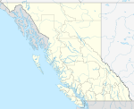 | |
|---|---|---|
| Communities | ||
| Metro areas and agglomerations |
| |
| Villages |
| |
| ||