Sixteen Mile Stand, Ohio
Sixteen Mile Stand is a census-designated place (CDP) in Symmes Township, Hamilton County, Ohio, United States, 19 miles (31 km) northeast of downtown Cincinnati. The population of Sixteen Mile Stand was 2,928 at the 2010 census.[3]
Sixteen Mile Stand, Ohio | |
|---|---|
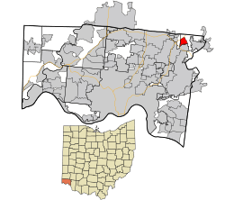 Location in Hamilton County and the state of Ohio | |
| Coordinates: 39°16′22″N 84°19′38″W | |
| Country | United States |
| State | Ohio |
| County | Hamilton |
| Area | |
| • Total | 1.1 sq mi (2.9 km2) |
| • Land | 1.1 sq mi (2.9 km2) |
| • Water | 0 sq mi (0 km2) |
| Elevation | 805 ft (245 m) |
| Population (2010) | |
| • Total | 2,928 |
| • Density | 2,600/sq mi (1,000/km2) |
| Time zone | UTC-5 (Eastern (EST)) |
| • Summer (DST) | UTC-4 (EDT) |
| FIPS code | 39-72620[2] |
| GNIS feature ID | 1065332[1] |
History
Sixteen Mile Stand takes its name from the distance to Cincinnati via the Montgomery Pike.[4]
Geography
Sixteen Mile Stand is located at 39°16′22″N 84°19′38″W,[5] along U.S. Route 22 (Montgomery Road). The city of Montgomery is directly to the south.
According to the United States Census Bureau, the CDP has a total area of 1.1 square miles (2.9 km2), all land.[3]
References
- "US Board on Geographic Names". United States Geological Survey. 2007-10-25. Retrieved 2008-01-31.
- "U.S. Census website". United States Census Bureau. Retrieved 2008-01-31.
- "Geographic Identifiers: 2010 Demographic Profile Data (G001): Sixteen Mile Stand CDP, Ohio". U.S. Census Bureau, American Factfinder. Archived from the original on February 12, 2020. Retrieved November 15, 2012.
- Nelson, S. B. (1894). History of Cincinnati and Hamilton County, Ohio: Their Past and Present, Including...biographies and Portraits of Pioneers and Representative Citizens, etc., Volume 1. p. 458. Retrieved 11 December 2013.
- "US Gazetteer files: 2010, 2000, and 1990". United States Census Bureau. 2011-02-12. Retrieved 2011-04-23.
Municipalities and communities of Hamilton County, Ohio, United States | ||
|---|---|---|
| Cities | 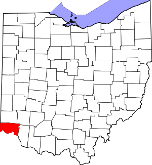 Map of Ohio highlighting Hamilton County | |
| Villages | ||
| Townships | ||
| CDPs |
| |
| Other unincorporated communities | ||
| Footnotes | ‡This populated place also has portions in an adjacent county or counties | |
This article is issued from Wikipedia. The text is licensed under Creative Commons - Attribution - Sharealike. Additional terms may apply for the media files.