Simeulue Regency
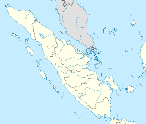
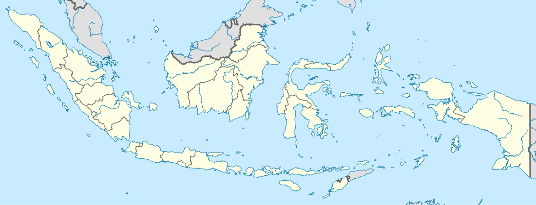
Simeulue Regency is a regency in the Aceh special region of Indonesia. It occupies the whole island of Simeulue (Pulau Simeulue), 150 km off the west coast of Sumatra, with an area of 1,838.09 square kilometres (709.69 square miles). It had a population of 80,674 at the 2010 Census;[1] the latest official estimate (for 2019) is 89,327.[2]
Simeulue Regency Kabupaten Simeulue | |
|---|---|
 Stranded boats and raised reefs at Busung, Gusong Bay, Simeulue, Indonesia, 8 April 2005 | |
Seal | |
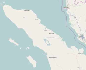
 Location within Aceh | |
| Coordinates: 2°35′N 96°5′E | |
| Country | Indonesia |
| Region | Sumatra |
| Province | Aceh |
| Established | 1999 |
| Regency seat | Sinabang |
| Government | |
| • Regent | Erly Hasyim |
| • Vice Regent | Afridawati |
| Area | |
| • Total | 1,838.09 km2 (709.69 sq mi) |
| Population (2019) | |
| • Total | 89,327 |
| • Density | 49/km2 (130/sq mi) |
| Time zone | UTC+7 (IWST) |
| Area code | (+62) 650 |
| Website | simeuluekab.go.id |
With its isolated geographic location, Simeulue has not been affected by the turmoil of conflicts in mainland Aceh between the Indonesian government and the Free Aceh Movement (GAM). There has been no major GAM activity on the island.
Administration

Simeulue was once a part of West Aceh Regency but was split off in 1999 with the hope that the region's development would improve. The seat of the regency is Sinabang.
The regency was divided at 2010 into eight districts (kecamatan), but two additional districts have since been added in 2012. All are listed below with their areas and their populations at the 2010 Census and according to the 2014 estimates.
| Name | Area in km2 | Population Census 2010[3] | Population Estiumate 2014[4] | Number of villages |
|---|---|---|---|---|
| Alafan | 191.87 | 4,479 | 4,945 | 8 |
| Salang | 198.96 | 7,625 | 8,835 | 16 |
| Simeulue Barat (West Simeulue) | 446.07 | 10,024 | 11,241 | 14 |
| Simeulue Tengah (Central Simeulue) | 112.48 | 9,010 | 7,101 | 16 |
| Simeulue Cut | 35.4 | (a) | 3,302 | 8 |
| Simeulue Timur (East Simeulue) | 175.97 | 28,931 | 28,429 | 17 |
| Teupah Tengah (Central Teupah) | 83.69 | (b) | 6,469 | 12 |
| Teluk Dalam | 224.68 | 4,914 | 5,524 | 10 |
| Teupah Barat (West Teupah) | 146.73 | 7,269 | 8,162 | 18 |
| Teupah Selatan (South Teupah) | 222.24 | 8,422 | 9,491 | 19 |
Notes:
(a) The 2010 population of the Simeulue Cut District is included in the 2010 figure for the Simeulue Tengah District, from which it was cut out in 2012.
(b) The 2010 population of the Teupah Tengah District is included in the 2010 figure for the Simeulue Timur District, from which it was cut out in 2012.
Villages
Administrative villages (desa) listed for each district:[5]
| District | Villages |
|---|---|
| Alapan (Alafan) | Lafakha, Lamerem, Langi, Lewak, Lhok Dalam, Lhok Pauh (Lhok Paoh), Lubuk Baik, Serafon |
| Salang | Along (Along Jaya), Bunga, Ganang Pusako, Jaya Baru, Karya Bakti, Kenangan Jaya, Lalla Bahagia, Meunafa (Meunafah), Mutiara, Nasreuhe, Padang Unoi, Panton Lawe, Suak Manang, Tameng, Tamon Jaya (Tamon), Ujung Salang |
| Simeulue Barat (Simeuleu Barat) | Amabaan, Babul Makmur, Batu Ragi, Lamamek, Layabaung, Lhok Bikhau (Lhok Bikhao), Lhok Makmur, Malasin, Miteum, Sanggiran, Sembilan, Sigulai, Sinar Bahagia, Ujung Harapan |
| Simeulue Cut | Amarabu, Borengan, Bubuhan, Kuta Inang, Kuta Padang, Latak Ayah, Sibuluh, Ujung Pandang / Padang |
| Simeulue Tengah (Simeuleu Tengah) | Dihit, Kampung Aie, Kuta Baru (Kuta Batu), Lakubang, Lamayang, Lambaya, Latitik, Lauree (Laure-E), Leuke (Lauke), Luan Sorip, Putra Jaya, Sebbe, Situfa Jaya, Suak Baru, Wel Wel, Wellang Kum (Wel Langkom) |
| Simeulue Timur (Simeuleu Timur) | Air Dingin, Air Pinang, Amaiteng Mulia, Ameria Bahagia, Ganting, Kota Batu, Kuala Makmur, Linggi, Lugu, Pulau Siumat, Sefoyan, Sinabang, Suak Buluh, Suka Jaya, Suka Karya, Suka Maju, Ujung Tinggi |
| Teluk Dalam | Babussalam, Bulu Hadik, Gunung Putih, Kuala Bakti, Kuala Baru, Luan Balu, Lugu Sek Bahak (Sebahak), Muara Aman, Sambai (Sambay), Tanjung Raya |
| Teupah Barat | Angkeo, Awe Kecil, Awe Seubal, Bunon, Inor, Laayon, Lantik, Laubang (Leubang), Leubang Hulu, Maudil, Naibos, Nancala, Pulau Teupah, Salur, Salur Lasengalu, Salur Latun, Silengas, Sital |
| Teupah Selatan | Alus Alus, Ana Ao, Badegong, Batu Ralang, Blang Sebel, Kebun Baru, Labuhan Bajau, Labuhan Bakti, Labuhan Jaya, Lataling, Latiung, Pasir Tinggi, Pulau Bangkalak (Pulau Bengkalak), Seuneubok, Suak Lamatan, Trans Baru, Trans Jernge, Trans Meranti (Trans Maranti), Ulul Mayang (Manyang) |
| Teupah Tengah | Abail, Batu-Batu, Busung Indah, Kahad (Kahat), Labuah, Lanting, Lasikin, Matanurung (Matan Urung), Nancawa, Simpang Abail, Situbuk, Sua-Sua |
Demographics
The people of Simeulue are similar to the people in the neighboring Nias Island, speaking 3 languages (Devayan, Sigulai and Leukon) which are distinctly different from the languages spoken in mainland Aceh.[6] The majority of the people of Simeulue are Muslim.
Earthquakes
Simeulue was close to the epicenter of the 9.3 magnitude 26 December 2004 earthquake, but loss of life was surprisingly low, mainly because the people are familiar with earthquakes and tsunamis in this seismically active region and so knew to leave the coast after the earthquake. A major earthquake and tsunami hit Simeulue in 1907, killing many of its inhabitants. Many died when they rushed to the beach after seeing the water recede, exposing the coral and fish. They went to collect the fish, not realizing that the water would come back. Those who survived told the story of the 1907 semong, the local word for tsunami, to their children. It is largely because of this oral history that many in Simeulue say that they knew what to do when the 26 December 2004 earthquake and tsunami struck.[7][8] In the fishing village of Kariya Vhapi on the NW shore of Simuelue, the 26 December 2004 tsunami was approximately 2 m high when it went through the village completely destroying all buildings.[9]
On 28 March 2005 an 8.7 magnitude stuck with its epicenter just off the south end of Simeulue Island.[10] During the earthquake, Simeulue rose at least six feet on the western coast; this left the flat top of its coral reefs above high tide level leaving it dry and dead. On the east coast, the land was submerged, seawater flooding fields and settlements.[11] At the village of Kariya Vhapi the 28 March 2005 tsunami was smaller than the one the previous December and did not damage the village; however it did overtop a 3.2 m high beach berm.[9] In Sinabang the 28 March 2005 earthquake and subsequent fire destroyed 50 to 60 percent of the downtown area and significantly damaged the port facility. At Sinabang the uplift was less than further north being only 40 cm.[9]
On 20 February 2008 at 03:08 PM local time, Simeulue suffered a 7.4 magnitude earthquake.[12]
On 11 April 2012 at 04:38 PM local time, Simeulue suffered an 8.6 magnitude earthquake.[13]
References
- Biro Pusat Statistik, Jakarta, 2011.
- DKCS (Dinas Kependudukan dan Catatan Sipil), Jakarta, 2019.
- Biro Pusat Statistik, Jakarta, 2011.
- Badan Pusat Statistik, Jakarta, 2018.
- "Daftar Desa & Kelurahan di Kabupaten Simeulue". www.nomor.net. Kode Pos Indonesia. 2020. Retrieved 2020-02-25.
- BPS Kabupaten Simeulue (2003). Simeulue Dalam Angka 2012. BadanPusatStatistik.Com. ISBN 0-0100-0021-6.
- Syafwina Syafwina (2014). (The 4th International Conference on Sustainable Future for Human Security, SustaiN 2013). "Recognizing Indigenous Knowledge for Disaster Management: Smong, Early Warning System from Simeulue Island, Aceh". Procedia Environmental Sciences. 20: 573–582. doi:10.1016/j.proenv.2014.03.070. Online reference in ScienceDirect.
- Brian G. McAdoo; Lori Dengler; Gegar Prasetya; Vasily Titov (2006). "Smong: How an Oral History Saved Thousands on Indonesia's Simeulue Island during the December 2004 and March 2005 Tsunamis". Earthquake Spectra. 22 (S3 – June 2006): 661–669. doi:10.1193/1.2204966.
- "USGS Scientists in Sumatra Studying Recent Tsunamis". United States Geological Survey (USGS) – Western Coastal and Marine Geology (WCMG) report. 12 April 2005.
- Gibbons, Helen (April 2005) "Second Tsunami Causes Damage in Indonesia—USGS Scientists Post Observations on the World Wide Web" United States Geological Survey
- Saved by tsunami folklore, BBC News From Our Correspondent, 10 March 2007
- "Poster of the Simeulue, Indonesia Earthquake of 20 February 2008 – Magnitude 7.4". USGS – Earthquake Hazards Program. USGS Shakemap.
- "M 8.6 – off the west coast of northern Sumatra". USGS – Earthquake Hazards Program. 11 April 2012.
Regencies and cities of Aceh | ||
|---|---|---|
Capital: Banda Aceh | ||
| Regencies |  | |
| Cities | ||