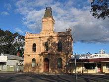
Shire of Yea
The Shire of Yea was a local government area about 110 kilometres (68 mi) northeast of Melbourne, the state capital of Victoria, Australia. The shire covered an area of 1,392.32 square kilometres (537.6 sq mi), and existed from 1869 until 1994. The shire's population was dominated by the town of Yea.
| Shire of Yea Victoria | |||||||||||||||
|---|---|---|---|---|---|---|---|---|---|---|---|---|---|---|---|
 Location in Victoria | |||||||||||||||
| Population | 5,030 (1992)[1] | ||||||||||||||
| • Density | 3.613/km2 (9.357/sq mi) | ||||||||||||||
| Established | 1869 | ||||||||||||||
| Area | 1,392.32 km2 (537.6 sq mi) | ||||||||||||||
| Council seat | Yea | ||||||||||||||
| County | Anglesey | ||||||||||||||
| |||||||||||||||
History
Yea was first incorporated as a road district on 1 February 1869, and became a shire on 28 November 1873.
Its boundaries changed a number of times throughout its existence:[2]
- 15 May 1907 - Annexed part of Shire of Seymour.
- 20 May 1914 - Lost part of North Riding to Shire of Alexandra.
- 21 April 1925 - Lost part to Shire of Healesville.
- 19 April 1961 - Lost part to Shire of Seymour.
- 1 October 1972 - Annexed part of Shire of Eltham near Kinglake.
- 1 October 1980 - Annexed part of Shire of Healesville.
The Shire was described in the 1949 Australian Blue Book as an elevated area given to pastoral and dairying pursuits, along with sheep and cattle grazing. By 1994, 51% of Yea's land was under cultivation as farmland, with the Kinglake National Park and Yea River Regional Park as well as the Murrindindi Forest, the latter being important to Yea's economy for timber production, accounting for much of the rest.[3]
On 18 November 1994, the Shire was abolished and merged into the Shire of Murrindindi with Alexandra and parts of Eltham, Broadford, Euroa, Healesville and Whittlesea.[4]
Wards
Yea's ridings were abolished on 27 May 1930 and all councillors represented the entire shire.
Towns and localities
- Yea
- Break O'Day
- Caveat
- Cheviot
- Devlins Bridge
- Dropmore
- Flowerdale
- Ghin Ghin
- Glenburn
- Hazeldene
- Highlands
- Homewood
- Kerrisdale
- Kinglake (split with Shire of Eltham)
- Limestone
- Molesworth
- Murrindindi
- Woodbourne
Population
| Year | Population |
|---|---|
| 1911 | 2,603 |
| 1954 | 2,866 |
| 1958 | 2,920* |
| 1961 | 2,697 |
| 1966 | 2,620 |
| 1971 | 2,970 |
| 1976 | 3,071 |
| 1981 | 4,437 |
| 1986 | 4,200 |
| 1991 | 4,744 |
* Estimate in the 1958 Victorian Year Book.
References
- Australian Bureau of Statistics, Victoria Office (1994). Victorian Year Book. p. 49. ISSN 0067-1223.
- Victorian Municipal Directory. Brunswick: Arnall & Jackson. 1992. pp. 908–909. Accessed at State Library of Victoria, La Trobe Reading Room.
- Monash University (1999). "Australian Places - Yea". Archived from the original on 18 March 2003. Retrieved 5 January 2008.
- Australian Bureau of Statistics (1 August 1995). Victorian local government amalgamations 1994-1995: Changes to the Australian Standard Geographical Classification (PDF). Commonwealth of Australia. p. 10. ISBN 0-642-23117-6. Retrieved 16 December 2007.