Shelter Island (Hong Kong)
Shelter Island, known in Cantonese as Ngau Mei Chau (Chinese: 牛尾洲) is an island located in the water body Port Shelter (Ngau Mei Hoi; literally Cow Tail Sea), in the Sai Kung District, the New Territories, Hong Kong S.A.R., China.
| Native name: 牛尾洲 (Ngau Mei Chau) | |||||||||||||
|---|---|---|---|---|---|---|---|---|---|---|---|---|---|
 Viewing Shelter Island from the sea | |||||||||||||
 Shelter Island | |||||||||||||
| Geography | |||||||||||||
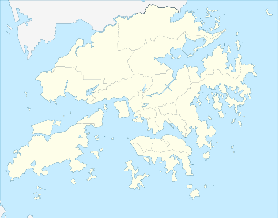
| Location | Port Shelter, Eastern Waters of Hong Kong | ||||||||||||
| Coordinates | 22.326978°N 114.296214°E | ||||||||||||
| Area | 0.55 km2 (0.21 sq mi)[1] | ||||||||||||
| Highest elevation | 117 m (384 ft)[1] | ||||||||||||
| Administration | |||||||||||||
China | |||||||||||||
| SAR | Hong Kong | ||||||||||||
| Region | the New Territories | ||||||||||||
| District | Sai Kung District | ||||||||||||
| Additional information | |||||||||||||
| Chinese name | |||||||||||||
| Chinese | 牛尾洲 | ||||||||||||
| Literal meaning | Cow Tail Island | ||||||||||||
| |||||||||||||
History
.png)
The island appeared in a map drawn by Father Simeone Volonteri in 1866, at that time it was marked as Ngau T'au Chü (Chinese: 牛頭洲; Jyutping: ngau4 tau4 zau1; Cantonese Yale: ngàuh tàuh jāu; lit.: 'Cow Head Island'). However, there are criticisms on the accuracy of Volonteri's map in general,[2] or for specific place name such as Green Hill, which historically known as Tuen Mun Hill.[3] There is a rock formation currently called Ngau Tau Pai (Chinese: 牛頭排), which connects to the island by intertidal zone.[4] According to a book, Pai means rock, hill or mountain that locates in water body in general in the language of the Tanka people.[5] It is not certain Volonteri's record is correct or not for the name of the island at that time.
The name Shelter island [sic] also appeared in a book for sailing directions that published in 1863.[6] In Asiatic Pilot by the U.S. Hydrographic Office in 1910, the island was described as 416 feet (127 m) high at that time. Shoal water extended northwards for 400 yards (370 m), and 300 yards (270 m) westwards from the island at that time.[7]
The island was part of a larger region that ceded to the Colony of Hong Kong in 1898.
According to the historical document of the District Office South,[lower-alpha 1] the island was uninhabited when it was part of the Port Shelter Firing Range.[8] The firing range was closed in the 1970s. In 2011, a mortar shell was discovered on a beach of the island.[9] Administratively, the District Office South was replaced by the Sai Kung District Office as well as other District Offices after the World War II.[10] At present, Shelter Island still administratively part of the Sai Kung District. It is part of Hang Hau East constituency of the Sai Kung District Council as of 2019 election,[11] despite the island is uninhabited. But in term of environmental protection, the island is surrounded by the Port Shelter Water Control Zone.
In the 1970s, the island was used by Ng Shek-ho, a drug lord, and his associates as a place to hide their goods.[12]
Nowadays, it was one of the tourist attraction of the Sai Kung District. In specific, the island was known for its sea cave, known in Chinese as 幽廊祕洞.[13] The surrounding water of the island is a popular diving site.[14] Such as the shallow waters in the bay Tai Wong Wan (大王灣), as well as west of Ngau Tau Pai, etc.[15][16] Commercial divers also catch sea urchin near the island for their own restaurant.[17]
In 2019, human bones were discovered in Tai Wong Wan.[15]
Biodiversity
24 species of vascular plant were discovered on the island.[1]
Corals also appears in the water surrounding the island. However, survey discovered that the coverage rate is decreasing, from 50.6% to 31.2%, according to the interpretation of Ming Pao on the survey summary.[14][18]
According to another research, Shelter Island has a high number of Drupella rugosa and Cronia margariticola, which preying coral species Pavona decussata and Platygyra sinensis in the location. That research reported that the coverage of hard coral at Shelter Island, was 50.2% at that time.[19]
A marine park that covers Sharp Island, Tai Chau, Shelter Island and surrounding water was proposed by the Country and Marine Parks Board, a consultative body for the government in 2014.[20] However, it was not materialized. In 2018, World Wide Fund for Nature also proposed to establish the Port Shelter Marine Protected Area, which also includes the Shelter Island.[21][22]
See also
- Ngau Tau Kok, a place in Kowloon, Hong Kong. It also named after "Cow Head" (Chinese: 牛頭).
Footnotes
- Not to be confused with the current Southern District, which geographically covers the southern Hong Kong Island. The historical District Office South administrated the southern New Territories and New Kowloon as well as islands that belongs to the modern day Islands District.
References
- 胡普炜 [Hu Puwei]; 邢福武 [Xing Fuwu]; 陈林 [Chen Lin]; 王美娜 [Wang Meina]; 王发国 [Wang Faguo]; 陈红锋 [Chen Hongfeng] (2011). 香港西贡牛尾海邻近岛屿植被与 植物物种多样性 [Vegetation and vascular plant diversity of islands surrounding Port Shelter, Hong Kong, China]. 生物多样性 [Biodiversity Science] (in Chinese). 19 (5): 607. doi:10.3724/SP.J.1003.2011.05049. ISSN 1005-0094.
- Ng, Ronald C. Y. (June 1969). "The San On Map of MGR. Volonteri". The Geographical Journal. 135 (2): 231–235. doi:10.2307/1796827.
- 劉智鵬 [Lau Chi-pang] (July 2012). 屯門與青山. In Lau Chi-pang; 劉蜀永 [Liu Shuyong] (eds.). 屯門. 香港地區史研究 (in Chinese). Hong Kong: Joint Publishing (Sino United Publishing). ISBN 978-962-04-3147-0.
- 萬里地圖製作中心 (ed.). 2018香港街道圖 (in Chinese).
- 珠三角水上人族屬概況. 珠三角水上族群的語言承傳和文化變遷. p. 23.
- Williams, Samuel Wells (1863). "Islands lying East of Hong Kong". The Chinese Commercial Guide (5th ed.). A. Shortrede & Co. p. 41 of appendix.
- Asiatic Pilot Vol.3: Coast of China, Yalu River to Hongkong with Formosa 1909. U.S. Hydrographic Office. 1910. p. 549.
- Coates, Austin (June 2010). "Shelter Island (Ngau Mei Chau)". In Strickland, John (ed.). Southern District Officer Reports: Islands and Villages in Rural Hong Kong. Royal Asiatic Society Hong Kong Studies Series. Hong Kong University Press. p. 293. ISBN 978-988-8028-38-2.
- 西貢石灘尋獲迫擊炮. Apple Daily (in Chinese). Hong Kong. 25 November 2011. Retrieved 5 November 2019.
- 施志明 (November 2016). 緒論. 本土論俗──新界華人傳統風俗. 香港史學會叢書 (in Chinese). Hong Kong: Chung Hwa Book Company (Sino United Publishing). pp. 3–4. ISBN 9789888420186.
- https://www.eac.hk/pdf/distco/2019dc/final/dc2019q2.pdf
- 跛豪案第六證人梁滔供 六九年郭昌來招彼入夥 公海接得貨運牛尾洲藏. Wah Kiu Yat Po (in Chinese). Hong Kong. 1 May 1975. p. 6.
- 薛永興 (2017). 行山攝水──香港的另一面 (in Chinese). Hong Kong: Chung Hwa Book Company (Sino United Publishing).
- 珊瑚覆蓋率普查 近六成檢查點下跌. Ming Pao (in Chinese). Hong Kong: Media Chinese International. 8 December 2019. Retrieved 15 December 2019.
- 泳客牛尾洲發現懷疑人骨. Headline Daily (in Chinese). Hong Kong: Sing Tao News Corporation. 15 April 2019. Retrieved 15 December 2019.
- 香港域內潛點簡介 (PDF) (Report) (in Chinese). Hong Kong Underwater Association. 8 June 2009. Retrieved 15 December 2019.
- 西貢‧香港後花園 – 漁家的自然之道. 野Guide (in Chinese). HK Discovery Limited. 16 May 2018. Retrieved 16 December 2019.
- Hong Kong Reef Check 2019 Results Summary (PDF) (Report). Hong Kong: Agriculture, Fisheries and Conservation Department. December 2019. p. 8. Retrieved 15 December 2019.
- Morton, Brian; Blackmore, Graham (2009). "Seasonal variations in the density of and corallivory by Drupella rugosa and Cronia margariticola (Caenogastropoda: Muricidae) from the coastal waters of Hong Kong: 'plagues' or 'aggregations'?". Journal of the Marine Biological Association of the United Kingdom. 89 (1): 147–159. doi:10.1017/S002531540800218X.
The numbers of feeding Drupella rugosa and Cronia margariticola varied from site to site but were, in particular, high at Coral Beach (Hoi Ha Wan), Sharp Island and Shelter Island
- Cheung Chi-fai (8 December 2014). "Extensive damage has been caused to Hong Kong's coral: green groups". South China Morning Post. Hong Kong. Retrieved 15 December 2019.
- Nip, Amy (31 May 2018). "Parks push to save turtles and dolphins". The Standard. Hong Kong: Sing Tao News Corporation. Retrieved 5 November 2019.
- "Advocating for more marine protected areas". Hong Kong: World Wide Fund for Nature. Retrieved 6 November 2019.
| Wikimedia Commons has media related to Shelter Island, Hong Kong. |