Shahkot, India
Shahkot is a city and a tehsil among 5 tehsils of Jalandhar district, Punjab, India. Shahkot is situated on Jalandhar-Moga-Barnala-Sirsa National Highway 703 (Old NH 71). Shahkot is administered by the Municipal Committee. About 250 villages belong to Shahkot tehsil. Shahkot was famous for its red chili peppers; but now, its main crops are Wheat, Paddy, Maize, potato, etc Agriculture Land is not suitable for Paddy. But with the use of pesticides and tubewell water; paddy is grown.[1]
Shahkot | |
|---|---|
City | |
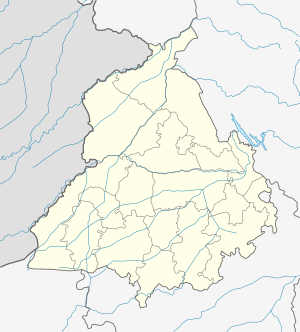 Shahkot Location in Punjab, India  Shahkot Shahkot (India) | |
| Coordinates: 31.08°N 75.34°E | |
| Country | |
| State | Punjab |
| District | Jalandhar |
| Government | |
| • Type | Municipal Council |
| Area | |
| • Total | 16.27 km2 (6.28 sq mi) |
| Elevation | 209 m (686 ft) |
| Population (2013) | |
| • Total | 25,449 |
| • Density | 1,600/km2 (4,100/sq mi) |
| Languages | |
| • Official | Punjabi |
| Time zone | UTC+5:30 (IST) |
| PIN | 144702 |
| Telephone code | 01821 |
| Vehicle registration | PB67 |
| Website | www |
Geography
Shahkot is located at 31.08°N 75.34°E.[2] The region has an average elevation of 209 metres (688 feet). The Pin Code of Shahkot is 144702. Shahkot is a subdivision and tehsil of Jalandhar Distt.
Demographics
As of the 2011 Indian census,[3] Shahkot has population of 25,449. The population is 53% male and 47% female. Shahkot has an average literacy rate of 83%, which is higher than the Indian national average of 59.5%. Literacy among men is 85.50% and female literacy is 80.50%. In Shahkot, 12% of the population is under 6 years of age. Hinduism and Sikhism are the predominant religions with 60% of the population registering as Hindus, 39% registering as Sikhs and 1% of other religions. Shahkot is near the Sutlej river which divides Doaba and Malwa.
See also
References
- Shahkot.: Shahkotcity.com
- Falling Rain Genomics, Inc - Shahkot
- "Census of India 2001: Data from the 2001 Census, including cities, villages and towns (Provisional)". Census Commission of India. Archived from the original on 16 June 2004. Retrieved 1 November 2008.