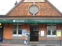
Selhurst railway station
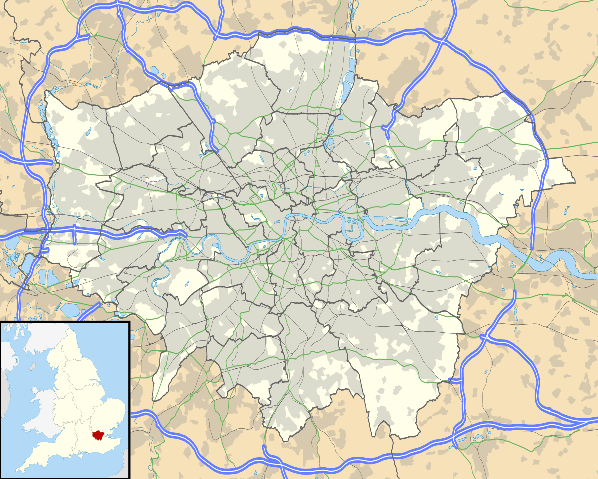
Selhurst railway station is in the London Borough of Croydon in south London, 9 miles 31 chains (15.1 km) along the line from London Victoria.[3][4] It is operated by Southern, who also provide almost all the train services. The station is in Travelcard Zone 4.
| Selhurst | |
|---|---|
 | |
 Selhurst Location of Selhurst in Greater London | |
| Location | Selhurst |
| Local authority | London Borough of Croydon |
| Managed by | GTR Southern |
| Station code | SRS |
| DfT category | D |
| Number of platforms | 4 |
| Fare zone | 4 |
| National Rail annual entry and exit | |
| 2014–15 | |
| 2015–16 | |
| 2016–17 | |
| 2017–18 | |
| – interchange | |
| 2018–19 | |
| – interchange | |
| Key dates | |
| 1 May 1865 | Opened[2] |
| Other information | |
| External links | |
| WGS84 | 51.3921°N 0.0883°W |
History

The Balham Hill and East Croydon line was constructed by the London, Brighton and South Coast Railway (LB&SCR) as a short-cut on the Brighton main line to London Victoria, avoiding Crystal Palace and Norwood Junction. It was opened on 1 December 1862.[5] Selhurst station was not however opened until 1 May 1865.[6]
The lines were quadrupled in 1903.[7] In 1912, the lines were electrified via Norwood Junction to provide access for the carriage sheds and repair depot for the LB&SCR railway electrification scheme.[8] In 1925, the lines from Victoria via Norbury were electrified.
Services
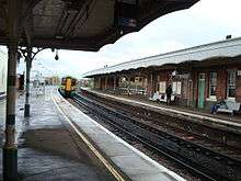
All services are operated by Southern. Most trains go to/from Victoria, with some going to/from London Bridge and Kensington Olympia.
The typical off-peak train service per hour is:[9]
- 5tph (train per hour) to Balham and Clapham Junction
- 4tph to London Victoria via Balham
- 2tph to London Bridge via Tulse Hill and Peckham Rye
- 4tph to West Croydon
- 2tph to Sutton
- 3tph to East Croydon
- 2tph to Caterham via East Croydon
- 2tph to Epsom Downs via Sutton
- 1tph to Milton Keynes Central via Kensington Olympia and Shepherd's Bush
Additional services to/from Milton Keynes Central also start/terminate here.
Extra trains stop here when a large football event occurs at Selhurst Park. Additionally a few otherwise 'fast' trains to and from East Croydon, which usually only stop at Clapham Junction and Victoria, stop here to serve staff working at Selhurst Railway Depot.
Electronic ticket barriers were installed at the station in Spring 2010.
| Preceding station | Following station | |||
|---|---|---|---|---|
| Thornton Heath | Southern Brighton main line and West London Route |
East Croydon | ||
| Thornton Heath | Southern Sutton and Mole Valley lines |
West Croydon | ||
| Thornton Heath | Southern London Bridge to Caterham |
East Croydon | ||
Connections
London Buses routes 75 and 157 serve the station.
Selhurst Railway Depot
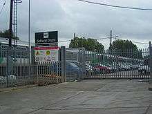
Selhurst Depot[10][11] is located to the east of the Selhurst station and occupies a triangle of land which is bordered on one side by the Victoria Lines and on the other by the London Bridge Lines. It was built on the site of the former Croydon Common Athletic Ground, where Crystal Palace F.C. played Football League match between 1920 and 1924.
The depot is operated by the Southern train operating company, and units serviced there include classes 171, 377, 455 plus numerous departmental units and a Class 09 shunter.
Within the main office building is located Selhurst traincrew depot, where many drivers and conductors are based. The depot has extensive stabling sidings, the three main groups of which are known as: Chalk, AC (which were so named because that was where the trains of the former AC system were stabled) and North. There is a large maintenance shed, an AC test rig (for dual voltage units equipped with pantographs), a train wash plant, and a cleaning shed. At the north east corner of the site near to Norwood Junction station is the smaller Norwood drivers' depot, and beside it the diesel fuelling point. Selhurst is unusual in that the maximum speed within the depot is 15 mph rather than the usual 5 mph, and signalled train movements are permissive.
References
- "Station usage estimates". Rail statistics. Office of Rail Regulation. Please note: Some methodology may vary year on year.
- Croydon's Transport ISBN 0-906047-17-X
- Body, Geoffrey (1989). PSL field guide to the railways of Southern Region. Wellingborough: Patrick stephens Ltd. p. 171. ISBN 1-85260-297-X.
- Yonge, John (November 2008) [1994]. Jacobs, Gerald (ed.). Railway Track Diagrams 5: Southern & TfL (3rd ed.). Bradford on Avon: Trackmaps. map 14C. ISBN 978-0-9549866-4-3.CS1 maint: ref=harv (link)
- Turner, John Howard (1978). The London Brighton and South Coast Railway 2 Establishment and Growth. Batsford. ISBN 0-7134-1198-8. p. 126-8.
- Turner, J.T. Howard (1978) p.250.
- Turner, John Howard (1979). The London Brighton and South Coast Railway 3 Completion and Maturity. Batsford. ISBN 0-7134-1389-1. p. 144-8.
- Turner, J.T. Howard (1979) p.177-8.
- https://www.networkrail.co.uk/running-the-railway/timetabling/electronic-national-rail-timetable/ (Timetable Nos. 170, 173 and 176, May 2018)
- Network Rail (3 September 2016). Kent Sussex Wessex Sectional Appendix LOR SO510 Seq 007. Module KSW1. p. 206.
- Quail Maps. Map#5 - Southern & TFL. [page 14c] Feb 1998 (Retrieved 2017-09-23).
External links
| Wikimedia Commons has media related to Selhurst railway station. |
- Train times and station information for Selhurst railway station from National Rail