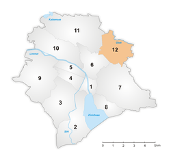
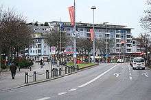
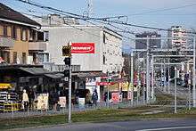
Schwamendingen
Schwamendingen is a district in the Swiss city of Zürich. It is district number 12.
Schwamendingen District of the city of Zürich | |
|---|---|
District | |
 Coat of arms | |
 | |
| Coordinates: 47.406°N 8.572°E | |
| Country | Switzerland |
| Canton | Zürich |
| City | Zürich |
| Area | |
| • Total | 5.97 km2 (2.31 sq mi) |
| Population (31. Dec. 2005) | |
| • Total | 28,314 |
| • Density | 4,743/km2 (12,280/sq mi) |
| District Number | 12 |
| Quarters | Schwamendingen Mitte Saatlen Hirzenbach |
The district comprises the quarters Schwamendingen Mitte, Saatlen and Hirzenbach.
Schwamendingen was an Alemannic settlement, named after one Swuamund, archaeologically attested from the 5th century. The settlement was given to the Grossmünster in the 9th century after the death of its last Alemannic owner, Picho son of Ertilo. The settlement is recorded as consisting of ten houses in 915. The Grossmünster presented the village with a church bell in 1461. During the Swiss Reformation, the first Protestant pastor in Schwammendingen, Hans Schmid, took office in 1526. Schwamendingen and Oerlikon became independent municipalities in 1872. These were incorporated into the city of Zürich in 1934, together with Seebach, Affoltern, Witikon, Höngg, Altstetten and Albisrieden.