Schlater, Mississippi
Schlater is a town in Leflore County, Mississippi, United States. The population was 310 at the 2010 census,[3] down from 388 at the 2000 census. It is part of the Greenwood, Mississippi micropolitan area.
Schlater, Mississippi | |
|---|---|
 Location of Schlater, Mississippi | |
 Schlater, Mississippi Location in the United States | |
| Coordinates: 33°38′25″N 90°20′50″W | |
| Country | United States |
| State | Mississippi |
| County | Leflore |
| Government | |
| • Type | Mayor and board of aldermen |
| Area | |
| • Total | 1.15 sq mi (2.99 km2) |
| • Land | 1.15 sq mi (2.99 km2) |
| • Water | 0.00 sq mi (0.00 km2) |
| Elevation | 1,128 ft (139 m) |
| Population (2010) | |
| • Total | 310 |
| • Estimate (2019)[2] | 287 |
| • Density | 248.70/sq mi (96.01/km2) |
| Time zone | UTC-6 (Central (CST)) |
| • Summer (DST) | UTC-5 (CDT) |
| ZIP code | 38952 |
| Area code(s) | 662 |
| FIPS code | 28-66080 |
| GNIS feature ID | 0677454 |
Geography
Schlater is located in northwestern Leflore County at 33°38′25″N 90°20′50″W (33.640156, -90.347246).[4] Mississippi Highway 442 passes through the town, leading east 3 miles (5 km) to U.S. Route 49E and west 10 miles (16 km) to Doddsville and U.S. Route 49W. Via US-49E Schlater is 17 miles (27 km) northwest of Greenwood, the Leflore county seat.
According to the United States Census Bureau, the town has a total area of 1.2 square miles (3.0 km2), all of it recorded as land.[5] McNutt Lake is a narrow waterway that passes through the town, connecting Ashland Brake to the east with the Quiver River to the west, part of the Yazoo River watershed.
Demographics
| Historical population | |||
|---|---|---|---|
| Census | Pop. | %± | |
| 1970 | 398 | — | |
| 1980 | 429 | 7.8% | |
| 1990 | 404 | −5.8% | |
| 2000 | 388 | −4.0% | |
| 2010 | 310 | −20.1% | |
| Est. 2019 | 287 | [2] | −7.4% |
| U.S. Decennial Census[6] | |||
As of the 2010 United States Census, there were 310 people living in the town. The racial makeup of the town was 68.7% Black, 29.0% White and 1.0% from two or more races. 1.3% were Hispanic or Latino of any race.
As of the census[7] of 2000, there were 388 people, 141 households, and 105 families living in the town. The population density was 332.8 people per square mile (128.0/km2). There were 150 housing units at an average density of 128.7 per square mile (49.5/km2). The racial makeup of the town was 38.92% White, 60.57% African American and 0.52% Asian.
There were 141 households, out of which 29.8% had children under the age of 18 living with them, 44.7% were married couples living together, 22.7% had a female householder with no husband present, and 25.5% were non-families. 24.8% of all households were made up of individuals, and 11.3% had someone living alone who was 65 years of age or older. The average household size was 2.75 and the average family size was 3.29.
In the town, the population was spread out, with 32.2% under the age of 18, 9.3% from 18 to 24, 25.5% from 25 to 44, 20.1% from 45 to 64, and 12.9% who were 65 years of age or older. The median age was 34 years. For every 100 females, there were 86.5 males. For every 100 females age 18 and over, there were 81.4 males.
The median income for a household in the town was $23,816, and the median income for a family was $25,000. Males had a median income of $21,667 versus $13,571 for females. The per capita income for the town was $10,022. About 34.9% of families and 44.3% of the population were below the poverty line, including 65.0% of those under age 18 and 14.3% of those age 65 or over.
Education
The town is served by the Leflore County School District.
Notable people
- Means Johnston, Jr., admiral in the United States Navy
- Ben Jones, race car driver
References
- "2019 U.S. Gazetteer Files". United States Census Bureau. Retrieved July 26, 2020.
- "Population and Housing Unit Estimates". United States Census Bureau. May 24, 2020. Retrieved May 27, 2020.
- "Total Population: 2010 Census DEC Summary File 1 (P1), Schlater town, Mississippi". data.census.gov. U.S. Census Bureau. Retrieved April 7, 2020.
- "US Gazetteer files: 2010, 2000, and 1990". United States Census Bureau. 2011-02-12. Retrieved 2011-04-23.
- "U.S. Gazetteer Files: 2019: Places: Mississippi". U.S. Census Bureau Geography Division. Retrieved April 7, 2020.
- "Census of Population and Housing". Census.gov. Retrieved June 4, 2015.
- "U.S. Census website". United States Census Bureau. Retrieved 2008-01-31.
Municipalities and communities of Leflore County, Mississippi, United States | ||
|---|---|---|
| Cities | 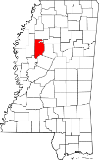 Map of Mississippi highlighting Leflore County | |
| Towns | ||
| CDP | ||
| Unincorporated communities | ||
| Ghost town | ||
| Footnotes | ‡This populated place also has portions in an adjacent county or counties | |