Santa Josefa
Santa Josefa, officially the Municipality of Santa Josefa (Cebuano: Lungsod sa Santa Josefa; Tagalog: Bayan ng Santa Josefa), is a 3rd class municipality in the province of Agusan del Sur, Philippines. According to the 2015 census, it has a population of 26,729 people.[3]
Santa Josefa | |
|---|---|
| Municipality of Santa Josefa | |
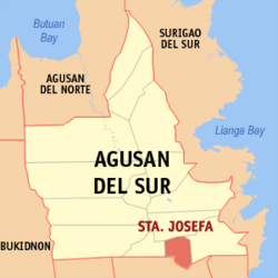 Map of Agusan del Sur with Santa Josefa highlighted | |
OpenStreetMap 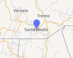
| |
.svg.png) Santa Josefa Location within the Philippines | |
| Coordinates: 7°59′N 126°02′E | |
| Country | |
| Region | Caraga (Region XIII) |
| Province | Agusan del Sur |
| District | 2nd District |
| Barangays | 11 (see Barangays) |
| Government | |
| • Type | Sangguniang Bayan |
| • Mayor | Symond O. Caguiat |
| • Vice Mayor | Richard M. Plaza |
| • Congressman | Adolph Edward G. Plaza |
| • Electorate | 18,596 voters (2019) |
| Area | |
| • Total | 341.8 km2 (132.0 sq mi) |
| Population (2015 census)[3] | |
| • Total | 26,729 |
| • Density | 78/km2 (200/sq mi) |
| • Households | 5,853 |
| Economy | |
| • Income class | 3rd municipal income class |
| • Poverty incidence | 40.47% (2015)[4] |
| • Revenue (₱) | 110,540,919.32 (2016) |
| Time zone | UTC+8 (PST) |
| ZIP code | 8512 |
| PSGC | |
| IDD : area code | +63 (0)85 |
| Climate type | tropical rainforest climate |
| Native languages | Agusan language Butuanon Cebuano Higaonon Tagalog |
Geography
Santa Josefa is located at 7°59′N 126°02′E, making it the province's most southerly settlement.
According to the Philippine Statistics Authority, the municipality has a land area of 341.8 square kilometres (132.0 sq mi) [2] constituting 3.42% of the 9,989.52-square-kilometre- (3,856.98 sq mi) total area of Agusan del Sur.
Climate
Santa Josefa is classified as Type II climate which has no dry season but with pronounced maximum rain period occurring from December to January.[5]
| Climate data for Santa Josefa, Agusan del Sur | |||||||||||||
|---|---|---|---|---|---|---|---|---|---|---|---|---|---|
| Month | Jan | Feb | Mar | Apr | May | Jun | Jul | Aug | Sep | Oct | Nov | Dec | Year |
| Average high °C (°F) | 27 (81) |
27 (81) |
27 (81) |
29 (84) |
29 (84) |
29 (84) |
30 (86) |
30 (86) |
30 (86) |
30 (86) |
29 (84) |
28 (82) |
29 (84) |
| Average low °C (°F) | 22 (72) |
22 (72) |
22 (72) |
23 (73) |
23 (73) |
23 (73) |
23 (73) |
23 (73) |
23 (73) |
23 (73) |
23 (73) |
22 (72) |
23 (73) |
| Average precipitation mm (inches) | 105 (4.1) |
80 (3.1) |
58 (2.3) |
39 (1.5) |
62 (2.4) |
75 (3.0) |
69 (2.7) |
62 (2.4) |
59 (2.3) |
71 (2.8) |
69 (2.7) |
69 (2.7) |
818 (32) |
| Average rainy days | 15.8 | 15.4 | 14.8 | 13.8 | 19.7 | 22.5 | 22.9 | 22.7 | 22.0 | 23.0 | 18.1 | 15.0 | 225.7 |
| Source: Meteoblue [6] | |||||||||||||
Barangays
Santa Josefa is politically subdivided into 11 barangays.[7]
| PSGC | Barangay | Population | ±% p.a. | |||
|---|---|---|---|---|---|---|
| 2015[3] | 2010[8] | |||||
| 160310001 | Angas | 12.2% | 3,271 | 3,119 | 0.91% | |
| 160310002 | Aurora | 9.9% | 2,651 | 2,396 | 1.94% | |
| 160310003 | Awao | 8.4% | 2,232 | 2,232 | 0.00% | |
| 160310010 | Concepcion | 3.9% | 1,055 | 898 | 3.12% | |
| 160310011 | Pag-asa | 4.2% | 1,122 | 923 | 3.79% | |
| 160310005 | Patrocinio | 8.4% | 2,238 | 2,182 | 0.48% | |
| 160310006 | Poblacion | 18.6% | 4,962 | 4,783 | 0.70% | |
| 160310007 | San Jose | 9.3% | 2,486 | 2,315 | 1.37% | |
| 160310008 | Santa Isabel | 8.8% | 2,363 | 2,293 | 0.57% | |
| 160310009 | Sayon | 9.8% | 2,620 | 2,368 | 1.94% | |
| 160310004 | Tapaz | 6.5% | 1,729 | 1,647 | 0.93% | |
| Total | 26,729 | 25,156 | 1.16% | |||
Demographics
| Year | Pop. | ±% p.a. |
|---|---|---|
| 1918 | 393 | — |
| 1939 | 663 | +2.52% |
| 1948 | 835 | +2.60% |
| 1960 | 1,687 | +6.03% |
| 1970 | 3,601 | +7.87% |
| 1975 | 4,972 | +6.68% |
| 1980 | 6,604 | +5.84% |
| 1990 | 11,392 | +5.60% |
| 1995 | 21,190 | +12.33% |
| 2000 | 22,730 | +1.52% |
| 2007 | 24,972 | +1.31% |
| 2010 | 25,156 | +0.27% |
| 2015 | 26,729 | +1.16% |
| Source: Philippine Statistics Authority[3][8][9][10] | ||
In the 2015 census, Santa Josefa had a population of 26,729.[3] The population density was 78 inhabitants per square kilometre (200/sq mi).
Economy
Santa Josefa's main products are rice and corn.[11]
References
- "Municipality". Quezon City, Philippines: Department of the Interior and Local Government. Retrieved 31 May 2013.
- "Province: Agusan del Sur". PSGC Interactive. Quezon City, Philippines: Philippine Statistics Authority. Retrieved 12 November 2016.
- Census of Population (2015). "Caraga". Total Population by Province, City, Municipality and Barangay. PSA. Retrieved 20 June 2016.
- "PSA releases the 2015 Municipal and City Level Poverty Estimates". Quezon City, Philippines. Retrieved 12 October 2019.
- "Municipality of Santa Josefa". Province of Agusan del Sur. Provincial Information Management Office (PIMO). Archived from the original on 19 October 2016. Retrieved 19 October 2016.
- "Santa Josefa: Average Temperatures and Rainfall". Meteoblue. Retrieved 29 April 2020.
- "Municipal: Santa Josefa". PSGC Interactive. Quezon City, Philippines: Philippine Statistics Authority. Retrieved 8 January 2016.
- Census of Population and Housing (2010). "Caraga". Total Population by Province, City, Municipality and Barangay. NSO. Retrieved 29 June 2016.
- Censuses of Population (1903–2007). "Caraga". Table 1. Population Enumerated in Various Censuses by Province/Highly Urbanized City: 1903 to 2007. NSO.
- "Province of Agusan del Sur". Municipality Population Data. Local Water Utilities Administration Research Division. Retrieved 17 December 2016.
- "Santa Josefa". Department of the Interior and Local Government - Region XIII - Caraga Administrative Region. 18 March 2013. Archived from the original on 12 April 2015. Retrieved 19 October 2016.
External links
Places adjacent to Santa Josefa | ||||||||||
|---|---|---|---|---|---|---|---|---|---|---|
| ||||||||||
Prosperidad (capital) | |
| Component city | |
| Municipalities | |